Appalachian Trail Pennsylvania: Smith Gap to Wind Gap

We finally made it back to Pennsylvania, and those rocks continue to be as advertised!

Check out the video and photos below. It was a nice hike and there were some nice views. I won’t miss the rocks though.

Miles: 8.3 (with side trails to views)

— Linus

View from Hahn's Lookout

View from Hahn’s Lookout

Hahn's Lookout

Hahn’s Lookout

View north from a side trail

View north from a side trail

Another view north from Blue Mountain summit

Another view north from Blue Mountain summit

Magical shadows

Magical shadows

Another powerline view north

Another powerline view north

My favorite blaze on this section

My favorite blaze on this section

Magical light

Magical light

View of even more rocks i mean trail

View of even more rocks i mean trail

A.T. marker

A.T. marker

View of the rocks i mean trail

View of the rocks i mean trail

View from the power line cut

View from the power line cut

Reunions

The past two Saturdays have been some of my favorites. I got to see and/or hike with my hiking companions from Georgia, Oso and Rockflipper. I haven’t seen these fellas since February when they were starting the trail. Obviously COVID restrictions impacted their hikes so these reunions were a little later than expected but well worth the wait! I met Oso in Kent as he was taking a much-needed zero, so I hit the trail for a few hours after a nice breakfast outside the Fife N’ Drum and ended up making 3 new friends on the trail, one who lives in my town. Caleb’s Peak and St. John’s ledges were the usual treats of scenery and challenge and my friend Lisa from our AMC chapter picked me up to save me the road walk so I could make lunch with Oso in time. It was great catching up with him and It was nice to see her too! I will try and catch Oso farther north.

I managed to catch Rockflipper in Cornwall Bridge, who had skipped this 12-mile section to visit a doctor and had planned to come back on this day to do it. I was luckily off from work this day and met him at 9am at the trailhead. His wife was slack-packing him for a few days so she gave us a ride up to the trailhead.  My tracker wasn’t getting a signal so I gave up on it for the time being as Overboard and Blueberry who he had been hiking with were at the same spot and ready to go. With everything being so dry lately, Guinea Brook was low and easily crossable. It wasn’t until the top of Breadloaf Mountain that I got a signal on my tracker. We met another hiker he knew, Dirtyjobz, as well as some trail magic on the way up. I didn’t take any trail magic as I was just day hiking and wanted to save it for the thrus. We all hiked together for a while until Dirtyjobz went ahead. Rockflipper and I stopped about halfway at Pine Swamp shelter for a snack and as the rain was kicking in. I surveyed the campsite and we headed out into the rain which did not stop and only got heavier. It rained on us the whole way and most of our views were obscured and my phone (and camera) hidden away in my pack. This is fine though because it gave us more time to focus on conversation and the moment and I have probably 10,000 photos of the CT A.T! We did get a lot of good ones before the rain.

The race track at Lime Rock was alive with the sounds of a car test driving for about an hour. For some reason, I haven’t ever been on Sharon Mountain when it wasn’t a torrential downpour all day long (or in one case, 2-foot snowdrifts I had to post-hole!). Maybe its the location of the mountain in relation to the weather systems. Don’t know, but I embrace the rain these days, especially when it’s 75 degrees, I am going back to my car later and not to camp, I don’t have much or any slick steep technical terrain, and its been hot and humid as heck the last two weeks! I didn’t bother with any protection other than the pack cover to protect my electronics.

My longest day was 11.8 in Georgia (with Oso and Rockflipper) and today was 12.1! Though my tracker didn’t get that first .3, I know I did it and it felt great. I am still getting used to my zero drop trail runners and definitely feeling it today but I love those shoes and I know they are better for you in the long run once used to them. It was awesome to hit a new milestone with one of the guys I hit the last one with 4 months ago.

I also got to meet several other hikers and do my trail patrol survey which includes checking out campsites and cleaning trash from bearboxes, noting water source levels, giving hikers important information on resources and answering their questions, explaining our section policies and leave no trace reasons behind them, picking up trail litter, clearing waterbars, and addressing or reporting any blowdowns. The work was light this day luckily so I could focus on hiking with Rockflipper.  I hope to join him up trail again too, or back down the trail when he flips back from Maine to finish where he skipped ahead after getting off trail for COVID for several months. Photos below.

miles day 1: 5.2

miles day 2: 12.1

wildlife: many frogs splashing about in the trail puddles, a salamander and a few garter snakes

— Linus

Linus and Oso

Linus and Oso

Hitting the trail

Hitting the trail

Rocky scenes

Rocky scenes

View from Caleb's Peak

View from Caleb’s Peak

Linus at overlook at St. John's Ledges

Linus at overlook at St. John’s Ledges

My new friends on St. John's Ledges

My new friends on St. John’s Ledges

Garter snake on St. John's Ledges

Salamander on St. John’s Ledges

Garter snake at St. John's Ledges

Garter snake at St. John’s Ledges

Linus and Rock Flipper

Linus and Rock Flipper

At Guinea Brook

At Guinea Brook

Hatch Brook

Hatch Brook

Linus and Rock Flipper at Pine Knob

Linus and Rock Flipper at Pine Knob

Linus in Rodger's Ramp

Linus in Rodger’s Ramp

Rock Flipper at Rodger's Ramp

Rock Flipper at Rodger’s Ramp

Rainy view

Rainy view

Carse Brook crossing

Carse Brook crossing


Trail Maintenance Hike, Schaghticoke Mountain, NY/CT Appalachian Trail

I was really missing the trail since I got back from Georgia so I thought I’d go up last Saturday on a favorite section of ours and check out trail conditions. Turns out, trail was in great shape, so there really wasn’t much to do except enjoy the hike!  My friend from our AMC chapter joined me. The weather was perfect for February hiking. Clear, sunny, warmish, and as a result there were a lot of hikers out! I made a video you can watch here, and there are photos below.

Miles: 5.8 (2.9 out and back)

— Linus

The climb up Schaghticoke Mtn

The climb up Schaghticoke Mtn

Stream crossing

Stream crossing

Glacial erratics

Glacial erratics

More Glacial erratics

More Glacial erratics

The southern view

The southern view

Linus at The southern view

Linus at The southern view

Where the trail goes back into CT for good

Where the trail goes back into CT for good

Linus on Schaghticoke mtn near dusk

Linus on Schaghticoke mtn near dusk

Georgia Appalachian Trail Section Hike Days 1-3

Last week I had the privilege of backpacking the Georgia Appalachian Trail. While I planned for up to 2 weeks, the weather was quite erratic and the cold temperatures bested my sleeping bag and all the warm gear I threw at it. I made the call after day 6 to end early as I couldn’t drop $600-800 on a zero degree bag (and wouldn’t for a section hike) and will come back to finish Georgia and make it up to Deep Gap, NC as planned when it’s warmer and the crowds have gone through. I was at the very front end of the bubble so I still found shelter space and had the honor of accompanying some new thru hikers for their first 53 miles north.

My format for this will be to copy verbatim from my trail journal that I wrote when arriving at camp or a hostel or town each day. I have already completed the video, and you can find that here, if you prefer that format. Everything in italics is an afterthought or comment I made that wasn’t in the journal itself. Photos are below the journal entries.

Miles Day 1-3:  25.7 (including the mile southbound up Springer Mountain before heading back north.

Day 1: Springer Lot to Springer Summit to Hawk Mountain shelter. 9.1 miles

Heavy rain at start, until back at the Springer lot, met Jarhead and his dog, I think they were heading into town because his dog popped his inflatable pad. Mostly downhill and flat until long climb up Hawk Mountain from Three Forks. Missed the turnoff to Long Creek Falls. Started to downpour about 2 miles before the shelter. Here with a crew of 5 and local day hiker Jamie Hiikes. We tried (or rather Paul did) to make a fire but its all wet and windy and is starting to rain again. Going to have dinner soon then sleep — was up early at Donald and Mary’s (Further Appalachian Shuttle) so I should sleep ok.

Day 2: Hawk Mountain Shelter to Gooch Mountain shelter. 7.6 miles

Got out around 9, with Rockflipper – and I got ahead of him on Sassafras, which normally would kick one’s ass-afras but I felt strong and crushed it. Too bad the view of Atlanta and the Marietta owl towers was a whiteout. Got a few views before the rain. Justus was mercifully re-routed but I still had some climb up it, plus a few more, and 2 exciting creek crossings including Justus creek. I took my boots off for both, and that’s actually good as clean feet also means less blisters. The water was warmish and felt good but I did tear a sock so I’ll get another pair at Neels Gap. Beautiful hike and I saw Mary who was shuttling out the hikers I shared a bunk with the night before, as one of them got sick. People left water at Horse Gap and Cooper Gap

 Afterthoughts: (not in my journal)  … and I found out later it was two hikers that joined us at the shelter this night: Lefty and another gentleman who didn’t have a trail name yet. They had a lot of extra so they dropped it there before hitting the trail themselves.

I just got to the shelter and had lunch and rockflipper is here now. Time to hang and have fun. And roll my muscles out.

 Afterthoughts: (not in my journal) : I picked that up from Early Riser, and with that and eating banana chips daily I didn’t have a single charlie horse! I also learned later from Whittle that I could use my trekking poles to do that too — just gotta do it before I set up my tent if using my tent as they hold it up!

Day 3: Gooch Mountain Shelter to Henry Gap. 9 miles

It was torrential rain all night and thunder and lightning in the early AM. It all got wet, some rain blowing in sideways.  Lefty and his friend had came in to camp later last night as did Oso who is one of my friends now. He hikes with Sleeves and knows him well. We made a video in the AM before McGyver and Snuggles (Paul) and everyone left.  The two late arrivals headed for Neels Gap then Blairsville and Snuggles and McGyver are taking a few days in Dahlonega to switch out some gear. Rain stopped shortly after leaving camp and rockflipper and I headed up Ramrock and Big Cedar — both big climbs but we did get the views on Ramrock before it socked in at Preacher’s rock, where we met some nice local hikers. We checked out Woody Gap and took pics there too. Some pretty cascades on the trail south of Henry Gap where we got off. Mary came out to get us on the trail and we went back to get a room at the Seasons Inn in Blairsville and hang at the Grateful hiker. Then the AYCE (all you can eat) pizza buffet smash! Now we just finished organizing all our stuff for the day/slackpack to Neels Gap tomorrow and tomorrow’s resupply and stay at Mountain Crossings. Enjoying the warm room, hot shower and toilet and town food. Did laundry too and dried out our stuff in a yard sale all over the room. We leave at 10 tomorrow and hope to hit Mountain Crossings by 330. It’s 7 miles, much of it uphill. Bringing my spikes in case it’s icy but starting late so that can melt off a bit.

— Linus

The weather wasn't promising

The weather wasn’t promising

At the Atlanta airport - it's like they knew!

At the Atlanta airport – it’s like they knew!

The Further Appalachian Shuttle and Grateful hiker are awesome check them out- based out of Blairsville

The Further Appalachian Shuttle and Grateful hiker are awesome check them out- based out of Blairsville

At the Springer Mountain lot

At the Springer Mountain lot

On top of Springer

On top of Springer

A shoutout from my shuttle

A shoutout from my shuttle

Refilling my water

Refilling my water

Three forks - all the creeks were super high

Three forks – all the creeks were super high

Hawk Mountain shelter

Hawk Mountain shelter

Paul and Jamie trying to make a fire but everything was saturated

Paul and Jamie trying to make a fire but everything was saturated

Rhodendron tunnels

Rhodendron tunnels

Justus creek crossing

Justus creek crossing

Creek crossing in my water / camp shoes

Creek crossing in my water / camp shoes

Linus on Ramrock Mountain

Linus on Ramrock Mountain

Resting in Blairsville at the Seasons Inn

Resting in Blairsville at the Seasons Inn

KT tape to the rescue for hotspots that almost became blisters

KT tape to the rescue for hotspots that almost became blisters

Linus and Rockflipper at Preacher's rock, Big Cedar Mountain

Linus and Rockflipper at Preacher’s rock, Big Cedar Mountain

Linus at Henry Gap

Linus at Henry Gap


Mohawk Trail: Northern Terminus to Lake Road (Southbound)

Pointing to the beast, Barrack Mtn, WAY worse than it looks

Pointing to the beast, Barrack Mtn, WAY worse than it looks (Click to englarge)

Last weekend, the weather gods were very kind. It was in the 60’s both days, and just shy of that overnight. My first instinct? Go backpacking! I got Brian on board quickly and before we knew it we were meeting in Falls Village to tackle this last 9.6 miles I had to complete. Only there was a reason I hadn’t done it yet. (Mostly, it’s just the northernmost 1.2 miles that struck fear into my and many hearts, but at that distance it was going to be part of a longer hike). This was the portion over Barrack Mountain. A bald Eagle flew just over me as I drove to the trailhead that morning, and I was hoping it was a sign of strength and that this time I’ve got this.

Once part of the Appalachian Trail, the Mohawk was created in the late 1980s (’88 I believe) when the A.T. was rerouted across to the west of the Housatonic.

Brian at a view halfway up Barrack Mtn

Brian at a view halfway up Barrack Mtn (Click to englarge)

This meant features like Mohawk Mountain, Cathedral Pines, Dean Ravine and Lookout Point would be no longer part of the national scenic trail’s beautiful surroundings. Tornadoes in 1988 did a lot of damage to the cathedral pines and the trail in the area in general, which was also part of the reason it was relocated. Some of my trail and AMC chapter friends joke that they are glad this is no longer the A.T., because it is a beast. This made me feel a little better that I found it so strenuous and steep. A friend who thru-hiked back in the day reminded me that most of the A.T. in the old days was like Barrack Mountain, that is straight up and straight back down both steeply, with long road walks in between.

View from Lookout Point on Barrack Mountain

View from Lookout Point on Barrack Mountain (Click to englarge)

I had attempted ascending Barrack via the southbound route a few Novembers ago as well, in similarly leafy and damp conditions. I turned around half way up. It is extremely steep, and with wet slippery leaves everywhere, it was downright dangerous. There are scant few if any actual switchbacks here folks. Same on the way down. And there are a lot of precipitous ledges that you were climbing up and along. Even with Brian there who had done this section and was spotting me, it felt just as sketchy as last time. Though I was glad he was along because as I felt last time, if I fell there, no one would hear me or find me for days. My arms are still sore; I did a lot of hand over hand work on the way up. The view up there is pretty amazing, and I noticed there’s an easier trail coming up the gentler side from a Jewish retreat center, I’ll have to see if it has public access, I imagine it does.  We’re friendly people!

Good blazing and signage here, trail could use some maintenance

Good blazing and signage here, trail could use some maintenance (Click to englarge)

Heavy wind gusts barreled across the mountaintop as we took in views of Lime Rock Park raceway and Sharon Mountain beyond. We knew we would have rain and wind overnight and were worried it moved in early, at the worst time. Going down was very steep rock faces topped with millions of slippery pine needles. Wet that would have just been life threatening. It felt close as it was. The rain did not come thankfully, and I did some butt-scooting down where necessary. No shame at all. I like living thanks very much. I’m here to hike not scale cliffs. Sometimes they throw that at you though and you gotta manage. A cool highlight along the way was an old A.T. geological marker like we found on Red Mountain a few years ago.

Also luckily Brian made the best suggestion ever — bring spikes, even if just for the wet leaves. SO we did. Let me tell you, I’m not sure how I would have done Barrack with a full pack and not just slid off the mountain. It was a game changer. Also when we had to cross large wet slippery blowdowns of which there were many. And stream crossings. We stayed off rocks as much as possible so as not to wear them down, but it’s worth keeping an old pair around when you replace or upgrade them because it really made us feel much more confident and sure-footed.

Day 1: The left shows Barrack Mtn and Dean Ravine, then Music Mtn

Day 1: The left shows Barrack Mtn and Dean Ravine, then Music Mtn (Click to englarge)

Dean Ravine was everything I expected — stunning. This whole section was. I have around 25 pictures this time because it was even impossible to get it down to that few. I’ll let the pictures do the talking. There is nearby parking access and a short hike down to the bottom of the falls and I recommend it. Breathtaking.

We started around 1:30 and it was a tough hike into the shelter (see the GPS grab though just the red lines because the bit above is not the topo for this bit, i moved it by accident when taking the screenshot). We got in just before dark and hung our bear bags. We knew heavy wind and rain were coming in overnight so we decided to sleep in the shelter… my FIRST time!  Good call. Besides, its hardly used because this trail is hardly hiked so not much food around to attract mice or worse. It was very clean, and the shelter log was nearly empty. Someone had a geocache in there but it looks pretty neglected too. This shelter was built in 1988, the same year they moved the A.T off here, just months later I assume. We had the place to ourselves. Some people do the Mohawk as a loop with it’s replacement A.T. portion so I’m sure some people stay here once in a while.  It was great. We had dinner and then talked in the shelter till around 9pm.

A view looking up the north side of Barrack Mtn.

A view looking up the steep north side of Barrack Mtn. (Click to englarge)

Overnight heavy winds and rain rolled in. It was heaviest and worst just before dawn, and was still going when we were getting up. But within 30 minutes as we made breakfast and packed up, it began to clear into another beautiful day. I felt safe and warm (if not too warm) in my sleeping bag in the shelter. I may be doing that more, at least when out solo with friends. As a ridgerunner I won’t take the shelter. And my wife isn’t interested in them, unless we are alone. I kind of feel the same way, though I am excited to have more shelter stays now. I got to try the loaded mashed potatoes for a dinner and it was the best! I will be redoing that one, it hit the spot. and you can throw some shredded jerky or meat or cheese you have in there to snazz it up. I brought a little olive oil. Good calories and fat and light.

Old A.T. geological marker

Old A.T. geological marker (Click to englarge)

As we hiked out on day 2, it was much more gentle terrain I dubbed the mercy miles. My arms and legs were shot from day one’s climbs and descents. We did have a few climbs this morning too but it was about 58 degrees, clear and breezy and beautiful hiking weather. We were treated to a large pond full of beaver lodges and dams and handiwork you can see in the photos below.

Driving around this area is also absolutely beautiful. The bucolic views of farms, country houses, pastures, rivers, mountains and covered bridges to postcard-worthy old towns are a treat of their own. We spotted many a home in the mountains that we’d live in ourselves!

A shot of the steepness on the south side

A shot of the steepness on the south side (Click to englarge)

We stopped at the Cornwall Country Market in Cornwall Bridge on the way home for what thru-hiker Underdog and his friends call a “hiker smash”. I had a bacon-egg-and-cheese, tater tots, a gatorade, banana and a coffee. You can fill up to 20oz of coffee for $1 at the market if you have a container. As if I wasn’t already a huge fan of their amazing food. Last time Brian and I had breakfast on the porch was after one of my ridgerunner weekends last July or August. I love having so many great hiking friends. And it was an absolute dream to be able to backpack in the middle of January. Sadly it’s pretty much guaranteed a result of climate change.

I am now done with the Mohawk, and I just received my Mattabessett completion patch! I think next I will focus on the New England Trail again and finish the bits of the Menunkatuck and as much of the Metacomet as possible before my A.T. season starts again. I am also just 1.5 miles off from finishing the Connecticut Forest and Park Association’s CT Blue-Blazed 200 Mile challenge!  I am continuing my role as a weekend ridgerunner in Connecticut and southern Massachusetts again this year so from late April to Mid-October I will be mostly on the A.T. working or doing section hikes with my wife. I should be able to finish the Connecticut portions of the N.E.T. in the next season or two if I stick to it!

Miles day 1: 4.8 (.5 road-walk from parking)

Miles day 2: 5.3

— Linus

Many more photos from this hike below.

The brook below Dean Ravine

The brook below Dean Ravine

More of the brook in Dean Ravine

More of the brook in Dean Ravine

Linus looking up at the waterfall in Dean Ravine

Linus looking up at the waterfall in Dean Ravine

Wickwire shelter at Dawn

Wickwire shelter at Dawn

Breakfast at the shelter

Breakfast at the shelter

Packed up and ready for day 2

Packed up and ready for day 2

Horsetail, an invasive but pretty

Horsetail, an invasive but pretty

The pond with all the beaver activity

The pond with all the beaver activity

Beaver handiwork

Beaver handiwork

More beaver handiwork

More beaver handiwork – the water on the left kinda looks like the left half of Connecticut!

Walking through young forests full of stone walls from a different time

Brian Walking through young forests full of stone walls from a different time

Mossy moonscape

Mossy moonscape

Linus on Pond Hill at 1450ft through old pastures

Linus on Pond Hill at 1450ft through old pastures

Appalachian Trail: Pennsylvania Section 1

The last two days we spent backpacking another section of the Appalachian Trail in Pennsylvania. Err.. ROCKsylvania, as its known. And it’s for real. Really real. Lots and lots and lots and LOTS of rocks. Big ones, little ones, medium ones, pointy ones, slippery ones, foot squishing ones, sideways ones… you get the picture. We knew in advance, we’ve been warned for years! ALL A.T. hikers pretty much know this, in fact.

We did the flat section in Boiling Springs in July when we were nursing wounds and it was 95 degrees as day hikes but I wanted to get a good, challenging overnight in in case this was the last overnight for us together of the season. Mission accomplished! (still sore).

I also had to make it to my son’s soccer game in Kent yesterday at 330 so I didn’t want to be a 4-hours-plus drive away. Wind Gap to Delaware Water Gap was 15.5 miles, with a shelter 9.1 miles in. The forecast was for 40’s-50’s temps at night and rain most of Monday. We have done our share in rain and that’s fine, but at those temps it becomes a risky combo that we had the luxury to avoid. Plus it was FIelden Stream’s birthday so we usually do a backpacking trip with one night in an inn and one on trail. So we did this again. And since Monday was actually her birthday we had an even better excuse to stay at the inn that night and wait out the rain.

We got a room at the old Deer Head Inn, right on the trail. It looked really cool last time we were in town. We loved it. The only downside was the live jazz and the restaurant weren’t open on Mondays. We will be back for that experience. We can still stay there after another nearby section. The family that run it were very friendly and we got a great rate. We had a really nice room (no TV at least in our room, but who cares!). I sat on the porch with my sketchbook, drawing the beautiful scenes from the porch while it rained, and listened to jazz on my iphone and had a glass of wine.

We got some great dinner suggestions all around the area but we were supposed to meet with a southbound thru hiker for dinner so we picked a place right on the main strip where the hostel and our inn were. As it turns out he was unable to make dinner, so we could have gone somewhere new. But we went to the Sycamore grill last time we were here when we finished New Jersey and liked it a lot. So we were just fine being there again for dinner.

We had a nice dinner and got to bed early after watching some videos on our phone. See, who needs a TV in the room these days!  We were up early to get coffee and donuts at the village farmer, and had fun taking our pictures in the pie slice and hot dog portrait sign. We also got a fresh loaf of raisin bread and cider donuts to have for breakfasts before and during the hike, and got an Uber to Wind Gap right on schedule! We had a nice talk with the driver who was also super friendly and helpful and then it was a quick climb up out of Wind Gap.

While it was a brisk ascent it was gentle on the feet here still, and it wasn’t long because we were already at 1,000ft coming up this way to the ridge. The other end is a much longer climb, and we even felt that going down it at the end!

Soon after we reached the ridge, the fields of rocks began. And kept going, and going… Elevation-wise this day was almost entirely flat once we reached the ridge. Wolf Rocks was a fun scramble, with much, much, larger rocks that formed the spine of a rocky ledge, with drops about 30 feet down on the mountain side. The views north were very nice, and we met a few day hikers here (and one backpacker) who were also taking the tricky scramble slowly. We got a few photos here and then finished the challenging technical walk as we re-entered the forest. I’m glad we waited for it to be dry, this would have been tricky and I did not want to miss it and take the bypass!

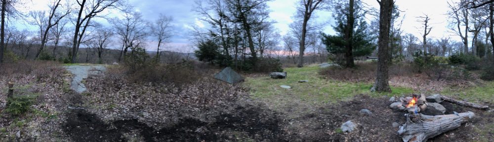
We had two more miles to go after Wolf rocks to the shelter and thankfully 1.5 miles of it was along a jeep road. We passed Fox Gap at the top of the ridge line and then it was only .5 to the shelter. We were told by lots of folks to camp at Nelson’s Overlook just beyond, and clearly many do as we found many fire ring sites. But I’m a Leave No Trace educator, and not about to break rules I teach, as lovely a spot as it was. We also met 3 southbound thru hikers at the shelter, when we thought we might be alone. And we really enjoy talking to the thru hikers, having a picnic table and shelter roof and privy when possible. So we set up on the hill behind the shelter and the water source was very close. It’s a spigot on the grounds of a religious retreat right on the same mountaintop. Wow what a view they have! Anyway the spigot is on seasonally and I called and asked on forums in advance to make sure it was still on, as that’s the ONLY water source on this entire 15.5 mile stretch except Eureka Creek at 1.2 miles south of the start. So I recommend checking that its on before you go, and if not pack in a bunch of extra water.

We had a nice night at the shelter. We spoke to the thru hikers a bit at dinner, did our best to catch the sunset over the retreat, and then retired very fatigued to our tent. It was cold, but we were close together and warm and all bundled up and tucked in so we stayed mostly comfrotably warm. We needed the rest so getting to bed at hiker midnight was no problem. We slept almost a full 12 hours.

We were up early the next morning and spoke briefly to a man who was staying at the retreat and came out to check out the view at Nelson’s Overlook. We then made our way out of camp before 8 am, as we had 6.4 miles to do before noon so we could make it to Kent in time.  The thru hikers had said it was easy and had a long flat road section and the ascent wasn’t bad at all (so our descent shouldn’t be).

Nelson’s Overlook was a wonderful view for sure. Apparently it’s popular with the hang gliders too. We moved on a bit further to a place called Lunch Rocks, where we had breakfast! It too had a great view, including our day’s hike laid out in front of us to the east. The ridgeline ahead stretched south and then east to Mt Minsi, on the Pennsylvania side of the gap. You could see Mount Tammany in New Jersey just behind. We also passed the 900-mile mark to Katahdin, which the thrus make out of little rocks. Always neat to see. From here, it was much less rocky but several uphills caught us off guard because I didn’t have a look at the profile in much depth. They weren’t bad or long but we were tired from the tough first day. But we did eventually reach that long flat stretch of road along the spine of the ridge, and it took us all the way to the summit of Mount Minsi. There was an incredible view south of the Delaware River, and we met two other SOBOs who were friends with the ones we were at the shelter with, and they were planning to meet up. That’s why the thrus were up late and still sleeping the night we were there – they were waiting to catch up with each other as they hadn’t seen each other since New Hampshire.

Just past there was the eastern view directly of the Mount Tammany summit and the gap below. We did that hike last fall. It was so fun to be on the other side of that view. It’s very dramatic from either side.  We began the descent that would take hours. While only 2.4 miles, it felt like double that. Now it had MANY incredible views of the gap all along the rocky rhododendron-lined descent. At several points it was very close to the ledge, and the leaves and acorns made it a little sketchy at times. Again I’m so glad it wasn’t wet. It really felt more like northern New England here. There were several scrambles, and it pushed some of our limits as we were getting low in energy. But the views…

Eureka Creek was flowing, and very pretty. I saw a juvenile bald eagle flying above me on the final lookout but didn’t succeed in getting him on camera. Once we reached the road to Lake Lenape and the parking lot, we were happy to have flat ground. The towering rock ledges on the side of the trail featured a big overhang cave with a steep path up to it. I got as close as I was comfortable climbing up while filming and then headed back down where Lake Lenape was and from there it was about a half mile out to the lot and the road and back down to the Inn. We did it in 4 hours which was my long estimate, but we didn’t anticipate how slow the descent would go. We fueled up at Taco Bell on the way back to Connecticut. Hiker hunger is also very real.

Another great hike in the books. We are at 400 miles now. With luck, we will get one more in this season if we get a warm weekend before Thanksgiving. Its always so hard waiting from October until April to go backpacking again! Photos below.  Watch the video here.

Miles Day 1: 9.1

Miles Day 2: 6.4

Bald Eagles: 1

Spiderwebs in the face: too many to count, a lot!

Rocks: WAY too many to count, a whole lot!

Views: Plenty of great ones!

SOBOs we met: 5

Spent a nice night at the Deer Head Inn

Spent a nice night at the Deer Head Inn Pre-hike

The A.T. goes right up that road

The A.T. goes right up that road

The Village Farmer in DWG, PA

The Village Farmer in DWG, PA

Fun at the Village Farmer

Fun at the Village Farmer

Starting at Wind Gap

Starting at Wind Gap

Rock town!

Rock town!

Rocksylvania

Rocksylvania

More rocksylvania

More rocksylvania

Aaaand more rocks

Aaaand more rocks

Even MORE rocks!

Even MORE rocks!

Frog Friend

Frog Friend ( a break from rock pics)

Wolf Rocks

Wolf Rocks

Wolf Rocks

Wolf Rocks

Linus on Wolf Rocks

Linus on Wolf Rocks

FIelden Stream on Wolf Rocks

FIelden Stream on Wolf Rocks

Nelson's Overlook

Nelson’s Overlook

The 900 Mile mark from Katahdin

The 900 Mile mark from Katahdin

The Delaware from Mt Minsi summit looking south

The Delaware from Mt Minsi summit looking south

Mt. Tammany, NJ from Mt Minsi PA, DWG

Mt. Tammany, NJ from Mt Minsi PA, DWG

Delaware Water Gap from Lookout Rock

Delaware Water Gap from Lookout Rock

Another view of the gap from Mt. Minsi

Another view of the gap from Mt. Minsi

Delaware Water Gap from Mt Minsi

Delaware Water Gap from Mt Minsi

Lake Lenape

Lake Lenape

Cave near Lake Lenape

Cave near Lake Lenape

Hiker hunger is real

Hiker hunger is real


Appalachian Trail: N.C. Section 25

We had a fantastic 2.5-day backpacking trip in North Carolina last week while down there for a graduation. Here’s the notes right from my trail journal. Photos and a link to our video of that hike are below.

Day 1: August 11. Rock Gap to Long Branch Shelter

Spent the previous night at our friend’s family cabin in Otto, NC. Then he helped us on this morning to drop our car at Deep Gap and drive us up to our start at Rock Gap. As it’s a big loop here, it wasn’t far between trail heads. We met shuttle driver Jim there who gave us lucky stones and his card, just in case we needed a bailout as our friend was headed home to Charleston after dropping us off.  A beautiful short 3.8 mile hike up to Long Branch shelter – it was at 4,500 feet and had a great water source and brand new shelter. It’s on a steep slope but the shelter and tent pads were placed in flatter areas.  We made a fire in the legal fire ring to ward off bugs and since we had a lot of time there, and chatted a bit with Rusty Jane, who was hiking half the trail and only had 100 miles to go. Coincidentally, Jim had shuttled her this afternoon to her starting point at Winding stair gap so we knew about her before we met!

Day 2: August 12. Long Branch Shelter to Carter Gap Shelter

Some big climbs and bigger views. The descent off Albert Mountain was steep but we were glad to go down it. Our new knee sleeves really helped on these steep downhills. No view at the fire tower but got great views from a ledge on Big Butt and even better (including  Pickens Nose) from Little Ridgepole mountain. Sad to see all the trash in all the fire rings but its usually locals and not thru hikers.  Met a father and son out for a section hike at the shelter. Enjoyed their company and campfire.  Had an unexpected heavy downpour overnight but no biggie as its our last night out.

Day 3: August 13. Carter Gap Shelter to Deep Gap

Dried things out for a bit and then opted to hike to the next water source a few miles down trail rather than the one at the shelter as it was a trickle and down a steep hill.  When we got to the creek south of Beech Gap I also changed my socks and put on some band aids as the 2 days in the same socks was giving me hot spots despite my best efforts to clean my feet.  We also had another snack and filled up both our water supplies. The band aids and new socks worked but the trail up Standing Indian was completely overgrown and wet and swarming with bees, and the trail was eroded in many spots and I almost slipped off the trail. My left leg saved my right one which wanted to go off the edge of the eroded trail. And I didn’t see it because of the soaked, overgrown, shoulder-high plants. Going to email the trail club there.  So my shoes and eventually my socks and bandaids soaked too but they managed to hold on until we got to the car. At the  top of the long climb up Standing Indian we met a man named Erik who had taken the lower ridge trail up from Standing Indian Campground and he and I hiked to the view at the summit which was incredible. Sad to see the camping area up there also littered with trash. PLEASE, Leave it better than you found it! Then it was a steep descent of many switchbacks to Deep Gap and our car.

Watch the video here.

Miles day 1: 3.8

Miles day 2: 9.4

Miles day 3: 9.2

— Linus

About to hit the trail at Rock Gap

About to hit the trail at Rock Gap

At the Rock Gap trailhead

At the Rock Gap trailhead

Water at Long Branch

Water at Long Branch

Into the Gap

Into the Gap

Downy Rattlesnake Plantain

Downy Rattlesnake Plantain

Long Branch Shelter

Long Branch Shelter

Our tentsite at Long Branch Shelter

Our tentsite at Long Branch Shelter

What a bunch of fungis

What a bunch of fungis

No view today

No view today

Or from the tower

Or from the tower

The descent off Albert

The descent off Albert

Snails enjoying Carter Gap campsite mushrooms

Snails enjoying Carter Gap campsite mushrooms

Overgrown as can be

Overgrown as can be

Another Gap

Another Gap

The southerly summit view from Standing Indian

The southerly summit view from Standing Indian

Scarlet Beebalm

Scarlet Beebalm

Humans can be very disappointing

Humans can be very disappointing

Enough Said

Enough Said

Carter Gap Shelter

Carter Gap Shelter

Pickens Nose from Little Ridgepole Mountain

Pickens Nose from Little Ridgepole Mountain

Stunning view from the ledge

Stunning view from the ledge

Classic North Carolina Rhododendron Tunnel

Classic North Carolina Rhododendron Tunnel

Blue Swallowtail on Standing Indian summit

Blue Swallowtail on Standing Indian summit

FIelden just north of Deep Gap

FIelden just north of Deep Gap

The last mile

The last mile

End of hike feet!

End of hike feet!

A.T. Beer!

A.T. Beer!

Beer blazing at the Lazy Hiker in Franklin!

Beer blazing at the Lazy Hiker in Franklin!

A.T. Thru-Class banners at Lazy Hiker

A.T. Thru-Class banners at Lazy Hiker

Ridgerunner Weekend #4, Bulls Bridge and Ten Mile River

For this weekend I covered the New York border up to the Bull’s Bridge. While not a lot of miles I added a few by doing a loop past the campsites up to the market for a root beer, and then back to the campsite. I did that again the second day, without the stop at the market. I met many nobo and sobo thru hikers, and a mom supporting her 15 year old thru hiker. I helped them with advice on town resources, itineraries, shelter and campsite options and conditions and had some fantastic conversations with them all about trail names and hiking in general.

I really enjoy this part of the job. There are a lot of great people out there on their journies and I love to hear their stories. One of my favorite moments of the weekend was saying “welcome to Connecticut” to a thru hiker just as he was entering our section and I was reaching the end of my shift at the New York border. He said thanks and then I heard him holler gleefully as he reached the Connecticut sign and I smiled as I walked in the opposite direction. I really felt like a trail ambassador and representative of this fine section in that moment.

Another great moment was going down to the river after setting up my camp to see our resident blue Heron we named Jim. He stood on a rock about 30 feet across the river near the opposite bank and posed there for about 30 minutes while I sketched him from the beach. I also came across a raspberry patch which gave me a boost of energy and morale.

The bugs were merciless and the humidity was pretty bad, but I always enjoy and embrace the suck because it is always so special to be out there. It heals me so. I will be headed down to North Carolina in a week to do 2-3 days of hiking there with Fielden Stream. Those glorious balds should bee just the therapy we need to deal with a bunch of difficult things we’re dealing with right now.

I brought my hammock out again after using it in my yard at home a few times and getting more comfortable in it. I also realized its more comfortable for me without a pad. So I will either need to get an underquilt or just use it in the dead middle of summer when its 70+ degrees at night. On this night it dropped to around 59 and being right near the river, it was colder, and I had an hour or so where it was a bit uncomfortable and I really bundled up but this is also because I brought my summer 55 degree bag not my 24 degree down bag.  I will find the right combinations, as its really much gentler on my back! I tried the inflatable pillow and while I like it, it slid around a lot in the hammock, so when hammocking I might stick to my current clothing bag pillow technique. It’s easier to keep in place.

And I finally tried out my Dirty Girl Gaiters my daughter got me and loved them!  So they will be a regular item going forward.  I really got into the zone this time out. I just really wanted and needed to be out there very much this time. I joked with my wife when I returned and was in a bit of a transition fog that I had re-adapted to my wild origins like a runaway animal does when in the wild too long. If only I could stay out much longer. One day.

Photos below.

Miles day 1: 6.2

Miles day 2: 5.7

— Linus

Welcome to Connecticut!

Welcome to Connecticut!

A beautiful scene

A beautiful scene

Rt 55 trail entrance

Rt 55 trail entrance

The trail above the Housatonic

The trail above the Housatonic

The trail along the Housatonic

The trail along the Housatonic

A tale of two trail snacks

A tale of two trail snacks

LIvin in a bag down by the river

LIvin in a bag down by the river

The Housatonic

The Housatonic

Jim the blue Heron

Jim the blue Heron

My sketchbook and trail journal

My sketchbook and trail journal

Running the ridges

Running the ridges

Looking upriver from the campsite

Looking upriver from the campsite

Winding up that hill

Winding up that hill

My new dirty girl gaiters

My new dirty girl gaiters

So humid my shirt is drenched with sweat

So humid my shirt is drenched with sweat


Appalachian Trail Ridgerunner Weekend #3 – Up and Down the Trail

Last weekend I saw a lot more of the Connecticut trail than one section. It started off by running into ridge runner Lizzie at the Cornwall Country Market. We hadn’t seen each other since the training days in late May, and I was stopping in to pick up some breakfast sandwiches for Brian and I. He was already out on the trail and planning to join me at the trailhead in Falls Village shortly after my stop here. Lizzie and I caught up for a bit and talked about our season so far. She was on day 6 of a 10 day stretch and was excited to be meeting friends at the market. She had met Brian on the trail earlier so she knew we were meeting up to hike later. She thanked me again for all the training I gave them, which felt nice of course. It was an honor, and a lot of fun!

I headed up to the trailhead lot in Falls Village. Set up there were a family doing trail magic out of their truck. With them they had both their daughters, and one was currently thru hiking the trail but had actually been in the Bear Mountain, New York area. They picked her up so she could join in providing the trail magic and see her family who were from Michigan. They were planning to drive her back to where she left off in New York on the way back.  They had coolers of water, gatorade, chips, sandwiches and some sugary treats. I spoke with them for a while about ridge running and then with a few other thru hikers who were arriving, and we’d see a bunch more of later on the trail.

Brian finally arrived (he got sidetracked by some other nice hikers we’d see several more times). Apparently he walked right past a large rattlesnake the other hikers saw right after their conversation by Belter’s Bump. I gave him the egg sandwich, which he had in addition to a fresh sandwich they made him. We enjoyed more conversation with hikers before finally setting off on the trail. It was getting hotter and I was ready to get into the shady covered woods.

There was a small issue here as an entry to the tracks was right next do a turn blaze on a pole. Only this wasn’t the entrance to the trail, it was about 50 ft farther. But the sign was covered by overgrown brush. Once I realized what was going on, I used some large sticks and branches to create a fence of sorts. Hopefully this will work for the time being while we can address it with the club for a more permanent solution. I’ve already raised it.

Once that was resolved it was a quick mostly flat few miles to the base of the Great Falls. We also made a stop to fill up our bottles at the power plant faucet. At the falls we ran into the trail magic family as we had recommended they come here to see the falls. They were surprised we were there already. Well, it was flat and we move at a good pace when hiking. We opted to enjoy the falls more properly and cool off on our return tomorrow. For now we wanted to get our miles down.

The long slow climb up Prospect Mountain is luckily almost all in the woods save for one short strip through a steamy meadow. We took a long break at the top and spoke with some day hikers and then two thru hikers we saw at the trail magic lot. He had left his phone in a shuttle driver’s car so Brian was helping him communicate with family who could help him make arrangements to get it back. It was a clear, bright, warm day and the view was long and clear from the summit.

We marched on, headed for the Giant’s Thumb on Rabbit Hill. I also wanted to take in Rand’s view, a glorious panorama of the Taconics and the trail ahead. There was indeed a stealth camping area here. A few of the thrus asked if they could camp in this area when at the trail magic and I said only at designated sites in Connecticut. They did comply and we saw them later at the campsite. But we had to address this stealth site. Once we made sure it was cleared of any fire evidence, I built another structure of sticks and vines to create a fence. Let’s hope it lasts. A more permanent solution is needed. But it seems people know about it and camping in the field from Guthook. Nevermind that it’s not allowed I guess a nice camp spot is more important to hikers these days than LNT.  Well, not all. And this IS one of the main reasons I’m out here. I’m hoping my fence solution sends the message without being offensive. I was certainly happy with it.

The Giant’s Thumb is a glacial erratic on Rabbit Hill that sticks straight up and resembles a thumb. It was only .3 farther up trail and mostly level so we decided it would be nice to visit it as our turn around point for the day. After nearly walking right by it, we stopped for photos and then headed back to the campsite. The big steep climb down to the campsite and shelter was next. I cut some branches hanging in the access trail and Brian taught me about how to cut tree branches so the tree keeps growing in a healthy way.

As steep as I’ve ever remembered it, we took our time getting down to camp. Once there, its a lovely campsite with a piped spring, a nice breeze, and a shelter and several platforms. We got set up and I answered questions and spoke to all the hikers as they streamed in, grumbling about the descent. I assured them we are working on a solution for that. Re-routes take a lot of meetings and surveys of the land and then approvals so once we get all that done, a re-route should be in place. At least that’s what I’ve been told.

The hikers from the trail magic that asked me about camping at the field were there, as were about 8 others, including 2 section overnight hikers. And one thru-hiking poodle. We enjoyed speaking with all of them at dinner at the picnic table and I helped the two overnighters arrange to get their little sportscar out the river road gate as their GPS took them down a very treacherous road to the other side of the gate and they were afraid the car wouldn’t make it back up. We met thru hikers from Australia, and one who’s waited his whole life to retire and do the trail. It was a dry, clear, moonlight quiet night, save for an owl and some fisher cats (I think they were mating?). Even the bugs eventually left.

In the morning we all seemed to be up and heading out at the same time so it was nice to not have to wait to see that the campsite was in order. We made quick time of the steep ascent and got back to the summit of Prospect Mountain. Those two climbs would be about all of it for the day except a few 50ft ups and downs along the train track section. We spoke with the hikers Brian had chatted with on Belter’s Bump as they were just making it to this section today. They are neighbors who have already done 1,500 miles of the trail but they do it all in day hikes and stay in hotels at night. We also saw a few members of another family who were taking their dogs up to the summit. We stopped at the falls and got to the edge of the water this time to cool off and splash a bunch of cold water on our heads. We spoke with a few thru hikers here and passed about 8 more on the way back to the car including Arrow and Nav, who I’ve been following on Instagram. Nav is a little miniature Collie. It was fun to run into them and was not sure I’d see them because the car show at Falls Village was drawing a lot of hikers because of the many food vendors.

I have also been followed and was following another hiker named Lightning McQueen. My friends at the Bulls Bridge informed me they’d be barbecuing and doing some trail magic, and to come over after we got off trail. So we planned on that in the morning and I told Lightning to meet us there if the timing was right. As I got on the road I was updated that she had already come by looking for me and had gone to the store. I reached out and she was still there and said she’d be back at the trail shortly. We really enjoyed meeting and talking and having lunch with her. I also met a National Park Ranger who is working with our chapter on educating locals on the trail and rules here, as well as addressing other issues along our section. So I was able to provide her with some information on the status of issues in the section of trail we just hiked.

It was perfect weather all weekend, and I got to make a lot of new friends, and meet up with some hikers I was hoping to meet, and as always, take care of the trail and the hikers the best I can. And my planks have paid off because it really minimized my knee pain and I had a long descent to test it out! I will be back out in a few weekends to do more ridge running. I am also planning a 3 day section in North Carolina to do with Fielden Stream as we will be in the area in a month for my son’s graduation. Can’t wait. Photos below.

Miles day 1: 7.5

Miles day 2: 5.9

— Linus


My fence to block a fake trail entry

My fence to block a fake trail entry

Almost 1500

Almost 1500

The one and only Rand's view

The one and only Rand’s view

Brian at Giant's Thumb

Brian at Giant’s Thumb

Camping at Limestone Spring

Camping at Limestone Spring

Lilly the hiking dog

Lilly the hiking dog

On top of Prospect Mountain

On top of Prospect Mountain

Spotted Wintergreen in Bloom

Spotted Wintergreen in Bloom

The Great falls, from the side

The Great falls, from the side

Below the Great Falls

Below the Great Falls

Appalachian Trail: Pennsylvania Section 10

Over the last weekend of June, we were geared up to do a 2-night/3-day backpacking trip to kick off Vermont. However, a swollen knee for Fielden almost took hiking off the schedule completely. She was limping and using a walking stick for days because of this inflammation and I was sure it was a done deal. To be honest, MY knee had also flared up on the last long downhill on last month’s hike. I have since been doing my daily planks a lot which really helps.

Luckily, over the next few days her knee did come back online, and with only minimal swelling and pain. We were feeling better about getting out there for our much needed forest therapy. But I still didn’t feel like it was wise to do the Vermont section in these circumstances. There are several large ups and downs, and it was a 17-mile section, and we had 2 nights planned. I felt it would be too risky to do this section and then have an injury come back miles in (and up), and have to be rescued out. The trail isn’t going anywhere, and we will be back for that section.

Instead, we picked a totally flat section in Pennsylvania’s Cumberland Valley, and decided to cover the 12 miles in two day hikes and a hotel overnight.  This worked out great, especially since it was in the 90’s both days, and despite my new OR sunhat and shirt helping me keep the sun’s effects at bay, we were happy to be back in the hotel pool after each day’s mileage.

Our planned start point got screwed up because I used an old version of AWOL’s guide and the hotel we planned to stay at so we could walk back to it from the trail, had been demolished and moved 1.5 miles down the road on the other side of the highway overpass. (That guide has since been discarded in favor of my 2019 White Blaze guide… lesson learned! ) Yes we could have walked the extra miles, but 2 miles on a busy road in 95 degrees was not of interest.. So we adapted, and decided to start in the middle and hike to the southern end on day 1, and then on day 2 pick a starting point farther north of originally planned, and hike back to the middle point. With the help of UBER, which was very active here, we got both sections done without a hitch other than me slipping on a muddy spot and wiping out! No matter, I had real hiker cred when we rolled into Boiling Springs and I had dried mud all over me! I’m sure they thought I was a thru at the ATC Mid-Atlantic regional HQ and the outfitter.

A great little town, we loved the walk along the Children’s lake and seeing the old furnace, as well as the chatty geese and ducks who surely know it’s THEIR lake. We ate at an old tavern in town and got recommendations for some other places to check out. Though by the time we were done eating, we were eager to get back to the pool to cool off. The tavern were very hiker friendly, you just have to leave your packs outside.

We also enjoyed roaming and dining in Carlisle’s historic downtown, including a cool vintage shop, a great hard-cider brewery for a tasting and seeing where George Washington visited.

This section’s walk through fields and pastures over many stiles was bucolic, save for the three highway overpasses. It was nice when we got a little shade in the forested sections.  We saw many thru and section hikers, though most of the earlier-start thrus are past here now. We saw some bear scat and tracks on the second day, but no bears. With all the berries out in bloom, its not surprising the bears are active.  We enjoyed visiting the ATC’s Scott Farm trail crew work center which the trail passes right by. It’s said this facility may be closing and there’s currently an effort to keep it active. I hope they do, as the section of trail a few miles in either direction from it was very well maintained and had lots of beautiful boardwalks. So their efforts are palpable and appreciated for hikers. We were short about 1 mille of this complete section but I decided on this on purpose as there is overnight parking at Sherwood Road and not at 944, so this was necessary for doing the next sections north as overnights.

Now that we’ve started Pennsylvania (our state #6!), we may just focus on this state for a while, as the difference in drive time compared to Vermont will dwindle the more we complete headed back towards home. We may work on completing the southernmost bit to the Maryland border, as its only about 60 miles from Boiling Springs to Pen Mar. Then we can head from Carlisle back to DWG next year.  I’m excited for Pennsylvania, except for that climb out of Lehigh Gap. But I’m sure we can do it when the time comes. Just DON’T. LOOK. DOWN! Pennsylvania is one of the longest sections at around 225 miles, so it will take us a while unless we hit the lottery and can take several weeks off to finish it all. I am also considering still doing that Vermont section next and trying to complete the 14-state challenge (do a section in each of the states the trail traverses) and doing sections in the 6 remaining we haven’t hiked in at all yet… but I am such a completist that knowing me, we will continue to check off one state at a time. While we have done 4 miles in North Carolina, they were just day hikes when in the area that didn’t complete a whole section and will need to be re-done to connect the dots. It’s fine for the 14-state challenge though. I don’t know, the jury’s still out.

Anyway, you can watch the video I made of this hike here. Hope you enjoy it! Please subscribe to our channel if you do.

I’ll be back out this weekend ridge running in Connecticut as the bubble is definitely here. As I have some time off this week I may go out a day early and complete the northernmost 10 miles of the Mohawk trail I have yet to complete. This trail used to be the A.T. in the area, and this bit is the steepest and most difficult part of that trail. But also the most scenic, featuring Dean Ravine, and the view from Lookout Point. I almost made it to that point a few autumns ago but there was a lot of leaf cover and the trail on the north side of Barrack mountain was steep and eroded, and I ran out of time allotted because it was so slow going. We will see, but it would be nice to get that done and have an extra night on trail for a change.  Photos below.

Miles day 1: 4.7

Miles Day 2: 7.3

Total Miles: 12

Trail miles: 11.7

— Linus

Day 1 plan

Day 1 plan

Testing my hitch pose in case no Uber

Testing my hitch pose in case no Uber

Starting point

Starting point

Crossing the stiles in style

Crossing the stiles in style

Arriving at the road into Boiling Springs

Arriving at the road into Boiling Springs

Lots of berries out!

Lots of berries out!

Waiting for the ATC regional HQ to re-open from lunch break

Waiting for the ATC regional HQ to re-open from lunch break

At the regional HQ Mid Atlantic ATC office

At the regional HQ Mid Atlantic ATC office

Using this here mud remover!

Using this here mud remover!

A nice stroll along Children's Lake

A nice stroll along Children’s Lake

The old furnace in Boiling Springs

The old furnace in Boiling Springs

Day 2 plan

Day 2 plan

This section along the creek is lovely and well maintained

This section along the creek is lovely and well maintained

Boardwalkin!

Boardwalkin!

The creek, which had kayakers and canoers too

The creek, which had kayakers and canoers too

Lovely trumpet flowers

Lovely trumpet flowers

Scott Farm ATC trail work center

Scott Farm ATC trail work center

Turnstiles decked out with Thistle and Chickory

Turnstiles decked out with Thistle and Chickory

Center Point Knob in the distance beyond Boiling Springs

Center Point Knob in the distance beyond Boiling Springs

Hiker dirt

Hiker dirt

Back at the lot, all done

Back at the lot, all done