West Mountain’s northern slope
I had another great day volunteering with our Connecticut trail crew yesterday, which I will talk about in more detail next time. But last weekend Fielden Stream and I got to do the section of the Appalachian Trail in New York that we had had to skip and substitute with another due to time constraints. And it was as tough but as great as we expected it to be.
As you may know we are doing New York southbound. And we have had to skip sections and come back later like this once or twice due to scheduling logistics. This hike was to cover the last 9 or 10 miles of section 10, which starts at the Bear Mountain Bridge.
With this segment done, we’ve now covered all but the last 17.9 miles of the New York Appalachian Trail, which is a total of 90 miles. So we are feeling good. I hadn’t expected to get three hikes in New York in already this season. But since we will be moving over the next few months, we won’t be getting out together much until late summer, and so are taking advantage of what time we have now. We plan to finish New York before the season is over, and we will also be doing one section of Massachusetts with friends at the end of next month. But besides that most of the hikes over the summer will be me doing my volunteer work.

Linus on West Mtn
I have met lots of great people on whiteblaze.net, a very popular internet message board focused on the Appalachian and other long-distance trails. I get incredibly valuable tips on gear, resources, landmarks and resupply points, and shuttles (people who volunteer rides along these trails.) In this particular instance I was hoping to save us from bringing both cars or hiring a cab, which can be hard to find and expensive in more rural areas and parks the trail corridor passes through. Not only did I find Suzy from MyHarriman.com for the last section hike’s shuttle there, but another member offered us a future ride as he also lives in the area. So this time he gave us a free ride from our end point to the start point, and he and his wife were planning on their own overnight in the park later that day. Shout out to Bob — thanks!

Balancing rock, West Mtn
Luckily we didn’t have to head out late after work again on a Friday night for this one, and had a full day and a half for this overnight… which is a luxury with our schedule lately. We arrived at the lot at Tiorati Circle that we started at last time. Bob and I had arranged for our pickup and he was waiting for us when we arrived. We had a nice in-person introduction and then chatted briefly as he drove us north along Seven Lakes Drive to the 1777 trail lot. This lot and trail are named after the route that the British troops marched into the area to attack the colonists and take Forts Clinton and Montgomery in 1777. There is a plaque here that outlines a bit of this history. As with our last hike in the area, we took the 1777 trail east a short distance to arrive at its crossroads with the A.T. where this time we would head south over West Mountain.

Filtering water
We knew it would be a good climb up. Actually, it’s a fairly ambitious climb up any side of this mountain. I’ve gone down the southern end on the A.T twice now, and up the Timp-Torne trail on the eastern side to the shelter there with the famous view of New York City. But this is the first time going up this side, and there were many rewarding views on this route as well. Soon after leaving the 1777 trail, the A.T. began to ascend the rocky face. It wasn’t that bad as far as steepness goes, but it was rocky. Soon we were rewarded with multiple views north and east of Bear Mountain, the Bear Mountain Bridge, the Hudson river, and west and south to Harriman State Park and the peaks we would ascend later this day. There were many hikers and backpackers out for the day here, including a group of 4 guys we would end up spending the overnight at the shelter with. In fact they were the first group we saw, just after getting on the A.T.

Palisades Parkway
This scenic part of the trail is a great (and obviously popular) loop option as you can park in the Anthony Wayne recreation area parking lots below which are massive and stretch the length of the mountain. So many people will start and end at the lot and take a combination of the A.T., Timp-Torne and the Ramapo-Dunderberg trails. I did this combination of trails on an overnight adventure by myself last summer.

Parkway median register
It was a beautiful day last Saturday, and the views from the mountaintops were long. The ridge of the mountain was heavily populated with young Beech trees. We stopped for lunch at the northern view of Bear mountain and the bridge and also enjoyed many sweeping westerly views as the trail followed and descended the western ridge. One big mountain out of the way, we were ready for our exciting crossing of the Palisades Interstate Parkway. But first we got water at a tributary of Beechy Bottom brook at the foot of West Mountain. This park is not known for abundant water sources, so you get it where you can.
Crossing the parkway was definitely exciting as the road was busy and the drivers were zooming along at a good pace. There is actually a trail register in the median between the northern and southern lanes. Fortunately the two directions are separate so you don’t have to do a full frogger; you can keep an eye on one direction of traffic at a time! When we got to the register we signed it that we had at least survived crossing the northbound lane! We got some great video of running across the southbound lanes, and that will be part of our New York A.T. video which we will add to this site later in the year when we finish the state.

Fielden Stream climbing Black Mtn
We then prepared ourselves for what ended up being an even-steeper-than-expected climb up the eastern side of Black Mountain. We read that there would also be views all the way to the skyline of NYC from the top, so we did have some extra motivation to push up it. We told ourselves we’d have a nice long break and a snack here as well. The first part was not too bad and switch-backed up a lower shoulder of the mountain where it crossed the 1779 trail. Not to be mistaken with the 1777 trail, this is the route “Mad” Anthony Wayne (who the recreation area is named after) led his American troops on to take back Forts Clinton and Montgomery two years later. As we approached the crossing we spotted many runners on the trail who were taking part in a 50-mile run through the park. I don’t know what the cause was, or if there was one, but many of the other trails we would pass this day also had the route marked on the trees with colored ribbons. Suddenly our 5.25 miles planned today seemed a little less tough, though we did have a lot of weight to carry and much more of our route was straight up and down over mountain tops.

NYNJTC volunteer work crew
As we reached the top of this first shoulder I saw the truly steep part ahead. I saw another couple taking their time up it ahead, and then chatting with someone else up there. As we reached the top of the first steep climb up some heavily eroded trail, we saw a New York / New Jersey Trail Conference work crew creating a set of new steps here to eventually route it off the eroded slope. It was one of these volunteers who had been speaking to the couple we saw earlier, about the work they were doing. When they had headed on, he also showed us how they used pulleys and metal wires to lift and move heavy rocks from one spot to another. It made me think of how the ancient Egyptians and Romans probably built their temples.

Scrambling up to Black Mtn Summit
He offered to bring us down closer to the work, but looking up ahead we saw we still had an even steeper scramble up a rock face and just wanted to get it done and get these packs off for a while. But I did tell him how I was a Connecticut volunteer and am involved in projects like this often and we had a nice conversation about that. We thanked them for their work as we went up the final steep section, where more of the volunteers were building stone steps into the rock face.
We reached the top and walked along the ridge to the summit where we sat with our packs off, taking in views of the New York City skyline and having a snack of beef jerky. From here we saw the next and last mountain of the day to climb and which our campsite for the night was on.

Fielden Stream on Black Mtn
The trail then took a similarly steep route down the west side of Black mountain, where we were also rewarded with a nice view of Silvermine lake. As we got to the gap between the two mountains there was an old woods road that led down to the lake and the recreation area there along Seven Lakes drive. The climb up Letterrock Mountain was gradual and we then followed its rocky spine to its end at a large boulder pile overlooking the shelter. This walk along the spine looked similar to pictures I had seen of Cat Rocks and Eastern Pinnacles which are farther down the trail near the New Jersey border.
I am quite sure I also saw a Barred Owl that I must have disturbed while hiking below suddenly fly overhead and into the woods beyond. I love these owls so this made me quite happy. The pile of boulders at the end of this ridge and overlooking the shelter was an exciting final descent, starting with a traverse across a large tilted slab and then through some smaller rock scrambles requiring the use of hands. I was glad we were not going over the slab in the rain. I felt bad for those who were headed that way the next morning!

Black Mountain Scramble #1,000
When we finally got down the rock scramble to the shelter we chatted briefly with one of the guys from the group we saw that morning on the trail. Two of them had been gone at least an hour on a hunt for water and he had asked if we had seen them.
There were a few other tents set up so we got the lay of the land, picked a spot to set it up and to hang the bear bag and popped a squat. The other couple we saw at the climb up Black Mountain had given us a few of their bug sticks when we ran into them a bit later while they were taking a break, and we were all complaining about the bugs. So as the bugs were even more annoying by this point at our campground we lit one and it did a decent enough job of keeping them at bay.
The other two guys had returned from their water trek, and some of the other campers headed off down another route on the same mission. It seemed it was at least a mile in any direction to get water from this campsite. Fortunately we filled up at Beechy Bottom brook per the advice of our guidebook and we boiled the untreated water for our meals and morning coffee so that we could keep the potable water for drinking.

Silver mine Lake from Black Mtn
As we finished setting up our tent, the guys had by now gotten a fire going in the fire ring and invited us all over to join. This was their first time backpacking and had all gotten their gear the day before. Wisely, they bought affordable gear to make sure they liked doing this before breaking the bank. The gear seemed to hold up just fine for this type of overnight, though only one of them was awake to report on that before we left the next morning, and he slept in all his clothes.

Fielden Stream’s bouldery descent
We told stories, listened to some music and I geeked out and told them about the Revolutionary War history in the area and taught them some backpacking and first aid tips I had learned at my Wilderness First Aid course the weekend before. They offered me some of their Jack Daniels so I gave Fielden Stream the rest of my wine, and the atmosphere for the remainder of the night was jovial and fun. The other group of hikers didn’t join us that night but they had done a very long day and went to bed after returning with their water and having dinner. Even though we knew rain was moving in overnight, we were all fortunate to have had a crystal clear sky and many constellations to admire that night.
The next morning we were up and out a little later than planned as I was still feeling the effects of the whiskey and with the added sleepy effect of the rain. As no one was in the shelter overnight, we brought our tent inside after we had packed everything else into our packs and took it apart there. We hung the footprint and rainfly on the bunks while we had breakfast so they could drip dry a bit before we packed them up. We spoke about our stoves and cook kits in true gear-nerds fashion with some of the other hikers who were starting to join us in the shelter to pack up and have breakfast.

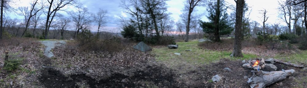
William Brien Shelter below
We decided to skip the hot breakfast to save time and just have our coffee and granola bars. We packed up, got our pack covers on, and headed southbound. As always, the trail route went right up from camp to another crest of a mountain. I am not quite sure if it was the same mountain or the next one. But it was exposed and the rain was turning to sleet at that point. We had to stop to put our gloves on so our hands wouldn’t turn into wet, half-frozen ones. Fielden pointed out the upside which was that at least the bugs weren’t out.
After a few miles the trail dropped back into a gap and past a few interesting rock formations, including one that looked like a cave with a closed stone door. We speculated that it was the secret passage to Ali Baba’s lair or the mines of the dwarves in the Lord of the Rings. Today’s hike out was shorter — only 4.5 miles and less steep climbs. Though there were two big ones at the end, and it was cold and rainy. It wouldn’t get over 50 degrees this day. Most of the time it was lower than that.

Rocky trail section behind the shelter
The trail brought us down across Seven Lakes Drive, where we had passed early the previous day on our shuttle from the end point. There was a nice brook down here and plenty of good water sources except one which Fielden Stream said looked like a swamp from “Labyrinth” as it was full of bright green slime. The trail meandered along through a forest with some nice dogwoods and violets in bloom and then reached the foot of the mountains. Ahead of us were too final big climbs. The first was gradual and the area around the trees was starting to really green out. It looked like we were walking through the emerald forest at times. Views east through the trees to the trip’s previous peaks were plentiful. We sang volleys of Billy Joel’s “You May Be Right” to get us through the climb. As the trail leveled out at the height of land we stopped for a few minutes and talked about what we would eat when we got off trail. I was looking for filling and greasy, of course.

William Brien Shelter
The trail then descended into another gap, where an old forest road, and part of the R-D trail re-appeared from where it had previously branched off on the last peak a few miles back. I hadn’t recalled the last climb looking as steep on the profile as it ended being, but we were definitely working hard at that point to get up it. It went most of the way up the next summit before it eventually rode around the shoulder and leveled out for the most part. But we were only about 100 feet shy of the summit so they might as well have just taken us all the way up! As we ascended we noticed that the colors of the leaves on the trees painted a very fall-like scene.
The trail traveled along this mountain’s shoulder for about 3/4 of a mile through mountain laurel tunnels before reaching the road crossing at Arden Valley road. I believe all of this was part of Fingerboard Mountain.

Rainy Fingerboard Mountain vista
We crossed the road and took the blue trail by the water tower back down to the parking lot at Tiorati Circle. Since we decided not to take any longer breaks or have a hot breakfast we made good time and were back at the car in less than three hours. And though we did start to slow quite a bit at the end from fatigue, we made sure to appreciate the scenery the best we could, including a lovely mountaintop brook and one vista similar to that of Bear Mountain, Connecticut from Lion’s head.

Stream going green
We drove the same route home as we took up, opting for the long views up and down the Hudson river, and found a great country diner on the way home called Grandmas. We loaded up on greasy appetizers and sandwiches and I also had a few celebratory beers. We picked out a few of their homemade pies to bring home to the kids.
While it was challenging, we had a great time, and look forward to finishing the last two sections in New York later this season. Who knows, maybe we will get there even sooner.
Day 1 miles: 5.2
Day 2 miles: 4.6
— Linus