Appalachian Trail Ridgerunner Weekend #3 – Up and Down the Trail

Last weekend I saw a lot more of the Connecticut trail than one section. It started off by running into ridge runner Lizzie at the Cornwall Country Market. We hadn’t seen each other since the training days in late May, and I was stopping in to pick up some breakfast sandwiches for Brian and I. He was already out on the trail and planning to join me at the trailhead in Falls Village shortly after my stop here. Lizzie and I caught up for a bit and talked about our season so far. She was on day 6 of a 10 day stretch and was excited to be meeting friends at the market. She had met Brian on the trail earlier so she knew we were meeting up to hike later. She thanked me again for all the training I gave them, which felt nice of course. It was an honor, and a lot of fun!

I headed up to the trailhead lot in Falls Village. Set up there were a family doing trail magic out of their truck. With them they had both their daughters, and one was currently thru hiking the trail but had actually been in the Bear Mountain, New York area. They picked her up so she could join in providing the trail magic and see her family who were from Michigan. They were planning to drive her back to where she left off in New York on the way back.  They had coolers of water, gatorade, chips, sandwiches and some sugary treats. I spoke with them for a while about ridge running and then with a few other thru hikers who were arriving, and we’d see a bunch more of later on the trail.

Brian finally arrived (he got sidetracked by some other nice hikers we’d see several more times). Apparently he walked right past a large rattlesnake the other hikers saw right after their conversation by Belter’s Bump. I gave him the egg sandwich, which he had in addition to a fresh sandwich they made him. We enjoyed more conversation with hikers before finally setting off on the trail. It was getting hotter and I was ready to get into the shady covered woods.

There was a small issue here as an entry to the tracks was right next do a turn blaze on a pole. Only this wasn’t the entrance to the trail, it was about 50 ft farther. But the sign was covered by overgrown brush. Once I realized what was going on, I used some large sticks and branches to create a fence of sorts. Hopefully this will work for the time being while we can address it with the club for a more permanent solution. I’ve already raised it.

Once that was resolved it was a quick mostly flat few miles to the base of the Great Falls. We also made a stop to fill up our bottles at the power plant faucet. At the falls we ran into the trail magic family as we had recommended they come here to see the falls. They were surprised we were there already. Well, it was flat and we move at a good pace when hiking. We opted to enjoy the falls more properly and cool off on our return tomorrow. For now we wanted to get our miles down.

The long slow climb up Prospect Mountain is luckily almost all in the woods save for one short strip through a steamy meadow. We took a long break at the top and spoke with some day hikers and then two thru hikers we saw at the trail magic lot. He had left his phone in a shuttle driver’s car so Brian was helping him communicate with family who could help him make arrangements to get it back. It was a clear, bright, warm day and the view was long and clear from the summit.

We marched on, headed for the Giant’s Thumb on Rabbit Hill. I also wanted to take in Rand’s view, a glorious panorama of the Taconics and the trail ahead. There was indeed a stealth camping area here. A few of the thrus asked if they could camp in this area when at the trail magic and I said only at designated sites in Connecticut. They did comply and we saw them later at the campsite. But we had to address this stealth site. Once we made sure it was cleared of any fire evidence, I built another structure of sticks and vines to create a fence. Let’s hope it lasts. A more permanent solution is needed. But it seems people know about it and camping in the field from Guthook. Nevermind that it’s not allowed I guess a nice camp spot is more important to hikers these days than LNT.  Well, not all. And this IS one of the main reasons I’m out here. I’m hoping my fence solution sends the message without being offensive. I was certainly happy with it.

The Giant’s Thumb is a glacial erratic on Rabbit Hill that sticks straight up and resembles a thumb. It was only .3 farther up trail and mostly level so we decided it would be nice to visit it as our turn around point for the day. After nearly walking right by it, we stopped for photos and then headed back to the campsite. The big steep climb down to the campsite and shelter was next. I cut some branches hanging in the access trail and Brian taught me about how to cut tree branches so the tree keeps growing in a healthy way.

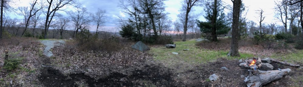
As steep as I’ve ever remembered it, we took our time getting down to camp. Once there, its a lovely campsite with a piped spring, a nice breeze, and a shelter and several platforms. We got set up and I answered questions and spoke to all the hikers as they streamed in, grumbling about the descent. I assured them we are working on a solution for that. Re-routes take a lot of meetings and surveys of the land and then approvals so once we get all that done, a re-route should be in place. At least that’s what I’ve been told.

The hikers from the trail magic that asked me about camping at the field were there, as were about 8 others, including 2 section overnight hikers. And one thru-hiking poodle. We enjoyed speaking with all of them at dinner at the picnic table and I helped the two overnighters arrange to get their little sportscar out the river road gate as their GPS took them down a very treacherous road to the other side of the gate and they were afraid the car wouldn’t make it back up. We met thru hikers from Australia, and one who’s waited his whole life to retire and do the trail. It was a dry, clear, moonlight quiet night, save for an owl and some fisher cats (I think they were mating?). Even the bugs eventually left.

In the morning we all seemed to be up and heading out at the same time so it was nice to not have to wait to see that the campsite was in order. We made quick time of the steep ascent and got back to the summit of Prospect Mountain. Those two climbs would be about all of it for the day except a few 50ft ups and downs along the train track section. We spoke with the hikers Brian had chatted with on Belter’s Bump as they were just making it to this section today. They are neighbors who have already done 1,500 miles of the trail but they do it all in day hikes and stay in hotels at night. We also saw a few members of another family who were taking their dogs up to the summit. We stopped at the falls and got to the edge of the water this time to cool off and splash a bunch of cold water on our heads. We spoke with a few thru hikers here and passed about 8 more on the way back to the car including Arrow and Nav, who I’ve been following on Instagram. Nav is a little miniature Collie. It was fun to run into them and was not sure I’d see them because the car show at Falls Village was drawing a lot of hikers because of the many food vendors.

I have also been followed and was following another hiker named Lightning McQueen. My friends at the Bulls Bridge informed me they’d be barbecuing and doing some trail magic, and to come over after we got off trail. So we planned on that in the morning and I told Lightning to meet us there if the timing was right. As I got on the road I was updated that she had already come by looking for me and had gone to the store. I reached out and she was still there and said she’d be back at the trail shortly. We really enjoyed meeting and talking and having lunch with her. I also met a National Park Ranger who is working with our chapter on educating locals on the trail and rules here, as well as addressing other issues along our section. So I was able to provide her with some information on the status of issues in the section of trail we just hiked.

It was perfect weather all weekend, and I got to make a lot of new friends, and meet up with some hikers I was hoping to meet, and as always, take care of the trail and the hikers the best I can. And my planks have paid off because it really minimized my knee pain and I had a long descent to test it out! I will be back out in a few weekends to do more ridge running. I am also planning a 3 day section in North Carolina to do with Fielden Stream as we will be in the area in a month for my son’s graduation. Can’t wait. Photos below.

Miles day 1: 7.5

Miles day 2: 5.9

— Linus


My fence to block a fake trail entry

My fence to block a fake trail entry

Almost 1500

Almost 1500

The one and only Rand's view

The one and only Rand’s view

Brian at Giant's Thumb

Brian at Giant’s Thumb

Camping at Limestone Spring

Camping at Limestone Spring

Lilly the hiking dog

Lilly the hiking dog

On top of Prospect Mountain

On top of Prospect Mountain

Spotted Wintergreen in Bloom

Spotted Wintergreen in Bloom

The Great falls, from the side

The Great falls, from the side

Below the Great Falls

Below the Great Falls

Appalachian Trail – NY Section 5

Interesting sign facts

Interesting sign facts

I’m going to start this post reiterating to myself to never base a trip on the weather forecast, unless maybe there’s a hurricane or tornadoes. Fool me once, shame on you, fool me twice, shame on me.

This was planned as a 2-day, overnight, 2-section outing. We were in the clear to get on the trail yesterday to do section 5, and stay the night at either RPH or Shenandoah tenting area if it was full, and do section 6 today. We knew it was going to rain. That was a given, and a factor we are well used to by now and really don’t mind that much. It was just that this forecast called for 100% chance of rain from 1pm yesterday to 8 pm tonight, with potential 38 mph winds. That just sounded downright unsafe, let alone miserable.

Southbound!

Southbound!

Being section hikers, we have the luxury of altering our plans accordingly. In fact based on this forecast, we almost didn’t go. I had gotten the time off already so I thought of maybe a trip to the Pequot Indian museum — a place I’ve wanted to visit again since going as a kid. I’m fascinated by Native American history and collect Kachina. However something must have been going on at the casinos there because every hotel with rooms under $200 a night in the area was booked.

Then we said you know what, no, we are going. We will just do a day hike, get one of the two sections done, check out RPH for next time and sill have a great time. It’s only an hour away. And we DID have a great time. We had a great hike, some beautfiul views, a nice chat with some local section hikers (Quicksilver, Skylark) and despite some rain, ventured on a bit into section 6 to check out RPH (Ralph’s peak hiker cabin) shelter. That place is amazing. It’s right by a road and you can order pizza or chinese there, there’s 3 bunkbeds, a desk, a covered patio, picnic tables and chairs, a large lawn for many tents, a water pump and a colorful outhouse.  There was also a case of beer of trail magic from the night before, so we had a beer and signed the register before we left.

Hosner Mountain Ferngully

Fern gully

As we drove back, the rain steadily increased. It rained all night, and we told ourselves that we made the right choice. I did hear some wind last night. But to be honest we’ve spent many nights in our tent in a downpour, and woke to a drier morning to pack up and hike out. In fact just last time at Sages Ravine was quite a storm. But at RPH we could have had a great meal under the porch, socialized for several hours, and ran to the tent for bedtime. And we were lamenting this fact as we sat under the porch enjoying the beer.

Sure enough, I awoke this morning to no rain and the forecast of a 10% chance between now and 4pm when some possibility – 35% of thunderstorms – could occur. By 4, we’d be on our way back already. 7 miles of walking even at our pace would put us somewhere around 230pm if we got our usual early start. I’m kicking myself. Why did I let these predictions, which are almost universally inaccurate, cut short our trip? Grrrrr. Never again. Unless like I said… hurricane, tornadoes….tropical storm…

IMG_7804

Fielden Stream on Hosner Mountain

On the bright side it wasn’t the first and it won’t be the last trip of the season. We’ve already done 3 overnights since April, covering 25 miles of the trail and in doing so checked one state off the list and a nice chunk of another! Also we are taking my family (my little brother is visiting with his boys from L.A.) to car camp and do the Pine Knob Loop for the fourth of July weekend next weekend, then taking my son “Jiffy Pop” to do section 4 of NY (we skipped it to save it for him) two weeks later. Another few weeks later we will be in Harpers Ferry and also southern WV for a wedding and will try and complete the 6 miles of that state with him.

Hosner Mountain vista

Hosner Mountain vista

We’re already talking about doing an overnight starting at RPH after work on a friday night, and then hiking out this section the next day on one of the weekends in between in July. We have a 3-day 2-nighter planned to finish sections 8 and 9 with friends and make it to Bear Mountain NY in mid-October. And race and Everett in the Berkshires of Massachusetts in September – though we could switch that to section 7 of NY if time is more constricted then and get back to Massachusetts next season. My goal by the end of this season is to have covered all the trail from the Mass line across the Hudson to the top of Bear Mtn NY. We did the trail from the Inn to the top of Bear a few years ago already, and the awesome and steep Major Welch trail. We did Connecticut northbound but are doing New York southbound. Simply because of its proximity to our home.

Blackberries

Blackberries!

Also on the bright side, it was a beautiful hike – even with the rain, and THAT is why we are out there at all. Lots of lovely ridge walking, great views of the Hudson river valley, the Shawangunks and the Catskills beyond, and even picturesque views of Interstate 84 and the Taconic State parkway! This land, known as the Fishkill plains, was 85,000 acres of formerly native American land that was traded to the English and Dutch in 1685 as part of the “Rombout Patent.”

Also, the trail maintainer, “Elvis Trailsley,” does a fantastic job of trail maintenance. There were many lovely corridors of placed stone and log benches, many cairns where we and other hikers are clearly enjoying adding stones to, and many small blazes on rocks in mid-trail so there’s no risk of ever losing your way.

Trail magic from Loggman! Tap the rockies!

Trail magic from Loggman! Tap the rockies!

He had an interesting sign on Stormville about the divide and water flow, and one at the creek by Hosner mountain road warning hikers of the danger of not treating the water there due to the farm upstream. We love seeing the different personalities of the maintainers of the different sections, and this man does a fine job! Thank you.

We saw and tasted our first wild blackberries of the season, and tromped through some beautiful fern gullies and hemlock groves. And got very excited for doing this next section knowing how special RPH is. Heck, we dont even need to bring our full packs if we did it that way! We could load up our car with trail magic and treat everyone that night if we wanted to then just leave our sleeping gear in the car and day hike that section. We will see! We’ve wanted to return the trail magic for a while.

Signn at RPH shelter (section 6)

Distance sign at RPH, not far to Bear Mtn bridge!

I’m going to appease myself that I’m not hiking today by taking this opportunity to go to REI’s 4th of July sale and get some outdoor gear retail therapy! Need some more fuel and mountain house anyway. And, I get to spend more time with my kids today. We will have lots of guests on our hike blog next weekend. Until next week, happy trails!

— Linus

Harpers Ferry, West Virginia

Lower Town Trail

Lower Town Trail

We went here in March for our 5th wedding anniversary to hike, relax, and enjoy the local wineries and the civil war history everywhere. We are also fascinated by that subject, and this is where the famous revolt of John Brown and his abolitionists occurred, eventually leading to the civil war. We didn’t backpack this time as we were staying in a lovely B&B to celebrate the anniversary right!

Loudoun Heights

Loudoun Heights

We were treated to snow one day, and late-spring/early summer temps the next day. It’s evident in the photos that the lower elevations were snow-free, while the mountaintops were not!

For this trail adventure, we decided to hike down the Lower Town Trail to the A.T. from the Park headquarters, across the Shenandoah up to a snowy Loudoun Heights on the West Virginia/Virginia border, and then back down to the other side of town and over the Potomac to the Maryland border. All in all, about 6 miles and change.

Crossing the Shenandoah

Crossing the Shenandoah

As you may or may not know, Harpers Ferry is also where the headquarters of the Appalachian Trail Conservancy is located. Just about .2 miles from the trail in the upper town, it is also known as the ‘psychological halfway point’ of the trail, though the real halfway point is about 30 miles away, just north of the Pennsylvania border. It is here that all thru- and section-hikers can register with the ATC and get a photo in their book, with their trail names and start dates. We weren’t sure this was something we could do as we can only get out in small sections several times a year. However, they were more than accommodating and it was a thrill. It is also the site of ‘Jefferson Rock’ – a balanced stone along the Shenandoah with views of the confluence of both rivers where Thomas Jefferson exclaimed “This scene is worth a voyage across the Atlantic.”

Registering at ATC HQ

Registering at ATC HQ

At the headquarters, we also got to enjoy the hiker’s lounge, look through the hiker boxes (boxes where hikers leave things they don’t need for other hikers) and get some great new books, A.T. swag and rest our feet for a bit. There’s also a great topographic map of the whole trail I loved, since I am a map geek as well. I don’t mind spending a bunch here because it all goes to support the conservancy, who take care of the trail. To that end, I am a card carrying member of the ATC, as well as the AMC (Appalachian Mountain Club). We also got me a cool A.T. earring, which has gotten a very enthusiastic response from other thru and section-hikers on the trail.  And A.T. happens to be the first two initials of my name — convenient!

Jefferson Rock

Jefferson Rock

On a side-note we also made a nice donation to the ATC to have an engraved brick on the new walkway in Damascus, Virginia. The ribbon-cutting ceremony was just yesterday morning at the annual ‘Trail Days’ event, where thousands of past and current hikers come together in this trail community to meet other hikers and ‘trail angels’ and meet representatives of top gear companies who are educating everyone on their latest advances for hiker gear. A goal for all hikers, and manufacturers alike, is to get the lightest gear with the strongest most durable materials. Every ounce counts, especially to ‘gram weenies’, aka ‘ultralighters’. I don’t have the best back either, so this is worth the extra investment these products will cost, and to anyone hiking hundreds or thousands of miles with it all on their back. When I think back to how heavy my external frame scouting pack weighed when it was fully-loaded in the early 80’s, I’m amazed at what 20 years of tech has resulted in. I am much happier with my lighter gear, even if my wallet is empty.  Thank god too for my REI membership — my dividends pay me back in more of the light gear I want.

John Brown's Fort

John Brown’s Fort

Some terms here to explain for the non-savvy:

Trail angels are people who are either former thru-hikers or just hiker-friendly and will set up along the trail and provide free food, rides to the nearest town to resupply and catch a night off (a ‘zero’), or will leave it out along the trail like the cooler you saw in my first entry. And a Trail community is a town that is along the trail where the businesses are friendly and cater to hikers. These usually include shops and residents who run hostels or cabins or allow hikers to camp in their yard, use their showers and bathrooms, and will give you rides back and forth to the trail for minimal fees. We have really enjoyed those services so far in Kent, Falls Village, and Salisbury, Connecticut, as well as Pawling, NY. Damascus, Virginia, where they hold trail days is one of the most famous.