Appalachian Trail Pennsylvania: Smith Gap to Wind Gap

We finally made it back to Pennsylvania, and those rocks continue to be as advertised!

Check out the video and photos below. It was a nice hike and there were some nice views. I won’t miss the rocks though.

Miles: 8.3 (with side trails to views)

— Linus

View from Hahn's Lookout

View from Hahn’s Lookout

Hahn's Lookout

Hahn’s Lookout

View north from a side trail

View north from a side trail

Another view north from Blue Mountain summit

Another view north from Blue Mountain summit

Magical shadows

Magical shadows

Another powerline view north

Another powerline view north

My favorite blaze on this section

My favorite blaze on this section

Magical light

Magical light

View of even more rocks i mean trail

View of even more rocks i mean trail

A.T. marker

A.T. marker

View of the rocks i mean trail

View of the rocks i mean trail

View from the power line cut

View from the power line cut

Ridgerunner overnight with Jiffy Pop and Friends

Another gorgeous fall-like weekend, and another hike. This time I took my son “Jiffy Pop” with me for a bonding and trail work/ridgerunner hike and my friends from our AMC chapter “Thumbs Up” and “Chilly Cheeks” came along.

The three of us hadn’t hiked together all year as a group, and my son hadn’t done an overnight with me in almost 5 years. I leant him my old pack, my trail runners, sleeping pad, puffy jacket and camp shoes to fill in the missing gear. He loved all of it and I am going to get him some trail runners like mine for school.

We met a Connecticut Forest and Parks maintainer and his son working on their trails that connect to the A.T. on Ten Mile Hill, and cleared a blowdown, bear boxes, and two fire rings at the campsite, one right under the no fires sign. Wow, that’s always frustrating. It feels like a direct insult to us maintainers by really disrespectful campers and I wish there was honestly a way to fine them if caught, not that that will do much to discourage these types.

We did meet some nice hikers as well, and enjoyed a starry night and lots of spiders out on the Ned Anderson bridge. I saw Jim the Blue Heron, and we saw some frogs, crayfish, and enjoyed s’mores and of course, Jiffy Pop!

I checked the privies and filled the duff buckets as well, and gave a Leave No Trace speech to some kids coming into the campsite with beer and other items, and had to ask another group of teens coming in playing loud music shining bright lights in the camper tents at 230 am to turn off the music and move on. The problems here continue, and it seems the town and/ or state don’t really want to bother doing much more than having US put up the signs and barriers which keep getting pulled down, and the occasional visit once in a while by a state trooper. Way more resources (or method of closing off the area securely) will be required to contain this problem now that we no longer have our volunteer group doing it. We continue to see abuse of the area and the trash piles and rule breakers coming out in force to disrespect this beautiful area and the people that work hard to keep it that way. Shame on all of you.

Nonetheless, we did what we came to do, and had a nice time doing it. So, mission accomplished. That wraps up my summer volunteer season, though I will certainly be out doing work over the fall and winter when needed.

Watch the video here. Photos below.

Miles day 1: 3.5

Miles day 2: 1.5

— Linus


Linus, Thumbs up and Jiffy pop getting ready to hit the trail

Linus, Thumbs up and Jiffy pop getting ready to hit the trail

Jiffy Pop at the trailhead

Jiffy Pop at the trailhead

Linus, Thumbs up and Chilly Cheeks on the trail

Linus, Thumbs up and Chilly Cheeks on the trail

Linus and Jiffy Pop on the trail

Linus and Jiffy Pop on the trail

Linus and Jiffy Pop on Ten Mile Hill

Linus and Jiffy Pop on Ten Mile Hill

Jiffy Pop on Ten Mile Hill

Jiffy Pop on Ten Mile Hill

Linus and Jiffy Pop cutting a blowdownon Ten Mile Hill

Linus and Jiffy Pop cutting a blowdown on Ten Mile Hill

Thumbs up and Chilly cheeks at the Housatonic Overlook

Thumbs up and Chilly cheeks at the Housatonic Overlook

Jiffy pop writing in the shelter register

Jiffy pop writing in the shelter register

One of two prohibited fire rings I cleared

One of two prohibited fire rings I cleared

A prohibited fire ring right in front of the no fires sign. Sometimes I really wonder what the heck is wrong with people

A prohibited fire ring right in front of the no fires sign. Sometimes I really wonder what the heck is wrong with people

Linus clearing a prohibited fire ring

Linus clearing a prohibited fire ring

Thumbs up and Chilly cheeks

Thumbs up and Chilly cheeks

Jiffy Pop and his favorite Mountain house

Jiffy Pop and his favorite Mountain house

Jiffy Pop on the stove!

Jiffy Pop on the stove!

Spider friends

Spider friends

Crayfish!

Crayfish!

Jiffy Pop at the river

Jiffy Pop at the river

Large blowdown, will have the sawyers clear it

Large blowdown, will have the sawyers clear it

Thumbs up and Jiffy Pop after the hike

Thumbs up and Jiffy Pop after the hike

Cleanups

My last two outings over the previous few weeks have been to do cleanups and survey conditions on the trail. That entailed some fire ring and trash removal from the campsites and shelter at Ten Mile Hill, restoration of some vandalized signage at the now closed and highly problematic Bull’s Bridge area, and post-tornado tree and debris removal from Belter’s Campsites with the sawyer crew. Fielden Stream joined for that one, and that was a treat since we’ve barely been able to hike or backpack together this year due to many factors, including of course the pandemic.

Apologies for the brevity, but I’m packing for a much-needed vacation on the cape with my son and his friend and frankly the situation at Bulls Bridge is so frustrating I really don’t feel ready to talk about it in more detail calmly. Our whole maintaining chapter, and the town feel the same way.

On a positive note, Belter’s campsite is now returned to its fully usable condition after our work party. Happy trails!  Photos below.

— Linus

On Ten Mile Hill

On Ten Mile Hill

View from Ten Mile Hill Summit

View from Ten Mile Hill Summit

Cleaning up at the shelter

Cleaning up at the shelter

The bear box is not a hiker box

The bear box is not a hiker box

Illegal fire ring

Illegal fire ring

fire ring after i cleared it

fire ring after i cleared it

Blowdown I removed

Blowdown I removed

Ned Anderson Bridge and Ten Mile and Housatonic Rivers

Ned Anderson Bridge and Ten Mile and Housatonic Rivers

Vandalized signs. Some people don't like rules

Vandalized signs. Some people don’t like rules

torn down trail closure signs

torn down trail closure signs

torn down trail closure fencing

torn down trail closure fencing

Sawyer crew working on the big blowdowns

Sawyer crew working on the big blowdowns

Fielden Stream cutting a blowdown

Fielden Stream cutting a blowdown

Linus cutting a blowdown

Linus cutting a blowdown

Reunions, Part 2

A week ago today I got another chance to hike with my new friends Ashley and Justin who I hiked with two weeks previously when I went to visit Oso in Kent and ran into them on the trail.  We did an exciting 5.2 miles that time including Caleb’s Peak and St. John’s Ledges. We talked online in the interim so I could find out when they planned to finish their hike of the Connecticut section so I could get the day off. Rather than meet them where they needed to start, I dropped my car at the end of my day’s hke (they were staying over) and got a ride back to a point just 2.5 miles north of where they’d start. I stopped at Cornwall country market on the way up for a breakfast sammy and luckily I only had to wait 10 minutes for them to open and would still be right on schedule. Worth it! the BEST deli on the trail in CT.

I got a ride from our CT AMC trails overseer for the A.T. as he was also out doing work on the trail in the area that day. We talked about things needing to be checked and as I waited to run into my friends I hiked in southbound a bit to check the trail there and cut a blowdown while I waited. We met there, and made our way north.

We all got along great the first time and happy to say we did again! They helped me with some of my trail duties and I taught them what I know in the process. I even gave Justin his first trail name “Dad Joke” as he didn’t stop making them for almost 13 miles! And I thought I was the dad joke pun master! Still working on Ashley’s trail name. I hope to get Justin to join me volunteering this season. And do more hiking with both of them.

We enjoyed the Great Falls, except all the weekend trash we had to eventually give up on collecting because we couldn’t carry it all 14 miles and FirstLight does and did clean that up later. We also enjoyed the views from Prospect Mountain including the legendary Rand’s view, where we cleared some stealth fire rings and checked on the water sources so I could update Guthook’s app for hikers coming through. Giant’s Thumb was a nice snack spot and we did a quick stop at Billy’s view before the steep descent down Wetawanchu mountain. That hasn’t gotten any less steep, but at least I didn’t have to do it in the rain this time. We also carried the trash all the way to Salisbury for disposal.  We found the remains of a porcupine along the way as well as passing the new 1500 mile mark.

The climb up to Lion’s head after 10 miles and in the worst of the day’s heat was slow and arduous but we met some cool people along the way and enjoyed a water and snack stop to refuel half way up. Plus we cut another blowdown which took a good amount of energy! Speaking of which, we passed through a blowdown of a size I don’t think I’ve seen yet and it made for a good photo opp!

The views I promised them lived up to their expectations and we enjoyed photos at both the south and north overlooks where I left them to continue on to Riga for the night and their push to the Massachusetts border the next morning. They reported back on campsite issues for me to pass onto the rest of the club maintainers. I intended to get there and do it myself but ran out of time. I trekked back down the Lion’s head trail to Bunker Hill, singing all the way, as this is bear country and they’ve been seen many times along the trail this season.

While my tracker once again dropped a little bit, it was only .1 before I noticed so altogether I did 13.4 miles and they did 14.5 or so. That was my longest day and my second hike over 12 miles in a row, even with my zero drop shoes! I’d say I’m getting used to them now. Seems my stamina and endurance is also up, which makes sense from all the outdoor labor I do 3-4 days a week in my other job, and an excercise routine each week. I have already caught up to the mileage I usually have by this point in a year (the Georgia hike helped of course) because the pandemic kept me indoors for months. And I should be able to beat most of my seasons, and my mileage record, and rack up plenty of volunteer hours if I keep it up. And that’s the plan. Photos below

Miles: 13.4

— Linus

Best deli ever

Best deli ever

Setting out

Setting out

The 3 at the Great Falls

The 3 at the Great Falls

View from Prospect Summit

View from Prospect Summit

Rand's view

Rand’s view

The 3 at Rand's view

The 3 at Rand’s view

Camo doing camo

Camo doing camo

the thru hiker's marker

the thru hiker’s marker

Ashley on the ladder on Wetawanchu mtn

Ashley on the ladder on Wetawanchu mtn

The 3 at the big blowdown

The 3 at the big blowdown

Porcupine remains

Porcupine remains

more Porcupine remains?

more Porcupine remains?

sawing logs

sawing logs

The 3 on Lion's head

The 3 on Lion’s head

Bear,Race,Everett,Greylock

Bear,Race,Everett,Greylock

Reunions

The past two Saturdays have been some of my favorites. I got to see and/or hike with my hiking companions from Georgia, Oso and Rockflipper. I haven’t seen these fellas since February when they were starting the trail. Obviously COVID restrictions impacted their hikes so these reunions were a little later than expected but well worth the wait! I met Oso in Kent as he was taking a much-needed zero, so I hit the trail for a few hours after a nice breakfast outside the Fife N’ Drum and ended up making 3 new friends on the trail, one who lives in my town. Caleb’s Peak and St. John’s ledges were the usual treats of scenery and challenge and my friend Lisa from our AMC chapter picked me up to save me the road walk so I could make lunch with Oso in time. It was great catching up with him and It was nice to see her too! I will try and catch Oso farther north.

I managed to catch Rockflipper in Cornwall Bridge, who had skipped this 12-mile section to visit a doctor and had planned to come back on this day to do it. I was luckily off from work this day and met him at 9am at the trailhead. His wife was slack-packing him for a few days so she gave us a ride up to the trailhead.  My tracker wasn’t getting a signal so I gave up on it for the time being as Overboard and Blueberry who he had been hiking with were at the same spot and ready to go. With everything being so dry lately, Guinea Brook was low and easily crossable. It wasn’t until the top of Breadloaf Mountain that I got a signal on my tracker. We met another hiker he knew, Dirtyjobz, as well as some trail magic on the way up. I didn’t take any trail magic as I was just day hiking and wanted to save it for the thrus. We all hiked together for a while until Dirtyjobz went ahead. Rockflipper and I stopped about halfway at Pine Swamp shelter for a snack and as the rain was kicking in. I surveyed the campsite and we headed out into the rain which did not stop and only got heavier. It rained on us the whole way and most of our views were obscured and my phone (and camera) hidden away in my pack. This is fine though because it gave us more time to focus on conversation and the moment and I have probably 10,000 photos of the CT A.T! We did get a lot of good ones before the rain.

The race track at Lime Rock was alive with the sounds of a car test driving for about an hour. For some reason, I haven’t ever been on Sharon Mountain when it wasn’t a torrential downpour all day long (or in one case, 2-foot snowdrifts I had to post-hole!). Maybe its the location of the mountain in relation to the weather systems. Don’t know, but I embrace the rain these days, especially when it’s 75 degrees, I am going back to my car later and not to camp, I don’t have much or any slick steep technical terrain, and its been hot and humid as heck the last two weeks! I didn’t bother with any protection other than the pack cover to protect my electronics.

My longest day was 11.8 in Georgia (with Oso and Rockflipper) and today was 12.1! Though my tracker didn’t get that first .3, I know I did it and it felt great. I am still getting used to my zero drop trail runners and definitely feeling it today but I love those shoes and I know they are better for you in the long run once used to them. It was awesome to hit a new milestone with one of the guys I hit the last one with 4 months ago.

I also got to meet several other hikers and do my trail patrol survey which includes checking out campsites and cleaning trash from bearboxes, noting water source levels, giving hikers important information on resources and answering their questions, explaining our section policies and leave no trace reasons behind them, picking up trail litter, clearing waterbars, and addressing or reporting any blowdowns. The work was light this day luckily so I could focus on hiking with Rockflipper.  I hope to join him up trail again too, or back down the trail when he flips back from Maine to finish where he skipped ahead after getting off trail for COVID for several months. Photos below.

miles day 1: 5.2

miles day 2: 12.1

wildlife: many frogs splashing about in the trail puddles, a salamander and a few garter snakes

— Linus

Linus and Oso

Linus and Oso

Hitting the trail

Hitting the trail

Rocky scenes

Rocky scenes

View from Caleb's Peak

View from Caleb’s Peak

Linus at overlook at St. John's Ledges

Linus at overlook at St. John’s Ledges

My new friends on St. John's Ledges

My new friends on St. John’s Ledges

Garter snake on St. John's Ledges

Salamander on St. John’s Ledges

Garter snake at St. John's Ledges

Garter snake at St. John’s Ledges

Linus and Rock Flipper

Linus and Rock Flipper

At Guinea Brook

At Guinea Brook

Hatch Brook

Hatch Brook

Linus and Rock Flipper at Pine Knob

Linus and Rock Flipper at Pine Knob

Linus in Rodger's Ramp

Linus in Rodger’s Ramp

Rock Flipper at Rodger's Ramp

Rock Flipper at Rodger’s Ramp

Rainy view

Rainy view

Carse Brook crossing

Carse Brook crossing


Trail Maintenance Hike, Schaghticoke Mountain, NY/CT Appalachian Trail

I was really missing the trail since I got back from Georgia so I thought I’d go up last Saturday on a favorite section of ours and check out trail conditions. Turns out, trail was in great shape, so there really wasn’t much to do except enjoy the hike!  My friend from our AMC chapter joined me. The weather was perfect for February hiking. Clear, sunny, warmish, and as a result there were a lot of hikers out! I made a video you can watch here, and there are photos below.

Miles: 5.8 (2.9 out and back)

— Linus

The climb up Schaghticoke Mtn

The climb up Schaghticoke Mtn

Stream crossing

Stream crossing

Glacial erratics

Glacial erratics

More Glacial erratics

More Glacial erratics

The southern view

The southern view

Linus at The southern view

Linus at The southern view

Where the trail goes back into CT for good

Where the trail goes back into CT for good

Linus on Schaghticoke mtn near dusk

Linus on Schaghticoke mtn near dusk

Georgia Appalachian Trail Section Hike Days 4-6

As per the previous entry, my text is coming from my trail journal and my reflections at the end of each day or the following morning before breaking camp. If you’d like to see the video, it’s here.  Photos down below.

Miles Days 4-6: 28.6

Day 4: Henry Gap to Neels Gap (Slackpack). 7 miles

We had a lot of fun with Donald and Mary of Further Appalachian Shuttle at their new hang the Grateful Hiker and at the Seasons Inn in Blairsville, Ga.  We did the $6.99 pizza AYCE buffet next door and I had two plates! We dried all our stuff out .We packed our slackpack stuff and after an awesome breakfast at Hole in the Wall we got up to Neels Gap to drop our packs and went back to Henry Gap and it was cold and clear.  A great hike up and over Blood Mountain and met a lot of folks including a dog who’s trail name was “Misdemeanor”! We also met Sarge up there.  The north side of Blood was like the north side of Bear in Connecticut, but was dry and fun! Resupplied from the shop at Mountain Crossings and got some food and just enjoyed it in the bunk room and hostel, while meeting some new friends and hikers including a guy from France who had just done the 40 miles from Amicalola to here in 36 hours! We will never see him again. We will be off to Low Gap shelter tomorrow and should see Oso again, he’s at the cabins nearby tonight. Gonna get a shower now at the hostel.  We watched Moby Dick and Last of the Mohicans and talked to thru hiker Neal and Mountain Crossings manager “Worldwide”. He had a lot of cool stories.

Day 5: Neels Gap to Low Gap shelter. 11.8 miles (including shelter trail)

(written the next morning, the morning of day 6)

A good climb out of Neels Gap on a brisk morning. 11.8 tough miles with lots of views before arriving at Low Gap shelter.  Cowrock mountain had great views as did the next one. Since it’s winter we have views all day long when it’s clear. There were a lot of people out enjoying the holiday weekend. There were lots of really steep ups and downs especially out of Tesnatee Gap. We met some maintainers out on the trail before Low Gap. There was a great creek there and a great crew. We caught up with Oso just after Neels so he was there plus about 12 others. Thru, weekend, and other section hikers and 3 dogs including Molly or “weezy” who we followed up trail. We met Neal again at the shelter and he made a great fire. I really enjoyed that night until it got so cold and despite my extra pad and layers my bag just did not cut it so I made the call to end at Unicoi Gap the next day so as not to risk another dangerous night with the wrong gear. I let everyone know I would be getting off at Unicoi and arranged my shuttle and ride to Atlanta. We also met Woodstock from Alabama at Low Gap and I learned some Appalachian Talk like “Djeet” and “Mayonaise” from him! Lots of laughs.

Day 6: Low Gap shelter to Unicoi Gap. 9.8 miles, FINALE

(written the next morning, the morning of day 7, my return day)

Much or almost half of this was level and nearly and the locals and maintainers all said this was the “flat” section. But lots more rocks and the hills that were there were still good climbs and descents but it was only 1,880ft of elevation over 10 miles. Hiked my last day with my friends Rockflipper and Oso and had some goodbyes at Blue Mountain shelter. Neal too. Also met Odin. Then it was my turn to do my first real miles alone.  It was another 300ft up then a 1,000ft descent, luckily a long gradual one. Mary met me coming down the hill then we spent some time at the Grateful Hiker before heading down to their friend Whittle’s (a GATC maintainer) in Atlanta for the night and he will take me to the airport soon. My second toe on my right foot is pretty banged up and probably would be losing a nail. I miss everyone already but am fulfilled. I never did catch up with Fresh Ground though. No mind, I got every part of the experience I really wanted, and felt strong! All that working out and winter hiking was good prep for the strenuous nature of this trail.

If you’d like to hear more of my thoughts on why I ended the hike early (and considering the recent A.T. news and weather forecast, I’m still good with that choice), I posted another video discussing it all here.

Thanks for following along. I look forward to hiking with my new friends when they reach my area, and if I’m able maybe I will even hike with them a bit up north or down south again if time allows. For now, I am content with having such an incredible experience. Warning there is a picture of my blue toe! Also I included my sketch of Blue Mountain shelter.

— Linus

Drying out at the Seasons Inn Blairsville

Drying out at the Seasons Inn Blairsville

KT tape to the rescue!

KT tape to the rescue!

Resupply planning

Resupply planning

Breakfast at Hole in the Wall Blairsville

Breakfast at Hole in the Wall Blairsville

The profile for the climb over Blood Mtn

The profile for the climb over Blood Mtn

Ice needles, when its really cold

Ice needles, when its really cold

The stone shelter on Blood Mountain summit

The stone shelter on Blood Mountain summit

Inside the stone shelter on Blood Mountain

Inside the stone shelter on Blood Mountain

Linus on Blood Mountain

Linus on Blood Mountain

Meeting people on Blood Mountain

Meeting people on Blood Mountain

The view from Blood mountain

The view from Blood mountain

Fun rock formation gag on Blood Mountain

Fun rock formation gag on Blood Mountain

Mountain Crossings

Mountain Crossings

Quick fuel up at Mountain Crossings

Quick fuel up at Mountain Crossings

The abandoned boot tree at Mountain Crossings

The abandoned boot tree at Mountain Crossings

Arriving at Mountain Crossings

Arriving at Mountain Crossings

The bunkroom at Mountain Crossings

The bunkroom at Mountain Crossings

Blood Mountain sign at Mountain Crossings

Blood Mountain sign at Mountain Crossings

View north of Neels Gap

View north of Neels Gap

Hog Pen Gap

Hog Pen Gap

Low Gap shelter

Low Gap shelter

At Low Gap shelter

At Low Gap shelter

The 11.8 day from Neel Gap to Low Gap shelter

The 11.8 day from Neel Gap to Low Gap shelter

Icicles everywhere

Icicles everywhere

Oso en guard!

Oso en guard!

Linus at a cascade

Linus at a cascade

Climbing the rocks up to Blue Mountain shelter

Rockflipper Climbing the rocks up to Blue Mountain shelter

Linus and Oso

Linus and Oso

Blue Mountain Shelter, drawing by Linus

Blue Mountain Shelter, drawing by Linus

Linus on his final steps into Unicoi Gap

Linus on his final steps into Unicoi Gap

Blue toenail!

Blue toenail!


Georgia Appalachian Trail Section Hike Days 1-3

Last week I had the privilege of backpacking the Georgia Appalachian Trail. While I planned for up to 2 weeks, the weather was quite erratic and the cold temperatures bested my sleeping bag and all the warm gear I threw at it. I made the call after day 6 to end early as I couldn’t drop $600-800 on a zero degree bag (and wouldn’t for a section hike) and will come back to finish Georgia and make it up to Deep Gap, NC as planned when it’s warmer and the crowds have gone through. I was at the very front end of the bubble so I still found shelter space and had the honor of accompanying some new thru hikers for their first 53 miles north.

My format for this will be to copy verbatim from my trail journal that I wrote when arriving at camp or a hostel or town each day. I have already completed the video, and you can find that here, if you prefer that format. Everything in italics is an afterthought or comment I made that wasn’t in the journal itself. Photos are below the journal entries.

Miles Day 1-3:  25.7 (including the mile southbound up Springer Mountain before heading back north.

Day 1: Springer Lot to Springer Summit to Hawk Mountain shelter. 9.1 miles

Heavy rain at start, until back at the Springer lot, met Jarhead and his dog, I think they were heading into town because his dog popped his inflatable pad. Mostly downhill and flat until long climb up Hawk Mountain from Three Forks. Missed the turnoff to Long Creek Falls. Started to downpour about 2 miles before the shelter. Here with a crew of 5 and local day hiker Jamie Hiikes. We tried (or rather Paul did) to make a fire but its all wet and windy and is starting to rain again. Going to have dinner soon then sleep — was up early at Donald and Mary’s (Further Appalachian Shuttle) so I should sleep ok.

Day 2: Hawk Mountain Shelter to Gooch Mountain shelter. 7.6 miles

Got out around 9, with Rockflipper – and I got ahead of him on Sassafras, which normally would kick one’s ass-afras but I felt strong and crushed it. Too bad the view of Atlanta and the Marietta owl towers was a whiteout. Got a few views before the rain. Justus was mercifully re-routed but I still had some climb up it, plus a few more, and 2 exciting creek crossings including Justus creek. I took my boots off for both, and that’s actually good as clean feet also means less blisters. The water was warmish and felt good but I did tear a sock so I’ll get another pair at Neels Gap. Beautiful hike and I saw Mary who was shuttling out the hikers I shared a bunk with the night before, as one of them got sick. People left water at Horse Gap and Cooper Gap

 Afterthoughts: (not in my journal)  … and I found out later it was two hikers that joined us at the shelter this night: Lefty and another gentleman who didn’t have a trail name yet. They had a lot of extra so they dropped it there before hitting the trail themselves.

I just got to the shelter and had lunch and rockflipper is here now. Time to hang and have fun. And roll my muscles out.

 Afterthoughts: (not in my journal) : I picked that up from Early Riser, and with that and eating banana chips daily I didn’t have a single charlie horse! I also learned later from Whittle that I could use my trekking poles to do that too — just gotta do it before I set up my tent if using my tent as they hold it up!

Day 3: Gooch Mountain Shelter to Henry Gap. 9 miles

It was torrential rain all night and thunder and lightning in the early AM. It all got wet, some rain blowing in sideways.  Lefty and his friend had came in to camp later last night as did Oso who is one of my friends now. He hikes with Sleeves and knows him well. We made a video in the AM before McGyver and Snuggles (Paul) and everyone left.  The two late arrivals headed for Neels Gap then Blairsville and Snuggles and McGyver are taking a few days in Dahlonega to switch out some gear. Rain stopped shortly after leaving camp and rockflipper and I headed up Ramrock and Big Cedar — both big climbs but we did get the views on Ramrock before it socked in at Preacher’s rock, where we met some nice local hikers. We checked out Woody Gap and took pics there too. Some pretty cascades on the trail south of Henry Gap where we got off. Mary came out to get us on the trail and we went back to get a room at the Seasons Inn in Blairsville and hang at the Grateful hiker. Then the AYCE (all you can eat) pizza buffet smash! Now we just finished organizing all our stuff for the day/slackpack to Neels Gap tomorrow and tomorrow’s resupply and stay at Mountain Crossings. Enjoying the warm room, hot shower and toilet and town food. Did laundry too and dried out our stuff in a yard sale all over the room. We leave at 10 tomorrow and hope to hit Mountain Crossings by 330. It’s 7 miles, much of it uphill. Bringing my spikes in case it’s icy but starting late so that can melt off a bit.

— Linus

The weather wasn't promising

The weather wasn’t promising

At the Atlanta airport - it's like they knew!

At the Atlanta airport – it’s like they knew!

The Further Appalachian Shuttle and Grateful hiker are awesome check them out- based out of Blairsville

The Further Appalachian Shuttle and Grateful hiker are awesome check them out- based out of Blairsville

At the Springer Mountain lot

At the Springer Mountain lot

On top of Springer

On top of Springer

A shoutout from my shuttle

A shoutout from my shuttle

Refilling my water

Refilling my water

Three forks - all the creeks were super high

Three forks – all the creeks were super high

Hawk Mountain shelter

Hawk Mountain shelter

Paul and Jamie trying to make a fire but everything was saturated

Paul and Jamie trying to make a fire but everything was saturated

Rhodendron tunnels

Rhodendron tunnels

Justus creek crossing

Justus creek crossing

Creek crossing in my water / camp shoes

Creek crossing in my water / camp shoes

Linus on Ramrock Mountain

Linus on Ramrock Mountain

Resting in Blairsville at the Seasons Inn

Resting in Blairsville at the Seasons Inn

KT tape to the rescue for hotspots that almost became blisters

KT tape to the rescue for hotspots that almost became blisters

Linus and Rockflipper at Preacher's rock, Big Cedar Mountain

Linus and Rockflipper at Preacher’s rock, Big Cedar Mountain

Linus at Henry Gap

Linus at Henry Gap


Mohawk Trail: Northern Terminus to Lake Road (Southbound)

Pointing to the beast, Barrack Mtn, WAY worse than it looks

Pointing to the beast, Barrack Mtn, WAY worse than it looks (Click to englarge)

Last weekend, the weather gods were very kind. It was in the 60’s both days, and just shy of that overnight. My first instinct? Go backpacking! I got Brian on board quickly and before we knew it we were meeting in Falls Village to tackle this last 9.6 miles I had to complete. Only there was a reason I hadn’t done it yet. (Mostly, it’s just the northernmost 1.2 miles that struck fear into my and many hearts, but at that distance it was going to be part of a longer hike). This was the portion over Barrack Mountain. A bald Eagle flew just over me as I drove to the trailhead that morning, and I was hoping it was a sign of strength and that this time I’ve got this.

Once part of the Appalachian Trail, the Mohawk was created in the late 1980s (’88 I believe) when the A.T. was rerouted across to the west of the Housatonic.

Brian at a view halfway up Barrack Mtn

Brian at a view halfway up Barrack Mtn (Click to englarge)

This meant features like Mohawk Mountain, Cathedral Pines, Dean Ravine and Lookout Point would be no longer part of the national scenic trail’s beautiful surroundings. Tornadoes in 1988 did a lot of damage to the cathedral pines and the trail in the area in general, which was also part of the reason it was relocated. Some of my trail and AMC chapter friends joke that they are glad this is no longer the A.T., because it is a beast. This made me feel a little better that I found it so strenuous and steep. A friend who thru-hiked back in the day reminded me that most of the A.T. in the old days was like Barrack Mountain, that is straight up and straight back down both steeply, with long road walks in between.

View from Lookout Point on Barrack Mountain

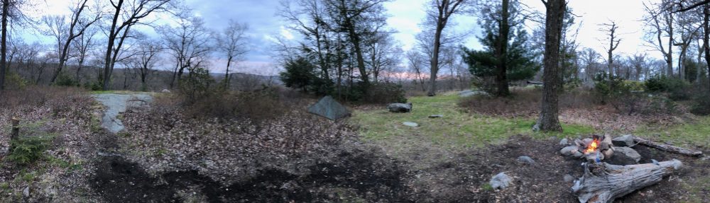
View from Lookout Point on Barrack Mountain (Click to englarge)

I had attempted ascending Barrack via the southbound route a few Novembers ago as well, in similarly leafy and damp conditions. I turned around half way up. It is extremely steep, and with wet slippery leaves everywhere, it was downright dangerous. There are scant few if any actual switchbacks here folks. Same on the way down. And there are a lot of precipitous ledges that you were climbing up and along. Even with Brian there who had done this section and was spotting me, it felt just as sketchy as last time. Though I was glad he was along because as I felt last time, if I fell there, no one would hear me or find me for days. My arms are still sore; I did a lot of hand over hand work on the way up. The view up there is pretty amazing, and I noticed there’s an easier trail coming up the gentler side from a Jewish retreat center, I’ll have to see if it has public access, I imagine it does.  We’re friendly people!

Good blazing and signage here, trail could use some maintenance

Good blazing and signage here, trail could use some maintenance (Click to englarge)

Heavy wind gusts barreled across the mountaintop as we took in views of Lime Rock Park raceway and Sharon Mountain beyond. We knew we would have rain and wind overnight and were worried it moved in early, at the worst time. Going down was very steep rock faces topped with millions of slippery pine needles. Wet that would have just been life threatening. It felt close as it was. The rain did not come thankfully, and I did some butt-scooting down where necessary. No shame at all. I like living thanks very much. I’m here to hike not scale cliffs. Sometimes they throw that at you though and you gotta manage. A cool highlight along the way was an old A.T. geological marker like we found on Red Mountain a few years ago.

Also luckily Brian made the best suggestion ever — bring spikes, even if just for the wet leaves. SO we did. Let me tell you, I’m not sure how I would have done Barrack with a full pack and not just slid off the mountain. It was a game changer. Also when we had to cross large wet slippery blowdowns of which there were many. And stream crossings. We stayed off rocks as much as possible so as not to wear them down, but it’s worth keeping an old pair around when you replace or upgrade them because it really made us feel much more confident and sure-footed.

Day 1: The left shows Barrack Mtn and Dean Ravine, then Music Mtn

Day 1: The left shows Barrack Mtn and Dean Ravine, then Music Mtn (Click to englarge)

Dean Ravine was everything I expected — stunning. This whole section was. I have around 25 pictures this time because it was even impossible to get it down to that few. I’ll let the pictures do the talking. There is nearby parking access and a short hike down to the bottom of the falls and I recommend it. Breathtaking.

We started around 1:30 and it was a tough hike into the shelter (see the GPS grab though just the red lines because the bit above is not the topo for this bit, i moved it by accident when taking the screenshot). We got in just before dark and hung our bear bags. We knew heavy wind and rain were coming in overnight so we decided to sleep in the shelter… my FIRST time!  Good call. Besides, its hardly used because this trail is hardly hiked so not much food around to attract mice or worse. It was very clean, and the shelter log was nearly empty. Someone had a geocache in there but it looks pretty neglected too. This shelter was built in 1988, the same year they moved the A.T off here, just months later I assume. We had the place to ourselves. Some people do the Mohawk as a loop with it’s replacement A.T. portion so I’m sure some people stay here once in a while.  It was great. We had dinner and then talked in the shelter till around 9pm.

A view looking up the north side of Barrack Mtn.

A view looking up the steep north side of Barrack Mtn. (Click to englarge)

Overnight heavy winds and rain rolled in. It was heaviest and worst just before dawn, and was still going when we were getting up. But within 30 minutes as we made breakfast and packed up, it began to clear into another beautiful day. I felt safe and warm (if not too warm) in my sleeping bag in the shelter. I may be doing that more, at least when out solo with friends. As a ridgerunner I won’t take the shelter. And my wife isn’t interested in them, unless we are alone. I kind of feel the same way, though I am excited to have more shelter stays now. I got to try the loaded mashed potatoes for a dinner and it was the best! I will be redoing that one, it hit the spot. and you can throw some shredded jerky or meat or cheese you have in there to snazz it up. I brought a little olive oil. Good calories and fat and light.

Old A.T. geological marker

Old A.T. geological marker (Click to englarge)

As we hiked out on day 2, it was much more gentle terrain I dubbed the mercy miles. My arms and legs were shot from day one’s climbs and descents. We did have a few climbs this morning too but it was about 58 degrees, clear and breezy and beautiful hiking weather. We were treated to a large pond full of beaver lodges and dams and handiwork you can see in the photos below.

Driving around this area is also absolutely beautiful. The bucolic views of farms, country houses, pastures, rivers, mountains and covered bridges to postcard-worthy old towns are a treat of their own. We spotted many a home in the mountains that we’d live in ourselves!

A shot of the steepness on the south side

A shot of the steepness on the south side (Click to englarge)

We stopped at the Cornwall Country Market in Cornwall Bridge on the way home for what thru-hiker Underdog and his friends call a “hiker smash”. I had a bacon-egg-and-cheese, tater tots, a gatorade, banana and a coffee. You can fill up to 20oz of coffee for $1 at the market if you have a container. As if I wasn’t already a huge fan of their amazing food. Last time Brian and I had breakfast on the porch was after one of my ridgerunner weekends last July or August. I love having so many great hiking friends. And it was an absolute dream to be able to backpack in the middle of January. Sadly it’s pretty much guaranteed a result of climate change.

I am now done with the Mohawk, and I just received my Mattabessett completion patch! I think next I will focus on the New England Trail again and finish the bits of the Menunkatuck and as much of the Metacomet as possible before my A.T. season starts again. I am also just 1.5 miles off from finishing the Connecticut Forest and Park Association’s CT Blue-Blazed 200 Mile challenge!  I am continuing my role as a weekend ridgerunner in Connecticut and southern Massachusetts again this year so from late April to Mid-October I will be mostly on the A.T. working or doing section hikes with my wife. I should be able to finish the Connecticut portions of the N.E.T. in the next season or two if I stick to it!

Miles day 1: 4.8 (.5 road-walk from parking)

Miles day 2: 5.3

— Linus

Many more photos from this hike below.

The brook below Dean Ravine

The brook below Dean Ravine

More of the brook in Dean Ravine

More of the brook in Dean Ravine

Linus looking up at the waterfall in Dean Ravine

Linus looking up at the waterfall in Dean Ravine

Wickwire shelter at Dawn

Wickwire shelter at Dawn

Breakfast at the shelter

Breakfast at the shelter

Packed up and ready for day 2

Packed up and ready for day 2

Horsetail, an invasive but pretty

Horsetail, an invasive but pretty

The pond with all the beaver activity

The pond with all the beaver activity

Beaver handiwork

Beaver handiwork

More beaver handiwork

More beaver handiwork – the water on the left kinda looks like the left half of Connecticut!

Walking through young forests full of stone walls from a different time

Brian Walking through young forests full of stone walls from a different time

Mossy moonscape

Mossy moonscape

Linus on Pond Hill at 1450ft through old pastures

Linus on Pond Hill at 1450ft through old pastures