Back to the Shawangunks and Minnewaska-Winter hike

Getting ready to hit the trail

Getting ready to hit the trail

As planned we headed back to the Hudson valley for our anniversary weekend so we could finally visit Hyde Park on Hudson and do more hiking in Minnewaska State Park. We visited here back in January, right when the Government shut down went into effect and effectively shut down our visit to the home of President Franklin Roosevelt. We are big history buffs, and also fans of the wonderful things his New Deal created such as the Civil Conservation Corps. Not only did the CCC help stabilize the economy after the great depression by providing thousands of jobs, but it also created some of our favorite state and national park buildings and roads. The more parks I visit, the more I see their handiwork and am grateful!

At the trail junction

At the trail junction

We had a great visit to the home on Friday and very much enjoyed our tour. These guides have a passion for their subject; I think I would love a job like that! We enjoyed a great lunch and dinner in Poughkeepsie as part of Hudson Valley restaurant week, and hope to get back in the fall to visit Eleanor’s house, Valkill, a few miles east of the main house.

The next morning we went back to New Paltz on our way to hike. We called Mohonk preserve from the hotel before we left as we were going to try and hike there but they said they only had snowshoeing and cross-country skiing, and no hiking. By that I deduced they just meant guided outings. This is a place where the very wealthy play and are pampered so I imagine this type of guided activity is the norm for their guests. I later realized as we passed one of their gates while entering Minnewaska S.P. that you can hike their trails if you so desire, you just won’t have a guide. No problem. No guide needed. That parking area had lots of outdoorsy folk getting out into the snowy wonderland and no sign of a guard station or entrance fee.

Fielden Stream

Fielden Stream

We stopped into the outfitter in New Paltz called Rock and Snow to look at maps of the rest of Minnewaska S.P. and see if they had any idea on the trail conditions. Given all the recent snow, we didn’t want to be postholing and didn’t have deep snow gear. We did have our microspikes (I recently picked up a used pair for Fielden Stream on a used hiking gear forum) and so as long as the trails were not knee deep in snow we wouldn’t need more than those. They didn’t have a lot of information on trail conditions and I found the map a little too minimal, so I checked my trusty AllTrails app and found many short loop options. As we drove west to the park, we could see that most of the mountainsides were snowless give or take a few spots. Of course this doesn’t always mean there’s not snow on top or on the trails. But it didn’t look too foreboding.

High Peter's Kill /SRT

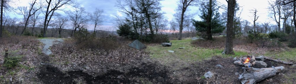
High Peter’s Kill /SRT

We picked a loop in the Peter’s Kill (the Dutch word for a river) area that circled the rocky craggs of Compass Rock and then followed Peter’s Kill back to the park office. I didn’t realize this area had a park office/ranger’s station until we got there so while we did have to pay a $10 parking fee, I am always fine with giving my money to support these parks. Plus, they had information, detailed maps of the area’s trails, a nature exhibit, bathrooms, and snowshoe rentals should we have needed them. The ranger was also able to tell us the trail conditions and that spikes were fine for the conditions. We saw many people out there with no spikes who said ‘we should get those’ when they saw ours, but they all managed without. We like the extra security knowing we wouldn’t slip on icy spots and had traction in the snow on the climbs and descents.

Classic Gunks rocks

Classic Gunks rocks

We got our spikes on and headed up the Bullwheel trail to start our loop. The climb from here was easy and not much of a grade. To the east, several rock climbing and bouldering trails branched off the main trail but you need permits for those and no one was out rock climbing considering the snow was 3-4 inches deep everywhere. These were indicated by blue/yellow blazes, though I didn’t figure that out till later.

Linus playing beneath the boulders

Linus playing beneath the boulders

We reached an old concrete foundation which we learned from the ranger was part of an old ski resort up the side of this hill back in the day. There were several runs, one of which we hiked up at the end of the loop. This was likely the support for the lift tower. At this point we were skirting the eastern edge of the rocky summit, and in better weather with a bouldering permit you can scramble up to the top. I was enticed for a second but without a permit, I don’t really believe in breaking rules. Especially when I ask others to follow and respect these kinds of rules as a ridge runner. I also wouldn’t want to have my wife deal with a fall! I will come back later when its dry and warm and with a permit.

Incredible view of the Catskills

Incredible view of the Catskills

The trail intersected here with the High Peter’s Kill trail. It is part of the longer Shawangunk Ridge Trail which follows the ridge lines for the length of the park. The trail continued east to the Mohonk Preserve but we continued west on the High Peter’s Kill portion around the summit of Compass rock. There were amazing views from its western slope to the high peaks of the Catskills just to the west. It descended sometimes steeply for a snowy trail to the banks of Peter’s Kill, a beautiful river nestled between the two mountains. It was wide and deep and had watering holes and a nice waterfall we passed. In the summer this would be an ideal place to cool off.

After following the river for a bit we opted for the shorter (but we would learn steeper) route up the red trail back to the parking area. This took us up the side of an old ski slope to where it met the Bullwheel trail we climbed earlier. A family with young kids was descending this trail and slipping all over the place because it was steep. So we were again glad to have our traction devices. We got a nice workout climbing up the hill and then enjoyed the gentle decline back to the trailhead.

Peter's Kill

Peter’s Kill

It was a short loop but very scenic, with all the typical flora and rocky crags you expect in the Gunks. With the snow, it was much more of a workout than in normal conditions. It wasn’t too cold and we had a great time. We then made our way to our friends’ beautiful home in nearby Cragsmoor, where we enjoyed a roaring campfire before a great dinner together. One day we will live that mountain and country life full time. For now, it’s always a pleasure to be in the mountains and the woods

More Shawangunk Ridges

More Shawangunk Ridges

Tomorrow I will be joining our overseer of trails with my Connecticut AMC chapter to inspect a section of our portion of the Appalachian trail and report back to the crews what work needed to be done. We will cut small blowdowns and clear what we can but we have larger work parties to do the heavy lifting, as well as sawyers to cut the big trees. It will be good to see the condition of the trail in Northern Connecticut as Fielden Stream and I will be out doing a section hike in Northern Massachusetts in 2 weeks and I was a bit anxious of the snow depths having just had our fourth Nor’Easter in a row. Last I read someone had to be assisted off the A.T. in that area of the Berkshires due to deep snow he wasn’t prepared for. Temperatures look like they will be in the 40s-50s until then so I’m hoping we will need nothing more than spikes. I will also check before we go with my contacts that maintain the Massachusetts section as they will know better than anyone.

We were planning to overnight it on that trip but it depends on if there’s snow up there as we don’t have much overnight winter gear. I know many thru’s are making the trek in deep snow in the Smokies right now with not much more than normal hiking gear, but there are shelters there. This section would only have a primitive campsite. If there’s a bunch of snow up there we will do it as a day hike, and this hike in Minnewaska was a good intro for Fielden to using her microspikes should we need them. I will do an entry on tomorrow’s trail maintenance hike as soon as I am able.

Miles: 2

– Linus

Trail maintenance and a little Appalachian Trail history

Housatonic River

Housatonic River

If you’re reading my blog regularly you know by now I am a volunteer for my local Connecticut Chapter of the Appalachian Mountain Club, who are responsible for maintaining the section of the Appalachian Trail in our state. For those of you who don’t, I do a job very similar to the seasonal ridge runners employed by the Appalachian Trail Conservancy and state maintaining clubs.

I believe it is the Berkshire AMC chapter in southern Massachusetts that hires the ridge runners for these two states. You can apply online to do this role in your region each year at the ATC website. If you get the gig, you are paid to be out there for around 5 days at a time, and off a few days for the duration of the season, something like April to October. You go back and forth along assigned sections of trail, interacting with and assisting hikers along the way. The only main difference in my role is I am out there when I can be or when occasionally asked to be at a peak time, and I’m not usually paid for it unless I am called up for these specific times. I’m pretty new on the job so this summer is when that will likely be the case for me for the first time. And pay or no pay that’s ok by me. I’m just happy to be out there giving back and taking care of the trail while doing something I love.

Fun Scrambles

Fun Scrambles

And as much as getting paid to do this all season long sounds like a dream to me, as a parent and full time employee of a marketing company, this is what works for me at the moment. Maybe one day I can work full time for the ATC. In the meantime, this role and my hikes with my family keep me happy on the trails. (See what I did there?)  The job also includes some manageable trail cleanup, campsite cleanup (including official sites and stealth sites), leave no trace education, and reporting any larger issues to the organization that are out of the scope of my responsibilities or abilities. You may also know from reading this blog that I also join the AMC for work parties on other state trails besides the A.T. when I am able.

So last Sunday I was back up on the A.T. to do some of my trail volunteer work. Despite being early February, El Nino has made for an unseasonably warm winter with little snow to date save for one blizzard (though it is currently snowing as I post this). It was in the high 30s by 9am and warming up quickly to the high 40s on this clear, beautiful day. Though I didn’t end up running into any hikers on this section of trail, just folks walking their dog or going for a walk/run on the flat river portion which begins just south of my starting point. I did my training on that section and another day walking the section from the state line to Bull’s Bridge recently, so I thought I’d pick a different area, and one with a camp site I haven’t visited recently.

Arriving at the camp site

Arriving at the camp site

I made note of blowdowns (fallen trees obstructing the trail) as I ascended up to Silver Hill campsite. This also happens to be the campsite Fielden Stream and I spent our first night on the trail together. And t’s a great one, about 800 feet up the side of the mountain, and complete with covered pavilion, deck, porch swing, water pump, and a new mouldering privy. There used to be a cabin where the deck and swing are, but that was burned down accidentally by some careless campers in the late 90s. The deck is all that remains and at some point the swing was added. I don’t know if the covered pavilion was there at the same time but it would make sense.  The campsite is only about a mile in either direction from a road and is easily accessible other than a bit of uphill hiking.

The deck & swing

The deck & swing

I enjoyed doing this section of trail again, even though it was short, and didn’t recall it being as much uphill as it was. There were a few spots where minor scrambling were required and I was proud of us for having done that on our first backpacking trip together, fully loaded up with heavy gear.

I stopped in to the campsite and cleaned up a fire ring, or should I say a fire site, because they didn’t even bother to put rocks around it! The ATC and AMC crews had recently downed a large evergreen that was a hiker risk, and the remnants were still there as the cleanup process was not yet complete. So unfortunately it made for easy firewood.

Silver Hill Pavillion

Silver Hill Pavillion

I also swept the privy and then checked for other campfire spots before sitting down to sign the register and try out my new MSR Micro Rocket stove and Toaks titanium cook kit — finally. I forgot the little peizo lighter the stove came with, but I had a mini Bic and matches along, and I was thrilled to be using it for the first time. It’s an even more compact version of the Pocket Rocket and fits perfectly in my new cook kit, allowing the lid to close fully. Ahhh, OCD. My original Pocket Rocket stove still works great and will be a great backup or loaner for friends hitting the trail with us that don’t want to make the investment for a one-time outing or the rare trip.

Coffee Break with the new stove

Coffee Break with the new stove

I had my Starbucks Via coffee and Tic-Tac container of powdered creamer and sugar (the backpackers spice and condiment hack!) and really enjoyed having the time to make a hot beverage. My only oversight was I forgot my homemade windscreen and since it was windy, efficiency on the stove fuel was compromised and I will need a new canister soon. Not to worry, as I was just out for the morning and any chance to use my backpacking gear is a good time. The stove performed exactly as its big brother, so it was familiar while being new and more streamlined. What a great product, in both cases. I then enjoyed my coffee on the swing before heading up the trail for one more ascent.

My down jacket being overkill, I wore my Patagonia Houdini wind shirt this time with a synthetic long sleeved base layer and an REI safari tech shirt (my ‘uniform’ shirt) and was plenty warm, even to the point of shedding the Houdini early on the climb. It is probably my favorite piece of gear I own. While not entirely waterproof it has a good DWR coating and I haven’t soaked through in it yet, either from rain or perspiration. It breathes despite not being ventilated so it keeps warmth in but doesn’t boil you from the inside out. And at 5oz, you can’t go wrong bringing it even if you never use it.

Camp fire cleanup

Camp fire cleanup

Besides I did some research over the last few days and almost everyone says you shouldn’t long distance hike in down (especially with a pack on that prevents room for air to travel between) but instead use it for a layer in camp after you’ve shed your pack and are not moving and generating excess heat and perspiration which can then cause moisture and freeze. I can certainly attest to this moisture accumulation on the last few hikes. It’s just too warm and wets with sweat too easy. I suppose your mileage may vary but I’m pretty warm-blooded. And over long periods of time this could become a safety risk as cold + wet = hypothermia danger. Synthetic is a better choice for this application. You could probably get away with skiing and snowboarding in a down coat as long as its got a waterproof coating and you’re not carrying a backpack. So that question has been answered for the time being. And I can layer either my Houdini or fully waterproof raincoat with my fleece and wool or synthetic base layers to achieve the warmth I need and shed them accordingly to avoid overheating.

Exped Trekking Poles

Exped Trekking Poles

I also got to try my new Exped trekking poles. These things are super light, and highly collapsible, which is great when every ounce counts. I guess my only negative feedback was they popped into the unlocked position a few times during use, and particularly when I was bearing weight down on them. This makes me think either I’m not using them right or they’re not strong enough to handle the weight of my body when using them to support it without disengaging, While it was only inconvenient on this hike, it could become downright dangerous. I’m going to reach out to the company to make sure that this isn’t a defective pair. Light and compact is great, if they do as good a job for me as my current REI Traverse poles or other more stout models.

The ridges of the Mohawk Trail to the East

The ridges of the Mohawk Trail to the East

On the hike I enjoyed extended views we did not have on that first overnight due to there being no leaf cover this time except for evergreens and the occasional Beech. I had great vistas almost 360 degrees around from the ridges.

The descent down to the road was on the steeper side, and with the heavy leaf cover I opted to walk back on the roads rather than reverse and retrace my steps when I reached the trailhead. While I prefer trail over blacktop any day, I had done what I came here to do, had a time restraint, and I felt there was no need to re-traverse rock scrambles on slippery leaves when I had an alternate, safer option. Though one could argue which is worse, slippery leaves and slick rocks or a mile walk on Rt 4, where cars heading to and from New York seem to maintain a 75mph average speed! Fortunately the second mile was alongside the Housatonic on the portion of River Road that is still paved, yet only used by residents. Along this road walk I could see part of the old town of Cornwall — it’s old church, historic homes and train stations — across the river, now nearly invisible from the modern bridge above which connects Rt 4 and Rt 7.

The rocky descent North to Rt 4

The rocky descent North to Rt 4

I passed many gorgeous country homes I would happily retire in, and disturbed a large family of blue jays along the walk back to my car. I made a detour to the stunning Kent Falls State Park on the drive back, to take in the beauty of the frozen cascade, and without having to pay the park entrance fee as it was the off-season. The A.T. in Connecticut at it’s earliest route passed behind the falls on its way north.

I got the 1968 Connecticut trail guide I ordered from a rare book store in the mail the other day, and while it didn’t have this 1930’s original route behind the falls (a massive hurricane in the 30s washed out the bridge once near my starting point and forced a reroute over Silver Hill),  it did have the later original route east of the river from Rt 4 in Cornwall over Mohawk, Red and Barrack Mountains. This route is now known as the Mohawk Trail. In a similar turn of events, a serious case of bad weather — this time tornadoes —felled the famous Cathedral Pines on this section in 1988. And at that time, with local residents also worried about the implications of what a now federally-protected trail would mean for their land ownership, the trail was re-routed west of the River from Route 4 to the Great Falls in Falls Village.

An icy Kent Falls

An icy Kent Falls

The book also includes the original trail route through Macedonia Brook State Park (see my last post) in Kent which took a large circular swing out of the way for the epic views I showed in that post all the way to the Taconics and Catskills. Apparently there was also a lean-to on Pine Hill. What a spot for it. I wish I had this book a week earlier — I would have looked for the location of the old lean-to. Oh, and that first southern section over Ten Mile Hill in Sherman to Bulls Bridge in Kent? Not on the original trail. I am still trying to find out when they re-routed that amazing section.

For a map geek like me, seeing this old map was like finding dinosaur bones on an archaeological dig or a pirate’s treasure map. It’s my favorite new book. I am hoping to find an even older guide or at least a map from that very first route from the mid-1930s.

Total Miles: 4.5

— Linus

Appalachian Trail – NY Section 5

Interesting sign facts

Interesting sign facts

I’m going to start this post reiterating to myself to never base a trip on the weather forecast, unless maybe there’s a hurricane or tornadoes. Fool me once, shame on you, fool me twice, shame on me.

This was planned as a 2-day, overnight, 2-section outing. We were in the clear to get on the trail yesterday to do section 5, and stay the night at either RPH or Shenandoah tenting area if it was full, and do section 6 today. We knew it was going to rain. That was a given, and a factor we are well used to by now and really don’t mind that much. It was just that this forecast called for 100% chance of rain from 1pm yesterday to 8 pm tonight, with potential 38 mph winds. That just sounded downright unsafe, let alone miserable.

Southbound!

Southbound!

Being section hikers, we have the luxury of altering our plans accordingly. In fact based on this forecast, we almost didn’t go. I had gotten the time off already so I thought of maybe a trip to the Pequot Indian museum — a place I’ve wanted to visit again since going as a kid. I’m fascinated by Native American history and collect Kachina. However something must have been going on at the casinos there because every hotel with rooms under $200 a night in the area was booked.

Then we said you know what, no, we are going. We will just do a day hike, get one of the two sections done, check out RPH for next time and sill have a great time. It’s only an hour away. And we DID have a great time. We had a great hike, some beautfiul views, a nice chat with some local section hikers (Quicksilver, Skylark) and despite some rain, ventured on a bit into section 6 to check out RPH (Ralph’s peak hiker cabin) shelter. That place is amazing. It’s right by a road and you can order pizza or chinese there, there’s 3 bunkbeds, a desk, a covered patio, picnic tables and chairs, a large lawn for many tents, a water pump and a colorful outhouse.  There was also a case of beer of trail magic from the night before, so we had a beer and signed the register before we left.

Hosner Mountain Ferngully

Fern gully

As we drove back, the rain steadily increased. It rained all night, and we told ourselves that we made the right choice. I did hear some wind last night. But to be honest we’ve spent many nights in our tent in a downpour, and woke to a drier morning to pack up and hike out. In fact just last time at Sages Ravine was quite a storm. But at RPH we could have had a great meal under the porch, socialized for several hours, and ran to the tent for bedtime. And we were lamenting this fact as we sat under the porch enjoying the beer.

Sure enough, I awoke this morning to no rain and the forecast of a 10% chance between now and 4pm when some possibility – 35% of thunderstorms – could occur. By 4, we’d be on our way back already. 7 miles of walking even at our pace would put us somewhere around 230pm if we got our usual early start. I’m kicking myself. Why did I let these predictions, which are almost universally inaccurate, cut short our trip? Grrrrr. Never again. Unless like I said… hurricane, tornadoes….tropical storm…

IMG_7804

Fielden Stream on Hosner Mountain

On the bright side it wasn’t the first and it won’t be the last trip of the season. We’ve already done 3 overnights since April, covering 25 miles of the trail and in doing so checked one state off the list and a nice chunk of another! Also we are taking my family (my little brother is visiting with his boys from L.A.) to car camp and do the Pine Knob Loop for the fourth of July weekend next weekend, then taking my son “Jiffy Pop” to do section 4 of NY (we skipped it to save it for him) two weeks later. Another few weeks later we will be in Harpers Ferry and also southern WV for a wedding and will try and complete the 6 miles of that state with him.

Hosner Mountain vista

Hosner Mountain vista

We’re already talking about doing an overnight starting at RPH after work on a friday night, and then hiking out this section the next day on one of the weekends in between in July. We have a 3-day 2-nighter planned to finish sections 8 and 9 with friends and make it to Bear Mountain NY in mid-October. And race and Everett in the Berkshires of Massachusetts in September – though we could switch that to section 7 of NY if time is more constricted then and get back to Massachusetts next season. My goal by the end of this season is to have covered all the trail from the Mass line across the Hudson to the top of Bear Mtn NY. We did the trail from the Inn to the top of Bear a few years ago already, and the awesome and steep Major Welch trail. We did Connecticut northbound but are doing New York southbound. Simply because of its proximity to our home.

Blackberries

Blackberries!

Also on the bright side, it was a beautiful hike – even with the rain, and THAT is why we are out there at all. Lots of lovely ridge walking, great views of the Hudson river valley, the Shawangunks and the Catskills beyond, and even picturesque views of Interstate 84 and the Taconic State parkway! This land, known as the Fishkill plains, was 85,000 acres of formerly native American land that was traded to the English and Dutch in 1685 as part of the “Rombout Patent.”

Also, the trail maintainer, “Elvis Trailsley,” does a fantastic job of trail maintenance. There were many lovely corridors of placed stone and log benches, many cairns where we and other hikers are clearly enjoying adding stones to, and many small blazes on rocks in mid-trail so there’s no risk of ever losing your way.

Trail magic from Loggman! Tap the rockies!

Trail magic from Loggman! Tap the rockies!

He had an interesting sign on Stormville about the divide and water flow, and one at the creek by Hosner mountain road warning hikers of the danger of not treating the water there due to the farm upstream. We love seeing the different personalities of the maintainers of the different sections, and this man does a fine job! Thank you.

We saw and tasted our first wild blackberries of the season, and tromped through some beautiful fern gullies and hemlock groves. And got very excited for doing this next section knowing how special RPH is. Heck, we dont even need to bring our full packs if we did it that way! We could load up our car with trail magic and treat everyone that night if we wanted to then just leave our sleeping gear in the car and day hike that section. We will see! We’ve wanted to return the trail magic for a while.

Signn at RPH shelter (section 6)

Distance sign at RPH, not far to Bear Mtn bridge!

I’m going to appease myself that I’m not hiking today by taking this opportunity to go to REI’s 4th of July sale and get some outdoor gear retail therapy! Need some more fuel and mountain house anyway. And, I get to spend more time with my kids today. We will have lots of guests on our hike blog next weekend. Until next week, happy trails!

— Linus