Backpacking Harriman with Whoops! Trip #2

Last weekend I got to take my friend Whoops! out on another overnight adventure in Harriman State Park in New York. This time however our camping portion was a bit more civilized! We opted to hike into AMC’s fairly recent (3 years old?) Harriman Gorman Outdoor Center. Fielden Stream and I had a lot of fun with our friends Goat and Kelby at the Mohican Outdoor Center many years ago, and I thought why not try the new place? While we did not rent a cabin and stuck to a ‘backcountry’ style campsite on the grounds, we were still right next to the wash houses, dining hall and other facilities at the camp. As I am member and AMC seasonal employee, I got us a small discount. This used to be a camp for urban youth to experience the outdoors.  You can take out boats, swim off the pier, and there’s the usual AMC family-style meals if you so desire. Which we did!  We did not get a chance to take a boat out as they were all booked and the place was full. But we did manage to get seats for the buffet and distanced dinner which was great, and it was nice having water and bathrooms readily available. Most sources on the trails were dry. This time of year this is often the case so this is also part of the reason I planned it this way.

There was a little confusion finding the trail down to the camp from the Breakneck Mountain trail, as there was only an orange ribbon marking it at this time. I gave them the feedback that they need a sign up there not just from camp pointing up (of course I did!) and the girl at the desk seemed a bit surprised that we walked there, as most people just drive in from the city. I found it amusing that she was surprised considering there are hundreds of miles of backpacking trails and shelters in the park. There was also some confusion about the reservations for dinner and boats, as when making reservations you’re talking to their main line out of the Boston area, so they need to work on that communication a bit. But we had a nice time anyway and the ice cream and gatorade we had when we arrived was worth the 5 miles in the hot and humid conditions.

There was a view or two of the Hudson river valley and Breakneck pond, but mostly this walk was wooded and rocky. There were many many blowdowns some so large they completely obstructed the trails so there was a good deal of walking around, over and under large trees. But we had a great time, made some friends, had a great swim and a campfire with a family in our camping area. I used my hammock and Whoops! used my wife’s gear and my old solo tent again. Though as of now, Whoops! just got the backpacking bundle and an Osprey Eja 48 in the REI labor day sale so she is fully outfitted! I gave her some extra poles we had and my wife gave her some Keen boots that weren’t fitting her well and they work great for Whoops! She will be a pro solo backpacker in no time!

We met a box turtle and lots of frogs, and there were some strange sounding critters running around camp at night, clearly looking for dropped snacks from campers. It was 5 miles in and 3 miles out in this loop which I found in the circuit hikes in Harriman book. We were very close to Big Hill, the shelter we stayed at earlier in the year. We will continue to explore this amazing park, as well as the A.T. of course!

On day 2 I did a small bushwack to Eagle Rock, a summit that used to be clear and on the trail I believe. We were so close that on the way back I couldn’t resist. Plus I had Whoops! there to voice guide me back if needed.  Day one was the longest backpacking day for Whoops! so far, and there was a 1,000ft elevation gain at the beginning and the same at the other end on day 2. Lots of rocks, almost like the Pennsylvania A.T. in places!

A note that the parking area on Diltzes lane was closing for construction as of the day we returned. Phew! Seek a different entry point if doing this loop. Perhaps the road closer to big hill is a safer bet.

Miles Day 1: 5

Miles Day 2: 3

You can watch the video here. Photos below.

— Linus

Linus and Whoops! ready to hit the trail

Linus and Whoops! ready to hit the trail

View of the Hudson river and valley

View of the Hudson river and valley

Big blowdowns everywhere

Big blowdowns everywhere

Grandfather stones

Grandfather stones

Classic Harriman scenery

Classic Harriman scenery

More typical Harriman scenery!

More typical Harriman scenery!

Breakneck Pond

Breakneck Pond

My setup for the night

My setup for the night

The pond from the dining hall

The pond from the dining hall

The beach and swimming pier

The beach and swimming pier

Dinner with a view

Dinner with a view

Farmers Tan Beach Fun

Farmers Tan Beach Fun

The water was so warm

The water was so warm

Our campfire

Our campfire

Morning view from the hammock

Morning view from the hammock

Prepping to leave camp

Prepping to leave camp

Box turtle on day 2 hike

Box turtle on day 2 hike

Hiker Bagel smash

Hiker Bagel smash

Another Return to Minnewaska

Two years or so since our last adventures in the Shawangunks, we finally made it back to visit our friends in Pine Bush, NY, and hike with them this time!  We did two hikes there in early 2018, you can read about them here and here.

We had a nice time catching up for the weekend and I even brought a 27-year old Dom Perignon Champagne! We sat around their fire pit, played and sang songs and also visited a winery and a brewery on the visit.

But of course I’m here to tell you about the hike! I’ve always wanted to hike up these rocks and get the ultimate hiker photo! It was a nice Saturday and we just made it in time before the lots were full. I had originally picked out a view on the map to head to but as we got many of the same views along the way, we decided to do the loop around Lake Minnewaska (not the only lake here) as it is pretty darn beautiful and I could get my picture without having to go back up there later.

They are building a new visitor center which you may be able to see in the background. I hope they paint it a color that blends in to nature. I recommend buying one of their water/tear-proof maps for $5 at the gate. It will last years of hiking there if not more.

We hope to get back in the fall and check out some of the trails at Mohonk Preserve. The views on the drive up over the mountain were incredible too and reminiscent of skyline drive in Shenandoah National Park. This hike wasn’t really challenging as it was mostly carriage roads. But there was about 700ft of elevation gain in our nearly 5-mile loop.  Photos below.

Miles: 4.8

— Linus

Oxeye Daisy

Oxeye Daisy

First views of the Catskills

First views of the Catskills

More Catskills Views

More Catskills Views

Lake Minnewaska

Lake Minnewaska

"THE SHOT"

“THE SHOT”

The girls

The girls

Beer making

Beer making


Harriman Overnight Backpacking Trip (NY)

Last Thursday I decided to finally realize my multiple threats (or should I say requests!) for a mid-week overnight backpacking trip between work shifts. I don’t know yet when I will be able to go back out in the field for work, and since there’s not really any open A.T. sections in my area that I haven’t done yet, I decided to find another great hike nearby. I have been tossing around the idea of Harriman State Park in New York since my previous two hikes on Connecticut’s Regicides Trail. This is mainly because they are very reminiscent of each other in ways.  I did research some other overnight sites in Connecticut but most were in state forests or parks that were not open. There were some options, but Harriman was at that point just calling me back. I did a solo overnight there in 2015 over the Timp and West Mountains. That was a scorcher! Well of course I became so pre-occupied since then with the A.T. and my various trail jobs on it as well as local Connecticut trails that this park just fell off my list.

But as I began to ponder and plan something there, I began to recall all the fantastic scenery that is to be enjoyed. Having done all of the A.T. in New York, we were also treated to another long section of trail in the park, including the famous “Lemon Squeezer.” This loop would take me within less than a mile of that feature, and was extremely reminiscent of the bear-troubled Fingerboard shelter and mountain, just north of where I camped. While this shelter did have a bear activity sign, being OFF the A.T. means a LOT less traffic and use, so I wasn’t too worried and didn’t have any issues. I am experienced in these matters and practice proper food storage and preparation guidelines and i know that helped. In fact I had the place to myself which was just what I needed out of this hike.  I did encounter many people day hiking, even a couple backpacking, but no one but myself stayed here.

Wow, was I right in my recollection of the scenery here. And I’ve only explored a tiny fraction of this park to date. I had some issues with one of my trekking poles on this hike, and my tent is trekking-pole supported. So when I got back I ordered some new poles which are on the way, and also a book of 35 circuit hikes in Harriman. Happy to give money to a great organization like NYNJTC (New York New Jersey Trails Conference) and I spend so much time on the computer, sometimes Its just nice having a book. I would print out maps for the hike and not bring the whole book along, but it’s also easier than scouring 100,000 web page reviews of best hike options for an overnight.

Mountainhopper helped me at the last minute decide which of several loops to do, as he had been doing this one (or a slightly longer version) the last few days and knew which roads and lots were still open from the Covid closures. The weather was glorious, even the rain overnight was no big deal. Though I’m much more tolerant of and accustomed to rain now! All part of the fun, embracing the suck.

Amyway, I made a video. Pictures are of course below, but if you want to see the video click here. I liked it so much it’s now my header image (using the panorama feature on my phone).

Miles total: 7

— Linus

Rules

Rules

I don't think we're in NYC anymore Toto

I don’t think we’re in NYC anymore Toto

Starting the climb up Hogencamp Mountain

Starting the climb up Hogencamp Mountain

Lone tree on Hogencamp Mtn

Lone tree on Hogencamp Mtn

Plenty of scrambles

Plenty of scrambles

Rock and vapor trails

Rock and vapor trails

Using Peakvisor

Using Peakvisor

Bald Rocks shelter

Bald Rocks shelter

Hey there Boo boo!

Hey there Boo boo!

Looking west over camp

Looking west over camp

RIding the mountain's spine

RIding the mountain’s spine

Approaching sunset

Approaching sunset

More sunset

More sunset

A bit more sunset

A bit more sunset

Gourmet

Gourmet

Sunrise from camp

Sunrise from camp

Hiking out on a soggy morning

Hiking out on a soggy morning just past sunrise

Rock runways

Rock runways

"Bowling rocks" just after sunrise

“Bowling rocks” just after sunrise

Laurel tunnels

Laurel tunnels

Morning fog over a lake

Morning fog over a lake

An old entrance to the Hogencamp Mine

An old entrance to the Hogencamp Mine

Hogencamp Mine. This is zoomed, Stay far away, if you fall in you are probably not getting out alive

Hogencamp Mine. This is zoomed, Stay far away, if you fall in you are probably not getting out alive, seriously.  This is the main shaft and VERY deep with walls as slick as slime


Birthday and Anniversary Hike at Ward Pound Ridge Reservation (NY)

Just one week later we decided to go for another hike at Ward Pound Ridge Reservation to celebrate Whoops!’s birthday and my and Fielden Stream’s 10 year anniversary. Parks are still open to encourage fresh air, sunshine and healthy distancing, so long as that is able to be maintained. Whoops!’s brother was visiting her and came along as well. We met several years ago at a BBQ and so it was nice to see him again, from a distance! We took separate cars, for starters.

This time we headed for the Leatherman’s cave and the vista above as our adventure, with a detour back to the CCC (Civilian Conservation Corps) camp to show Whoops! and her brother, and to see the bits we didn’t catch last week (see the entry below this one). For a little info on the Leatherman, check out the infographic plaque in the photos below.

Most of the trail we did was a wide carriage road except the one up to the cave and over the hill the cave was on, so the miles were easy except for those two climbs. I don’t know of a name for that hill, but the one just southwest is called Joe’s Hill and its about 70ft higher. You get a nice view of it from both vistas on the cave hill, as well as a wide view of the Cross River Reservoir and mountains and valleys to the west and north. I believe I spotted the hills along the Connecticut New York border which the Appalachian Trail straddles in the Kent area. But I did not pull out Peakvisor this time to confirm!

There was a good number of folks out enjoying the park again this time, and the park was free, i imagine to limit human exposure to each other, and to the attendant at the gate. Photos below.

Miles: 4.2

— Linus

A pleasant brook

A pleasant brook

About the Leatherman

About the Leatherman

Climbing up to the cave

Climbing up to the cave

Whoops! and her brother

Whoops! and her brother

Linus and Fielden Stream

Linus and Fielden Stream

Linus in front of the cave

Linus in front of the cave

Looking down the hill from the cave

Looking down the hill from the cave

Linus the Bear Man

Linus the Bear Man

View to Joe's Hill

View to Joe’s Hill

Linus Pointing to a distant peak

Linus Pointing to a distant peak

Linus on the hill

Linus on the hill

View from the vista

View from the vista

Whoops! and brother at Cross River vista

Whoops! and brother at Cross River vista

Linus looking over the expanse

Linus looking over the expanse

Wittling

Wittling

Linus breaking for the view

Linus breaking for the view

Site of old CCC camp mess hall

Site of old CCC camp mess hall


Family Hike at Ward Pound Ridge Reservation (NY)

On Sunday we decided some fresh air and sunshine would be good for us so we took our dog Jojo and my son Jiffy Pop (trail name of course) to New York’s Ward Pound Ridge reservation (park), a mere 30 minutes away and Westchester County’s largest park at almost 5,000 acres.  I had been to this beautiful park in the past for a hike to one of the famed Leatherman’s caves, but it’s been many years.  This park contains many stone shelters built by the Civilian Conservation Corps during FDR’s new deal, and there was a CCC camp here as well for the workers while they built the shelters and other stone works. The park has 35 miles of hiking and cross-country skiing trails, campsites, fishing, several picnic areas and a trailside nature museum. More info at: https://parks.westchestergov.com/ward-pound-ridge-reservation

In my new role at the Westchester Parks Foundation, this is one of the parks I will be at often to do volunteer park improvement events. So I was eager to get back there and re-aquaint myself with it. Of course, we only hiked 2.5 miles out of the 35 but it did serve the purpose at a basic level. I will get to know it quite well I am sure.  I did identify a few trail features I want to go back and address as a future project.

I was excited to get our dog Jojo back out on another hill, and my son Jiffy Pop as well, on this beautiful day. We did the Fox Hill trail, and a little bit of a walk through the Marsh. There were a lot of people it turns out, but given all the space and fresh air I’m not too worried it was a bad decision in this time of social distancing.  Photos below.

— Linus

Jiffy Pop and Jojo

Jiffy Pop and Jojo

Linus, Fielden Stream and Jojo

Linus, Fielden Stream and Jojo

View of Fox Hill

View of Fox Hill

Linus and Jojo on the Fox Hill trail

Linus and Jojo on the Fox Hill trail

Jiffy Pop stream crossing

Jiffy Pop stream crossing

Skunk Cabbage coming up

Skunk Cabbage coming up

Phenology Trail

Phenology Trail

Fielden Stream and Jiffy Pop and Jojo

Fielden Stream and Jiffy Pop and Jojo

CCC Camp was here

CCC Camp was here

A CCC-built shelter (one of many here)

A CCC-built shelter (one of many here)


Appalachian Trail Night Hike and Cold Winter Overnight

Ready to go!

Ready to go!

On Thursday, the much-delayed and much needed winter overnight finally fell into place. It’s been a rocky couple of weeks (pun intended) in the real world and as always, when things get tough, nature comes to my rescue. I was planning to do this the previous week. Some thought also went into doing it this coming week on my birthday, but that’s going to be a day hike with a more luxurious overnight to celebrate the occasion. Besides, the temperatures at night maybe something I will brave and did on this occasion, but are not enjoyable for most. Fielden and I have had our share of cold nights on the trail, but 25 is pushing it for her and this is now only my second time camping on such a cold night. I had been going back and forth on whether I was going to do it, but a trip to Bass Pro shops/Outdoor world that morning provided the final inspiration. Their new location in Bridgeport, CT is amazing.

Hitting the trail at dusk

Hitting the trail at dusk

I like knowing I can do it, so that if I do end up in these temperatures on a long section in the future, I am prepared. The last time was a very cold April night last year when I camped along the Housatonic River at Ten Mile River Campground. I also like doing these once in a while because it gives me a chance to re-test and possibly improve my layering and sleep system for the colder temps. I love testing gear. Like last time, the temperatures were around 25 degrees at the lowest.

I decided to go up to Wiley Shelter on the New York Appalachian Trail. As I’ve been there 3 times now, I know the layout, so finding my way around in the dark would be easy. And its a short hike out and its close to a road in case it was just too cold and I needed an emergency bailout . But I did not.

My layering and sleep system was as such:

Clothing bottoms: Long Johns (Patagonia Cap 3), fresh pair of dry wool socks (always have these!) and my hiking undies – REI synthetic briefs. (I took off the hiking pants to put on the long john bottoms. Sometimes I hike with both on.)

Clothing tops: (the bottom two were my hiking layers) Smartwool short sleeve base layer, Patagonia Dual Aspect hoodie (one of my favorite new pieces of gear, will also use for skiing and snowboarding), Marmot Precip rain coat.

Minus 33 beanie

Minus 33 beanie

Hat: Minus 33 beanie – finally I found one that fits my big noggin!

The final piece, the raincoat, was one I discovered and employed last time, because I just wasn’t at the comfort level I needed to be. Down is great but I didn’t want to sleep in my down jacket last time because once you do heat up it will wet out from sweat, and then become dangerous. I also don’t hike in down for the same reason, as I discovered on a day hike up Mt. Higby about a year ago.

Sleeping Pads: I combined two pads like I did last time. Was only planning on using the foam one but brought my inflatable because I thought that might be too close to the ground and conduct too much cold and I was right. the Thermarest z-lite foam pad does help add R-Value and protect from roots and rocks underneath, but on its own I quickly realized I needed to be further off the ground to be properly warm so I blew up my Thermarest Neo-Air Xlite, and voila, I didn’t feel the cold ground. The foam pad is a bit long for my modest height of 5’7″ so I did what many thru hikers do and cut off the top two panels and will use those as a seat. This also makes it easier to carry the pad between the body and brain of my pack.

Crossing Duel Hollow Brook

Crossing Duel Hollow Brook

Also one thing I’ve always read is to have a hot meal before bed as it will keep your body generating heat as it is working to digest the meal. So after a few failed attempts to get a lot of wet wood to light for a campfire ( a solitary mouse came by to watch and laugh at me failing before scurrying off), I got out my stove and had some Mountain House chili mac and washed it down with a little red wine. I did not bring a nalgene so I could not put a hot water bottle in my bag, but I didn’t end up needing it. I did put my Sawyer squeeze filter in there to keep it from freezing. I have frozen (or at least I think, don’t wanna find out the hard way) two Sawyer minis already because I left them in my backpack which I left in my car for a couple days after a winter day hike. They may be fine. But Guardia is no way to find out that its not. And at $25 each its really not a big deal to replace them.

Camping "essentials"

Camping “essentials”

Anyway I like the squeeze because its only an ounce or two heavier and the filtering flow rate is much faster. Since I usually hike with Fielden and or the kids, and I’m often in a hurry (i.e. impatient) I prefer the faster rate. In the future I’m going to get a Katahdin hiker pro, as my friend Ray recommended it to me and showed me his after the hike. I thought they were much bulkier and heavier but really they’re not. And being able to pump the water from low sources is a seriously good feature. I always bring back up tablets in case any of these filters fail or I meet hikers who have no method of filtration. This filter is more in the $60+ range so I will wait till the next sale at REI.

When I hiked in, temperatures were still in the mid 30s. The lowest point of 25 was around 3 or 4 am and returned to the 30’s with sunrise. But this is the time when are bodies are really at their coldest so its important to have the right amount of insulation from the cold so we are not at risk of hypothermia. My layering system and meal planning really succeeded in keeping me very warm throughout the night.

Sawyer Squeeze and Smart Water bottle

Sawyer Squeeze and Smart Water bottle

I also re-tested the whole smart water bottle with the Sawyer filter screwed on top. Thru hikers rave about this on their channels, as its so easy and convenient. My water bladder has sprung a tiny leak and so I figured I’d give it another shot. Still unimpressed. While it is convenient to just unscrew the thing, fill it with water and drink, every time you drink the suction compresses the bottle so you have to unscrew it partially to let air back in there. Secondly I don’t have a way to attach it to my pack straps and even then it would be awkward and bulky. So I had to put it back in my pack pocket which felt like dislocating my shoulder each time to reach back there. Since my pack has one large pocket, it also isn’t held in there securely and fell out once, which I worried about happening. If it did and there wasn’t a pump at the shelter (there is) I could be in real trouble. So I’m not doing that method again. Ill get a new bladder and that’s that.

A few other gear notes: I bought a sea to summit x-cup for solo hikes so that I could have my coffee in it in the morning and not have to use my pot which I will be using for my meal.  When I go with Fielden we have a cook pot with two cups… I did not end up using the x-cup though as my morning plans changed as you will see below. But I am looking forward to trying it. I was finally convinced on it when one of the hikers I watched, Homemade Wanderlust, mentioned how much she loved it.

Casio Forester watch

Casio Forester watch

Also, I have owned several hiking and outdoor watches. A few seasons ago I experimented with the Suunto Ambit GPS watch. I had some fun with it but not being able to charge it without USB led to it shutting off in the middle of a hike when I needed it. So I traded it for a Casio Pro-Trek. No GPS on board, but it charged by solar, has a barometer, altimeter and compass. A cool watch and everything but I never used any of those features, and I had a little of trouble reading the tiny numbers and dials at night. As the battery has since died,  I went to Wal-Mart and got a $20 Casio ‘Forester” watch. It has a face I can easily read (except the date window which is not crucial), a powerful backlight that is easy to turn on, and a fabric and velcro strap for durability and comfort. Honestly, this watch is all any of us need. I love this little watch and I don’t have to worry about banging it up or breaking it. If I do, I’m out $20 not $200 or $400 even.  A no-brainer. All those gadgets are neat, and fun to try out, but most are overkill. If anyone is interested in buying my Pro-Trek, let me know. just needs a new battery.

Dark Dark Night

Dark Dark Night

This was also my first experience night-hiking in earnest. I was a little surprised sunset was so early and sunrise so late, as its getting close to February. Sunset was slated for 4:58 and I knew sunrise has been around 7am lately. Lots of time alone in the dark! I was racing  the sunset as I drove up. I guess you can park just north of the shelter on Duel Hollow road overnight but I wasn’t certain so I parked at Hoyt Road which meant a 1.2 mile hike in. There’s some decent little ups and downs here and as I walked in the sun was setting fast. It was fully dark as I reached about a quarter mile in.  One owl swooped overhead as I followed the dark trail, and the howl of a coyote was heard in the distance. Definitely a good way to keep one’s senses active! There’s not a whole lot you can do if something out there has plans for you. Still i told myself I’d much rather go that way than dying suddenly at work or home from a stress-related heart attack! I’m 45, this is prime age for that so I have to take care of myself.

Arrived at camp

Arrived at camp

I reached the campsite at around 6pm . It was dark as can be. There was no moon, and no stars. I heard a barred owl hoot once in the far distance, but without a reply he must have moved on as it was silent the rest of the night. I slept like a rock undisturbed, only waking once or twice. I listened to a little Miles Davis while I set up camp. I did try and set up my tent on the platform but as its not fully freestanding it wasn’t working so I set up next to it and then went about attempting to make the fire…

Before I nodded off my friends and family checked in on me. My friend Ray, another maintainer from the Connecticut AMC who lives 5 minutes away, offered to meet me at the campsite and bring breakfast! How could I say no to that. He also offered to be my emergency bailout pickup if I needed it.

Sunrise view from the ridge

Sunrise view from the ridge

At 7am I let everyone know I was alive and didn’t freeze to death. In fact I was very warm!  Sunrise wasn’t really impressive as it was overcast, so no red hot fire ball burning over the ridge line like last time I was there. Ray came around 7:45 with Dunkin Donuts coffee and and egg and cheese and we chatted for a while. He gave me a lift back to my car and then we went to his house for a bit so I could warm up by the pellet stove.

I had a great time, faced some fears, braved the elements and learned a few things about myself and my skills.

View from the tent to the shelter

View from the tent to the shelter

For my birthday, Fielden and I have decided to check out Minnewaska State Park and or the adjacent Mohonk Preserve as many of my friends have been posting video and photos from there and I want to do a hike in a new place and where we only have to bring one car.

Miles: 1.2

— Linus

Appalachian Trail: NY Section 13 (and completion of NY!)

A.T./State Line junction

A.T./State Line junction

Saturday, we finished New York. I can’t say how thrilled I am. On the trail I asked Fielden: “when we started at the New York-Connecticut state line last April, did you think we’d actually finish the whole state by next year?”

Well the answer is neither of us knew for sure if we’d stay at it all the way to New Jersey. We did it though, and it feels great. Our life and schedules are hectic. So this was a big accomplishment. We stuck at it as many weekends as we could each season and got it done!

We did most of New York southbound, though the last few sections we did in reverse, just for logistical reasons based on pickups and trail head parking. We did from 17a north to East Mombasha road and Little Dam Lake in August (where we left off southbound hiking), and then from the New York/New Jersey state line north back to 17a on this hike. This one was a day hike where as the previous was a backpacking trip.

At the state line

At the state line

Since it was Fielden’s birthday I was treating her to a nice bed and breakfast instead of a tent. We tried that last October, at least for the first night. It was freezing. We can deal with that and have many times, but given the occasion, a nice bed to sleep in seemed the right way to go.

We drove down to the state line trail lot across from Greenwood Lake marina. The top level of the lot is specifically for hikers. I had read on many sources that this is only day hiking parking, but many of the locals we talked to seemed to think overnight wouldn’t be a problem. We wouldn’t find out today.

Fielden Stream at Prospect Rock

Fielden Stream at Prospect Rock

As we got to the lot there were a few cars and people getting ready to hike. Shortly after, 4 or 5 more cars showed up and filled the lot. What I thought was a group of backpackers was in fact either a meetup or a local yoga class who were hiking up to the ridge to do yoga. I think that’s pretty cool and I like my yoga, but in a lot this size, carpooling would have been better so that everyone had a place to park. We were lucky to arrive when we did.

Fielden Stream scrambling

Fielden Stream scrambling

We hit the trail immediately so that we could get ahead of the group. The state line trail climbs 800ft in just over a mile to its intersection with the A.T. It’s not too bad and switchbacks a lot, with only one or two steeper sections as you climb what is known as Bearfort Mountain on the New Jersey side. As you near the ridgeline you also pass the eastern spur of the yellow-blazed Ernest Walter trail that circles Surprise lake in Abram Hewitt State Forest. Once you reach the Appalachian trail you are just shy of the highest point of the hike, at almost 1,400ft. From here we headed north along the A.T. just a short distance to reach the state line. There’s the famous line painted on the rock with “N.Y.” one one side of it and “N.J.” on the other. We took what is a typical photo with one of us on each side of the line and took out the GoPro to get a shot for our video.

Mini Mahoosic Notch

Mini Mahoosuc Notch

After a short snack break we headed north along the rocky spine of the mountain to Prospect Rock. At 1,443ft it’s the highest point on the entire New York Appalachian Trail. There is also a large American flag here, and a sweeping view of the lake, the Ramapo hills and on this day, despite it being overcast, New York City’s skyline. I don’t know for sure why the flag is here. I assume it’s either to mark the highest point, or as a 9-11 memorial similar to the one on Shenandoah Mountain, since you can see the city from here. There is a trail register box but we were distracted by the great views and did not sign it. We did of course get many photos. I could see the rocky face of Bellvale Mountain in the distance. We would be climbing that soon enough.

A bit north, the Zig-Zag trail intersects with the A.T. and leads west to Warwick County Park. This short trail allows day hikers to take in the great views here without quite as much effort as climbing up from the State Line or the longer walk through Abram Hewitt State Forest from Warwick turnpike to the south.

Fielden Stream climbing the rebar ladder

Fielden Stream climbing the rebar ladder

From here the long rocky ridge walk continues for a mile or two before dropping into the forest. After a good distance in the woods we reached the bottom of the rock tumble and ledge on Bellvale Mountain. The first half is a pile of car sized boulders that you climb around and over and while you don’t go under or through any of them, I called it a mini Mahoosuc Notch. It was easy though. From there the trail twists sharply up a few more large rocks before depositing you at the bottom of a 20ft ledge. There used to be a metal ladder here similar to what you’d use to clean the gutters on your roof. Now there are several rebar stairs and handholds drilled into the slighter face of the mountain. This was something that at one point gave me some anxiety but upon doing it, It was a ton of fun and a piece of cake. That of course would be a different story had it rained.

Southeast view from summit of rock ledge

Southeast view from summit of rock ledge

The forecast originally had rain in the afternoon so we were in a hurry to get at least half way through the hike where the rocks stop before any rain. We ultimately lucked out and it didn’t rain at all until that night. And very heavily. This is not a hike we would have done the next day unless we had to, and even then we might have zeroed. Several miles of large wet rocks and ridge walks would have been sketchy, though I know many do it. When you have the choice though why take the risk.

View from Mt. Peter

View from Mt. Peter

As we reached the summit of Bellvale Mountain, we were greeted by several cairns and more broad views to the east and our first real views to the west. The trail continued along rocky spines and puddingstone outcroppings. It returned to the forest shortly and up one last smallish rock scramble just before the view on Mt. Peter. The back side of this mountain is actually a ski resort, and where the Bellvale Creamery and hot dog stand are, though its confusing because the next section of trail which we completed in August calls itself Bellvale Mountain, and the creamery takes the same name. So who actually knows.

Village Vista Trail to town

Village Vista Trail to town

There’s a broad view southeast over Greenwood Lake and the town of the same name. You also get a nice northeastern view from here. Shortly after this view the trail returns to the forest for the remainder of the section. Also ahead (nobo) is the intersection with the village vista trail which takes you right down to the town of Greenwood Lake and so it is very popular for backpackers to resupply as well as for day hikers from town who just want to get some excercise and a nice view in just over a mile walk. We saw many local hikers on the top of Mt. Peter and on their way up to the view.

Warwick hot dog stand on Mt. Peter

Warwick hot dog stand on Mt. Peter

The final 2 miles of the section was easy and mostly flat through young forests, reminding us of Shenandoah. We saw a blue blazed turn off about a quarter mile before we reached the road but didn’t know what it was for. Turns out it goes up to the parking lot where our target was: the hot dog stand. However, upon exiting the A.T. on 17a and walking west on the road to the lot with the hot dog stand, we realized if we had taken that trail up, we wouldn’t have finished the last bit of the section, so it worked out just fine. I wanted to note that every single water source on this section was dry. Some folks left jugs of water just north of the 17a crossing though.

CT AMC Appalachian Trail Day

CT AMC Appalachian Trail Day, Oct 15, 2016, Kent, CT

We were looking forward to those hot dogs and a soda and asked many of the day hikers we passed on the way if they were still open this late in the season. Luckily, they were! We scarfed down some hot dogs, chips and a soda and called our friends at Nite Owl taxi to get back to our car on the N.J. line. We celebrated our completion of New York by visiting several local wineries and doing tastings, followed by a delicious Italian dinner in Warwick.

We will likely continue working on finishing Massachusetts in the spring, and this Saturday is the 10th anniversary of our annual Appalachian Trail day with the Connecticut AMC. There are lots of hikes, trail work parties, rock climbing and even paddling events all culminating with our grand BBQ at Macedonia Brook State Park ($6 donation for the BBQ). Non-members and members alike are welcome and there are hikes for all ages and abilities. I will be there and hope to see you! I will be going along on a hike covering another past route of the A.T.

Oh, and lest I forget, the full video of our journey across New York is here. Two years in the making, I tried to make its 19 minutes entertaining as possible. I hope you enjoy it!

Miles: 7.1

–  Linus


A Day in the Life of a Trail Patroller: Old and New

Wildflowers

Wildflowers

Last weekend I did another trail patrol hike, mainly to check in on a campsite and its water supply. I also added a little side jaunt on a section that was once the A.T. but is now known as the Mohawk trail.

I headed back up to Falls Village, where we did our family backpacking trip over labor day weekend (scroll down to the next entry). But from here I headed south instead. This section runs from the crossing of Rts 7 and 112 to Rt. 4 in Cornwall Bridge.

Top of the bump

Top of the bump

It also includes the famous “hang glider’s view” on Sharon Mountain to Lime Rock racetrack and beyond. There’s a campsite farther south of that view known as Sharon Mountain campsite, though I was not headed that far today. I was here to check out Belter’s campsites, just south of Belter’s bump, a small outcrop on a ridge only .75 miles south of the intersection on the northern end of the section. Then I would turn around, head north and pick up the blue-blazed Mohawk trail.

Eastern view, a bit overgrown

Eastern view, a bit overgrown

I parked in the hiker lot on Rt. 7 just south of the bridge over the Housatonic that the trail crosses. The trail loops around a cornfield as it skirts the river, then crosses the busy road. From here it’s pretty much right up to Belter’s bump. This spot is named after a local farmer whose land it used to be. It’s a few hundred feet up but rather quickly and so it definitely gets your heart going. At the top is a small rocky outcrop where you get a nice little view of the mountains to the east. In summer, the rattlesnakes like to sunbathe here. Luckily I didn’t meet any this time or when we were through here last as it was a downpour on that trip.

Belter's Campsites

Belter’s Campsites

The campsites are a little bit farther down the trail but one of them that is farther up the hill from the others is close to the outcropping. The spring for the campsite is still a tiny bit farther down the trail on the opposite side of the campsites. I went up the blue blazed campsite trail and inspected the three different camping areas and privy. These are nice sized campsites and had recently had some trees cut down and so there were many log seats around them. The campsites were mostly in a hemlock and pine grove so lots of soft needles covered the ground and it looked like a really nice place to camp. I’d say the primitive exposed privy might be the only deterrent for some, but it was clean, and it’s better than no privy. There are very few of these left on our section of trail.

Early autumn on the trail

Early autumn on the trail

I didn’t find any fire rings or issues at the campsites, so I then went to check out the spring. It was running just enough to be usable. I believe this one is fairly consistently reliable.

I then headed back up and over the bump and met a northbound section backpacker with his dog. This time of year really is a popular one for these folks as the weather has cooled down, the thrus are all long gone so the campsites are less crowded, and the leaves are changing.  It’s a much more individual experience which is what most of us are seeking when we backpack. Someone had left their coat up on the outcropping so I brought it down with me. I dropped it in the car as I passed right by it again before heading north over the bridge. The bridge has several official Appalachian trail logos in it and a few blazes painted on it. Last time we were here in that downpour and were crossing the road from the bridge, a large group of bikers at the light had a bit of a laugh at our expense. We were as miserable as we looked after 9.5 miles in the cold rain that day.

The Bridge is also the trail

The Bridge is also the trail

Ahead of me I had views of the shoulder of Barrack Mountain, my next exploration. It rises steeply over the river and the climb begins quickly after leaving the A.T. The A.T. follows Warren Turnpike for a short distance from route 7 and alongside the Housatonic Valley Regional High school before returning to the woods. I picked up a lot of trash here along the road, more likely from high school students than hikers. Just before the A.T. returns to the woods, the northern end of the Mohawk trail begins. Before a big re-route a few decades ago to the west of the river, this was the original A.T route. It includes many scenic spots including Breadloaf Mountain, Cathedral Pines, Mohawk Mountain ski resort, Deans Ravine, and Barrack Mountain. I have done about the southern 9 or so miles from its southern end on Breadloaf Mountain to the top of Mohawk ski resort with its incredible views all the way to the Catskills and beyond.

Trail along the road

Trail along the road

I had heard that Barrack Mountain was quite steep and challenging, and I wanted to see just how steep and challenging it was. I made the turn off at the blue-blazes and climbed up a railroad embankment. After crossing the railroad tracks, and passing to the south of the hiker — and biker-loved Mountainside cafe along route 7, the trail quickly climbs. After a brief but steep section it follows the edges of the mountain along narrow and pretty eroded dirt tracts. Rock piles and dry creek beds through them break up the dirt path and provide some breaks from watching your feet every step. As I rounded the next corner. the trail headed straight up through larger rock piles.These required a lot of careful negotiation with the path covered in piles of leaves. In several places I had to scramble and climb hand over hand and get my balance.

Barrack Mountain

Barrack Mountain

The trail here reminded me a bit of Agony Grind in New York, but steeper and less maintained.

The climb became steeper and the leaves more precarious. After a few more switchbacks I realized I was running out of time quickly and that the pace I was taking to do this safely would leave me short of the summit today. Looking up, the trail became even narrower and steeper and there was no way I’d be able to summit any more quickly than I was going. So I prepared myself for the slippery descent and turned back.

Turning onto the Mohawk

Turning onto the Mohawk

Its easy to feel defeated in these situations but I knew if I had more time I could have made it all the way.  And sometimes we have to make these decisions whether for time constraints or just for safety reasons. A slip on this part of the mountain meant severe injury, and without any other hikers around, help would be hard to come by. I made the judgement call that I think was best, and I know I will be back to complete it when I have more time. I’d like to backpack the rest of the Mohawk Trail since the original shelters are still there from when it was the A.T. I have about 18 miles or less of it now to complete and could do that over a weekend, perhaps next summer. The mountain certainly lived up to its reputation at least.

Slippery leaf-littered ledge

Slippery leaf-littered ledge

I got back down to the cafe and walked route 7 back to my car, already planning when I could get back to finish this challenge.  In the meantime, Fielden Stream and I are off to Warwick in 5 days to finish the last 6 miles of New York and celebrate her birthday on the trail and then at a beautiful B&B on Greenwood lake. I promised this year I wouldn’t make her sleep in a tent on her birthday. That section promises to be a tough climb up from the state line trail to the ridgeline, with rebar ladders and lots of steeps. But once we’re up there we will enjoy miles of lake views from the ridgelines and it will be a gorgeous finale to another state. That also means I can finish our New York video that I’ve been working on the last two years and share that with you in about 2 weeks or less. I can’t wait.

Steep and steeper

Steep and steeper

I also hope you will join our Connecticut Appalachian Mountain club for our 10th annual A.T. day on October 15th. We have hikes all along the CT section of the trail, as well as hiking in Macedonia Brook State Park along what was also once part of the A.T. There’s also paddling trips, a beginner’s rock climbing class at St. John’s Ledges, trail work volunteering projects, and family hikes. All followed by a BBQ.  I and many of the great caretakers of our trails in Connecticut will be there. Come hike, help out and have a burger afterwards!

Miles: 4

— Linus


Appalachian Trail – NY Section 12 (Part 2)

Day 1

Day 1

We got back out on the trail this past Friday night for our previously postponed overnight here in New York and did the last 8.8 miles of section 12. Now that this section is complete, that leaves only one 5.9 mile section (section 13) until we’ve finished all 90 miles of the trail in the state! Though we also are going to use the steep 1-mile state-line trail to get up to the border crossing and start that last section north. That’s going to be quite a dramatic one, both for the climbs, and the views. We can’t wait. Thank god for rebar, I think.

This past weekend’s hike, especially the last 1.7 miles, was a mix between very easy walks through the woods, and challenging ascents up and down rocky cliffs and boulder piles. We did the northern 3.6 miles of it three weeks ago and were only hoping we could get 4 more miles of it done for a quick overnight this time.

Fielden Stream climbing Eastern Pinnacles

Fielden Stream climbing Eastern Pinnacles

But as we were arriving later than planned, things actually worked to our advantage in many ways. As we were sitting in the last of several rounds of Friday evening rush hour traffic, Fielden Stream suggested a change: to do it northbound. We’ve done all of N.Y. southbound, and I can be pretty O.C.D. and stubborn once I’ve spent a lot of time researching and planning a section. So last minute changes usually unsettle me, and this one did too. But I also found her logic sound, and also found the silver lining which was that if we could get a ride from farther out, we could put in more miles than planned the next day, and maybe even finish the whole section. And that we could potentially experience some beautiful sunsets on our hike and still make it to the shelter by nightfall.

Watch your footing!

Watch your footing!

The elevation profile, except for the features known as the Eastern Pinnacles and Cat Rock, was mostly level. And both of those, should it already be dark at our arrival there, had side routes around them to avoid them if necessary. I of course really, really wanted to see them up close, especially at sunset. So I was feeling a little stressed about covering the two miles and seeing them both in less than an hour before nightfall. But the original plan also meant getting a taxi to meet us at a pickup spot we didn’t really know well and then getting a ride up to the north end to hike south. We’d likely be climbing a 500ft ascent in less than half a mile in the dark if we stuck to the original plan. We did call the cab company and confirm with them that they could do that, but it just made us nervous as we’d never used them before, and the other cab company I called on the drive down basically hung up on me when I called, giving me more anxiety about using a cab.

Eastern Pinnacles at Sunset

Eastern Pinnacles at Sunset

As always, I referenced several printed and online sources about overnight parking on the road crossings along this hike, but I found the information contradictory from one source to another in this particular area. The last thing I want is to hike back to a car that is no longer there. They really need to either get all these sources to be consistent somehow, or the towns should post signage at the road crossing that is clear if you can park there or not. The lack of those signs, while encouraging, is not any clearer, and also brings about its own anxiety fest. I’d probably care less if I wasn’t needing to be back at a specific time, and already pushing to go a much farther distance. We were already cutting it close if anything went wrong. My mind was juggling the options frantically as we approached the trail crossing on 17a.

More pinnacles

More pinnacles

We ultimately decided we would hike northbound like Fielden Stream suggested, and take our chances with a ride out. That kinda thing is hard for me, but its therefore also good for me to trust in things working out without me having every last detail sorted. Maybe there would be a trail angel at one of the road crossings with a car…Ah the work us section hikers have to do just to get away for a few hours or days. And people think its harder for thrus. I don’t know…

It turns out the cab company we used were fantastic, though. And I want to thank Lori and Night Owl taxi for the excellent service, and Ken on the Appalachian Trail Section hikers Facebook page for recommending them when he wasn’t able to shuttle us himself.

The climb up Cat Rock

The climb up Cat Rock

Next question. Where should we park on 17a? I did know where you could officially park in one lot, and that was the plan. But there’s not an endless number of parking spots.

And it was a Friday night on the first non-oppressively-hot weekend in a month, and a very popular section to hike. So you need to have a plan B, and so I had already researched other parking options in the area.

Another person on the Facebook forum said we could overnight park at the upper lot at the Bellvale creamery, which is used for the hawk-watching platform. We decided to park there because we thought it would save us some time. And we figured by using the .2 mile side trail to the A.T, it would also take a little distance off our hike and hence a few minutes less worrying about remaining light. We have not night-hiked yet and while we were ready to try it if we needed to, I still really wanted to do the rock scrambles to the views.

Linus on Cat Rock

Linus on Cat Rock

There were lots of ‘no parking, private property’ signs on the road leading up to the upper lot, but when we got up there, there were none. We figured it must be okay, and the advice of a local is as good as any we’d gotten.

But to be honest, I was still all nerves about that and almost made us drive down to the other lot after our packs were already on, since there were actually some spots there that we saw after all.

But I let it go and we buckled in and headed up the access trail. I’d love to check out the hawk watch, but we can do that when we finish here. We didn’t have any time to spare.

Just as I was getting relaxed because I was on the trail, I realized the quarter-mile side trail was taking us back south to the A.T. almost where it crossed the road by the other lot! So essentially we just added this distance to the hike we had less than an hour to do!

Good to go Thai Curry. Photo courtesy Good To Go Website

Good to go Thai Curry. Photo courtesy Good To Go Website

It wasn’t until we reached the bottom of the climb up Eastern Pinnacles that my anxiety finally drifted away and I was in adventure mode; though I created plenty of anxiety in the process for Fielden Stream. We made quick time of the first easy mile before reaching them. As soon as I saw the rocky climb I knew it would be something awesome and also a little challenging. But I’ve had so many great opportunities this year to push my comfort limits that I literally ran up it without pause. It felt great. My trail runners also needed a real traction test and they didn’t let me down. I took in the long view to Cat Rock and the mountains and valleys beyond as the sun set over them. Fielden began to follow me up the rock outcropping.

I got myself so giddy with my new spidey-senses that as soon as I saw a few women hiking our way, I asked them to take a picture of us on the rocky ledge with the beautiful sunset and ventured a bit down the ledge. This was of course completely insensitive to my wife who was not ready for a picture, or a conversation with strangers while negotiating the climb. Mind you, she climbed them like the best of em, but I embarrassed her.

REI Trail Stool: Only 1lb and $23!

REI Trail Stool: Only 1lb and $23!

They offered repeatedly to do the photo but we declined and I tried to undo my stupidity and went back to help her get the poles in her pack, on top of the ledge. For a second I wasn’t sure I’d be able to balance correctly up there to do it, but I was still maneuvering beyond my own expectations, and it was a breeze. I thank my trail runners as much as Mt. Race.

The women moved down the trail and we stopped to take in the view before also heading down along the rocky spine of the pinnacles. It was like a balance beam for a while, but fun. We headed back into the woods and made our way to Cat Rock, which is just before the shelter.

This formation is a bit different. While it requires a similar climb to the pinnacles, it’s almost completely flat on top, and the western edge drops sheer down into a ravine and the top jutts out over the cliff, almost like a mini mcafee knob. I was also glad here that we went northbound, as the climb down was a bit trickier, and would have been tougher going up. I took in more sunset views and as many photos as I could, though I kinda wish I took one from farther as it would have been more dramatic if I were standing on the edge!

Day 2

Day 2

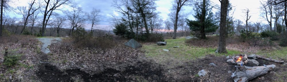
Fielden stream waited for me to catch up and as we got back into the woods, night was beginning to set in. We had only one or two tenths of a mile to the shelter. We passed one brook which was little more than a puddle, and then saw the sign to the campsite area. Some hiker had dropped used tissues or toilet paper along the last half mile or so of trail. Perhaps a kid? Yes this stuff is biodegradable but its reprehensible that someone would just drop these every quarter mile and if it was a child that the parent didn’t care enough to help them pack it out. It really marred the experience and the trail for us here.

We quickly found a flattish spot to set up our tent. There were a few southbound and a few weekend hikers already set up. Some of them had set up their tents in the shelter, which I think is incredibly obnoxious and entitled. Furthermore, when I was asking them where the bear box and privy were, they wouldn’t even get out of their tent they had set up in the shelter to show me, and got irritated with me when I couldn’t understand where they were saying they were because I couldn’t see them inside their tents and it was getting dark fast. This is not how we share a campsite with others. Just because you were there first, and you’re doing a long distance hike, does not entitle you to act this way. Their two tents took up the entire shelter. While no one else had trouble finding a camping spot, shelters are for those who don’t carry a tent, and to protect people in bad weather.  This entitled behavior is what gives some thrus a bad reputation.

Thanks for catching the flies chasing me!

Thanks for catching the flies chasing me!

Anyway, we went about making dinner, our first time with ‘Good to Go’ brand. We did the Thai curry which could be considered a questionable decision when sharing a tent! They are also around $11.50 each so certainly the meal of short section or weekend backpackers not on a long term budget. But they are reviewed as one of the best dehydrated backpacking meals out there (including a Backpacker Magazine Editor’s choice award), and particularly this recipe. It was tasty, even if it took 20 minutes to cook. I brought along the camp stool again, which I love and hogged the whole night. The 1lb weight is totally worth it, especially for a weekender like me.

After a nice dinner where the bugs enjoyed eating us as much as we enjoyed eating the curry, I managed to find the bear box and get our food put away despite the lack of the hook, and the mcgyvered closure method with the piece of chain that was left. I sent a few pictures to our family and we got ready for bed.

I had decided recently to use my smaller, lighter usb charger to re-charge my phone overnight, and knew that last time I used it it still had about 50% charge. I didn’t check it or re-charge it. Big mistake. It was dead. I use an app to check topo changes and that we’re on trail whenever blazing gets iffy. So I was super annoyed. Next time, I’ll just bring my heavier Anker. It still has its charge 2 months later. Clearly this goal zero lipstick style one doesn’t hold a charge long. I shut off the phone to preserve battery until morning.

Trail Magic #1

Trail Magic #1

We slept just with light cover as it was warm still, though cool enough to be comfortable now that the heatwave broke. The full moon woke me in the middle of the night shining down from the sky.

The next morning I found the small campsite brook and collected some water for our coffee and grits. The privy was absolutely disgusting and left a lot to be desired. Trash was everwhere inside, and spiders the size of baseballs lined the walls and hung from webs above.

Fitzgerald Falls

Fitzgerald Falls

There was an interesting bird call we heard which I think was a whipporwill. We did meet one nice northbound thru and had some conversations with him. I gave him some info on the Connecticut spots (and privies!) he might enjoy best. He didn’t seem to have any issue with this disgusting privy but I was proud to tell him how nice our new moldering open-air privies are! I signed the register after breakfast and we headed up to the trail in a hurry, but letting our new friend go first as we were obviously going to be slower than someone who just did over 1,000 miles. If we could manage it, I really wanted to get the 6.7 miles to where we left off covered. And we were to discuss this as we reached the bottom of this mountain at the first road crossing 1.5 miles north. If we didn’t we’d still have 1.7 miles left of the section and we’d have to do that either on a separate trip, which seemed foolish, or when we were back in October to finish to the NJ line. 1.7 miles… easy, right? Not this 1.7!

We had an easy hike along the ridge from the shelter and then a steep descent to the first road. There was more of the pieces of tissue along the path here…

We crossed the road and since I thought the beautiful Fitzgerald falls were just into the woods on the other side,  I suggested we discuss the plan by the falls… Well the falls were about half a mile into the woods on the next 3.5 mile stretch to the next road. At this point, if we didn’t want to risk not having a ride further out it was go back half mile or go forward 3. So we did the latter. But first we called the taxi company again to check how far they’d go and they had said they could come get us at either road crossing. So we gave them a time frame and they said to call when we were about 30 minutes out. Feeling good to have lined up a ride back, we continued on.

Highlands trail junction

Highlands trail junction

The falls were beautiful and the trail conference had built brand new steps up along it to replace what was left of the original ones. The falls weren’t raging by any means but they had a decent flow and were very lovely.  The stairs were steep but easy, and we passed the second southbounder of the day on the way up. The ascent up to Mombasha High point continued, though because we were going northbound, this ascent and the next (we thought) would be gentler. It was still pretty steep, though before the summit there was a long stretch along a shoulder of the mountain that was nearly flat and was like walking an old woods road.  The mushrooms were everywhere here and we enjoyed listening to more bird calls and trying to identify them.

There was one more short ascent before we reached this mountain’s ridgeline and the intersection with the Highlands trail. That trail takes you 5 miles south along the Sterling ridge to the Sterling Fire tower, which we hiked to in October of 2013 when on a trip to Warwick for Fielden’s sister’s birthday. This is the ridge on the opposite side of Greenwood lake that the A.T. is on.

More boardwalks

More boardwalks

From here we walked the ridgeline for around a mile and enjoyed the breezes, and a snack before the descent. There was a nice little view up there, at about 1,280ft. We passed another southbounder who had confirmed there was a view or two, and gladly he was right. We would meet him again later. The trail descended steeply and then followed a series of boardwalks to West Mombasha road. This is where we would likely stop for the day. Except you know I didn’t want to do that!

Here we had the discussion about the last 1.7 miles. We sat down in the shade on the boardwalk and I did my best convincing that this is only 1.7 miles and we had just done 5 in less than 3 hours, and still had an hour and a half to do this last bit. It couldn’t be that hard! And then we would be able to finish the state on one last glorious hike this season!  We already had a ride guaranteed from either road, so that cinched it.

We crossed the road and met another southbounder who was having a snack and filling up on water from the cache of water jugs left there. We asked what the last bit was like and she said the first part was easier and the second part a bit bumpier. The guy we met on the top of Mombasha high point had also told us it was a bunch of little 500ft ups and downs. The profile didn’t show anything that severe, or so we thought. Or we would maybe have waited on it. Her description wasn’t that intimidating either, and she told us there was another supply of trail magic water at the other end.  Off we went. I was happy.

What the?

What the?

Just before we climbed the first of the ‘three spikes’ in the profile, I noticed several other wide trails here, and a bizarre human ‘target practice’ dummy. It was creepy. I’m assuming someone does some sketchy things here. I picked up the pace and as I rounded the corner, found myself at the bottom of a large rock pile. Here I thought, boy is she going to be pissed! Beyond this boulder pile with the white blazes through it was a cliff ledge. I had done these in Harriman last summer and Fielden certainly has done stuff like this. I had no doubt she could.

But I was going to be in trouble for saying this would be a quick easy section. She was annoyed with me, but it was easier than it looked. There were easy paths through the rocks, and it really wasn’t steep except for the last 10 feet which you could pull yourself up easily. I waited for her at the top while she put away her poles and followed me up. I then moved ahead a bit and followed some ledges to a nice break point where there was a plaque commemorating an Austrian man who was a trail volunteer here for many years and when he died they had spread his ashes here.

FIelden stream met with me here and we enjoyed the ridge walk and the views of Little Dam Lake from the ledges. We were glad we were finally at the top of that and surely the final bump couldn’t be any worse. We had a steep but manageable descent into a hemlock grove and as I was a bit ahead, I let her know with a call when I saw it ahead. Another boulder pile and cliff. Only twice as steep, and with no end in sight.

1 of 2 crazy rock climbs

1 of 2 crazy rock climbs

As I put my poles in my pack, the phone started lighting up with texts and a voicemail from the cab, saying she was in the area, and happy to wait for us a bit if we still needed the ride. I texted her back and left a voicemail saying thanks so much for reaching out to check in and we’d hopefully make it there by 1-130, as the last climb ahead was going to be a doozy. At least a little prepared by my warning, when Fielden arrived at the bottom I helped her pack in her poles and we just set about the business of climbing the monster called Mount Buchanan.

It started with the same negotiating of boulders. But these were much bigger, with not really any room between them, and fallen trees in between to make it a bit more difficult. Though one tree did have a path cut through it. Thanks, volunteers. It then got immediately steeper and more difficult. As I pulled myself up a large rock and negotiated around its backside, I saw ahead that there was another twist to the right through a crack in the cliff face.

As I approached that and balanced myself on a sloped rock along the cliff, I found a root to pull myself safely to the next turn. At this turn, the trail climbed again up a large pile of boulders with a few roots from a nearby tree to grab onto and hoist up. The steepness and the twists did not subside here. Fielden was below me and trying to talk herself through it to me. I totally understand that method, but I was feeling like I was in survival mode and was not talking back. Everything I had in me was used for concentrating on footholds and grabbing roots and rocks that could support the weight of myself and my pack. I made it to the ledge here and just pushed ahead. As I followed that ledge a bit I looked up and again the trail climbed steeply over more jumbled rocks and roots to a higher ledge. I grunted and bitched and looked down only once to know that looking down wasn’t a good idea. But what I thought was the end was ahead. I’m pretty sure I said ‘this ain’t hikin’ anymore folks!’ or something to that effect. I knew a fall here could be a serious or fatal one.

View from Buchanan Mountain

View from Buchanan Mountain

At last I pulled myself up the last bit of it and shouted down to my wife “ are you still alive” which she thankfully answered yes to! We made it to the top, dripping buckets of sweat and thanking the lord above we had no falls on that. And glad we didn’t have to go down it, which we would have had we gone southbound. My balance and gravity are far worse on downhill ledges. Our guts and our trail runners got us through in one piece.

We then wondered why in the hell there is no name for this little feature. In the guide, it’s described as a ‘very steep tumble of rocks.’ While that might be accurate, we dubbed it ‘the cliffs of insanity’ in tribute to the Princess Bride. How Agony Grind and St. John’s Ledges can have a name that illicit fear, but this one doesn’t is beyond me. Combine those two and you’ve got this one. And never during those did I feel in real danger. I like our name for it. There was a nice view at the top but at this point we just had one thing in mind: get to the bottom, get in the cab, and go have ice cream at Bellvale Creamery.

I hurried down ahead to meet the cab driver. On the way I passed the other cache of water and as we ran out a while back, took a big gulp before going out on to the road. I managed to preserve my phone battery and was at about 4% so I was glad she was there waiting already. She was enjoying the day, and a little rest while waiting for us. We thanked her profusely for making sure we connected and got the ride we needed, and told her about the crazy climb on the way back to the creamery. She mentioned the ‘stairway to heaven’ up Wawayanda Mountain just south in New Jersey, but that doesn’t sound so bad compared to what we just did. And suddenly the rebar ladder on the state border seems less intimidating after today. Let’s hope I’m right about that.

View from Bellvale Creamery

View from Bellvale Creamery

We got to our car and drove it down to the creamery which sits at the top of Mt. Peter on the ridgeline. Mt. Peter is also a ski resort, and we could see the trails from the top of the legendary cliff on Buchanan Mountain after enduring the crazy climb.

I was glad to see the car was still there, and that one more piece of the puzzle came together without issue. I hope this helps me learn to just trust in things working out more. Because everything did fall into place, despite the challenges and all my worries. The ice cream tasted great, and I went to get my GoPro to film the amazing pastoral view of the Warwick valley and the Catskills beyond. As I turned around I saw Fielden stream talking to our friend from Mombasha High Point.

He was in need of a ride into town to resupply, so we took him down to the village of Greenwood Lake to a shopping complex. As we couldn’t bring him back up the hill since we had to get back to Connecticut by 3:30, we recommended the Night Owl taxi. Turns out they were right across the street. And even better, which I didn’t know at the time is there’s a trail called the village vista trail that takes you from town back up to the A.T. I hope someone told him about it. I asked him his trail name as we said goodbye and he said it used to be Shepherd because he started his journey hiking the trail with a goat, but the goat was too slow. So he doesn’t really have one now. I should have come up with one, damnit. “Goatless”, maybe? Or “no goat.”

We made it back in good time, excited for our return in October for Fielden Stream’s birthday weekend and the last New York last section. Usually we end our overnight season in October. But who knows, with how warm the weather has been we might get the chance and urge to do one more. That would probably be in Massachusetts. We were going to do that one with the kids, but after this weekend, since the trail has a similar description, we thought it better to start with an easier stretch and not take unnecessary risks. It’s hard enough watching each other go up those crazy scrambles. Watching the kids, while they are probably twice as nimble and able as us, would bring major anxiety and we want to be sure they have fun doing backpacking before taking them mountain climbing!

I will be back out volunteering for the next few weekends in Connecticut. Fielden Stream, Jiffy Pop and Ratchet will be out with me too for the second weekend which we will do as an overnight. Maybe we’ll see you!

Miles day 1: 2.4

Miles day 2: 6.7

— Linus

Appalachian Trail – NY Section 12 (Part 1)

Heading up the grind

Heading up the grind

Tomorrow we leave early for another hike on the New York Appalachian Trail. We started section 12 southbound last Saturday and slack-packed it as a warm up hike for this weekend. We thought about finishing all of the state in these two hikes but something about the rebar ladder up the cliff just north of the N.J. line said it to me that it was best going up that, and with a day pack vs a full weekend pack. So we will likely slack-pack that one too, to finish off our season, and the state in early fall.

Last weekend the weather forecast was much like this weekend’s. Stifling heat and humidity, and chance of heavy thunderstorms. We got both of those last weekend but luckily the rain came after the hike. In this kind of heat though, rain like that can be a blessing as long as you have a way to keep dry. We are going to bring the tarp this time too, as it really saved the day in these conditions last season. There is a shelter but we don’t like to sleep in them, and it will likely be full if the weather is bad.  I am hoping at the least that this means Fitzgerald Falls will be raging when we pass it tomorrow. As long as it doesn’t make the trail to precarious, I don’t mind the rain. We’re just going to drive down early in the morning as we are camping out for the night, so rolling into camp at 630 won’t be a problem and we can start at 10 or 11.

Fielden climbing part 1!

Fielden climbing part 1!

Fielden had such better results with her trail runners and normal socks last weekend and didnt get a single blister! Based on this miracle, and knowing how much rockier the trail has been getting in southern New York, I ordered a pair from the REI outlet that came recommended from a friend, and they will be delivered today. I went by the store yesterday to get some more appropriate socks, and a short sleeve merino shirt. The merino really works better for me in these conditions as it wicks away the sweat a lot better, retains no odor, and dries quickly. For my chemistry I find it better than synthetics in the humid and wet summers. I have one in long sleeve but at 95 degrees heat index, I want a short sleeve. The smartwool shirts are not cheap, but every review I read, and my experience with my current longsleeve say its worth it.  I love having new gear to test, and this weekend will be no exception. There are rock steps along the falls, and the rocky outcroppings of eastern pinnacles and cat rocks. I want all the traction I can get. Hopefully I won’t find the opposite to be true for me, and I load up with blisters with the new shoes and socks.

First view (east)

First view (east)

Last weekend’s section included the famous “Agony Grind”, a 500ft climb up rock piles in less than half a mile. While it was steep, and very rocky, there was really no spot where you would fall long distances or heights if you slipped. I would want to do this less if it was rainy, but going slow it could still be done. We lucked out this time in that it was dry out for the moment. We stayed in Fort Montgomery the night before so we could get to the trail as early as possible, and still be back by 5 to meet other commitments.

The second scramble

The second scramble

We stayed at a nice hotel and ate at a great BBQ place next door. We met a West Point graduate who was headed up there shortly to celebrate his 50 year anniversary of graduation with classmates, do a presentation and then hike. He had done many parts of the A.T. in the south, and we had a nice talk about our plans.

We saw they were having a Native American pow-wow at the Bear Mountain area, and since I am fascinated with that culture and collect Kachina, we wanted to make sure we had time to visit it too. And because we weren’t clear on if there was parking at our originally planned endpoint, we made the hike a little shorter that day and for tomorrow where we knew there was parking allowed. So instead of 5.4 miles we did 3.6. Still, it had many good ups and downs, and some great scenery.

View of Ramapo Valley and 87

View of Ramapo Valley and 87

As we headed over the interstate from Elk Pen, a truck honked at us and I didn’t even do the arm tug! I was filming but sadly had stopped rolling at that time. We ran across rt.17 and headed into the woods to start the climb up Arden Mountain and agony grind. Some thru hikers we saw earlier trying to get a ride into town from near here had set up their camp right by the road in the woods, clearly for this purpose. The uphill started right away, and there were about 4 different sections to ascend.

Fielden at Western view

Fielden at Western view

Someone was set up in their hammock on the ridge by the first view, half way up. It was very pretty throughout the ascent, and we were in good spirits and enjoying it. We met some thru hikers and stopped to chat with them below the third scramble. They had just resupplied so got a late start today. As we were chatting with them and exchanging blogs and instagram accounts, we saw another group of backpackers and they joined the chat. As the thru-hikers headed north (and thanked me for being a volunteer!), and I asked Fielden to get some good footage of my ascent up one of these scrambles, these southbound backpackers recognized us from when we hiked through section 10 in April! They too stayed at William Brien shelter that night. Small world.

Fielden at Western view

Fielden at Western view

They were headed to Wildcat shelter for the night, where we are headed tomorrow. We passed each other on and off along the way and chatted each time. We told them at the last stop together that we were parked at the next road so that would probably be the last time we see them. They were finishing New York and we still had more to go. But you never know. We had a snack at the top of Arden Mountain at a trail crossing, and signed a trail register there. It apparently goes 2 miles north to the Harriman train station. We passed a group camped on a ledge on the western side of the mountain, that the thru hikers had told us about. They didn’t seem to be backpacking as they had a fairly large campsite and lots of beer. Even though its a good uphill to this site, its not too long a hike.

Blackberries!

Blackberries!

Where we met our old friends at the last stop together on Orange Turnpike there was all sorts of trail magic, both at the bottom of the hill and the top. At the bottom there was a whole tarp / lounge setup with a trash bin, a bin of fresh fruit, water jugs, sodas, snack bars, bug spray, even athletes foot cream! There was a register book too which we signed. Our friends snapped a photo of us here before heading off. There were a few blackberry bushes and we all treated ourselves to some.

I’m certain they got stuck in the storm that rolled in later, but hopefully made it to the shelter not too long after to dry off. At the top of the last short climb of the day, there was a camping area and a first aid trail magic box, full of first aid supplies! I’ve never seen that before. This uphill was a bit steep but not too long and before long we were descending to the edges of LIttle Dam lake.

1st aid trail magic

1st aid trail magic

The lake was absolutely beautiful, and we spotted what I thought was Indian paintbrush but was actually cardinal flower. It lined the lake, which itself was full of lily pads and croaking bullfrogs. At the inlet area where you cross on stone steps, there were obvious signs of camping areas, but no signs saying it was prohibited. Though I’ve read you’re not allowed in the guide and on whiteblaze. In New York, I think the unspoken rule is you can camp where needed if you leave no trace. The cardinal flower was everywhere here and was quite beautiful. We saw another trail magic area on the way back to the road, with a couple more water jugs. I think that is great as long as the people come back and pick them up when they are empty. Its been brutal weather. I know how much we appreciated it when we were in Massachusetts.

Cardinal Flower at Little Dam Lake

Cardinal Flower at Little Dam Lake

When we did get back to our car, someone had written “hi” in the dirt next to it. We were hoping it was our friends from William Brien. We gave them the blog address so guys if you’re reading this and that was you, leave a comment!

On our way to get the other car at Elk Pen, we stopped at a gas station in Southfields near the trail to get some drinks and use the bathroom. Even though the gas station was state of the art and in pristine condition, they had a sign on the door that said ‘bathroom out of order, sorry use porta-potty outside.” We got our snacks and the second car and tried to find a bathroom farther up the road on the way to the pow-wow. There was a gas station with a ‘Wally-Mart” right across from the Harriman train station on rt. 17 that the blue trail leads to from the A.T. on Arden Mountain. Guess what, they said no bathrooms too. Clearly, the proximity to the trail has made these two businesses refuse to offer their bathrooms to hikers. I’m not going to pass judgement on these decisions, but I thought if you were reading this, you should know the situation and not expect that amenity at these places.

We drove over to Anthony Wayne Recreation area for the pow wow. We ate Indian Fry bread, bought some momentos, watched some dances, and I got to go inside a Tee Pee and shoot a bow and arrow for the first time since summer camp. I was quite good back then and once I got comfortable with the bow, I got a near bullseye on my second attempt. I am always looking for more ways to relax and decompress in this hectic world and I found the local Y is doing adult archery courses in the fall. So I think I’m going to try the class and see if its something I enjoy doing regularly.

Little Dam Lake lily pads

Little Dam Lake lily pads

We saw the black clouds start to roll in around 4 and headed to the car, literally as the sky opened up with torrential rain. The drive back over the Bear Mountain bridge and around Anthony’s nose in the downpour was sketchy. The road winds up and around the mountains and we could barely see out of the windshield. It didn’t last long though and before you knew it it was sunny and humid and sweltering hot again. The rain never did make it to our home in Connecticut.

"Hi" at the road

“Hi” at the road

This weekend is the famous perseid meteor shower and the display is supposed to be better than most years. I hope the skies are clear enough to see from the shelter. We will also look tonight from our deck, but we live in a small city, and its currently raining now, so its anybody’s guess if we will see anything. We are also excited because the Bellvale Creamery ice cream shop and the hot dog stand are right at our end point Saturday, so we plan to reward ourselves properly when we get back to the car.

Archery is fun!

Archery is fun!

After tomorrow’s section, we have only 5 or so miles left of New York! Also, you’ve probably noticed I’m beardless now. It’s just been way too hot a summer for a fur-face!

I added the recent footage to the New York video, and I can’t wait till we finish the final section and I can post the video of the whole state!

Miles: 3.6

— Linus