
Packs on, let’s do this!
Last weekend we finally ventured into Massachusetts on the Appalachian Trail. Mind you, Sages Ravine campsite is officially in the state, despite the state line crossing sign being down the ravine half a mile. So we have dabbled in the state at least. Last year when we finished the Connecticut section we stayed at that campsite and had some adventures. Even Fielden Stream wrote about it. The sign placement is based on which state chapter manages the trail on either side vs the actual geological border. So this confuses many thru hikers. Though at the end of the day, they’re going to keep on going so it doesn’t really matter.

AMC Northwest Camp
Anyway, we’ve been looking forward to heading north for a long time, and conquering the ledges of Mt Race, and the highest summit we’ve done so far on the trail, Mt Everett. But we were saving it for our friends to do with us and continued to work on the New York section in the meantime. We have 17.9 miles left of that state, and plan to finish it by the end of the season.
It took some time to get the planning with them in place, as they live in Miami. But it finally happened, and it was everything we could have wanted. While we were down there in Florida for winter break in February we nailed down the rest of the details and they bought tickets. We went through the equipment lists and luckily had most of what we needed to outfit them too, since we had extra gear from car camping and my gear upgrades over the years. They found a place to rent packs and had them delivered to our house a few days before the trip.

Bears!
They did buy some nice new trail runners and Fielden Stream and I are thinking we will head over to REI and pick up some too. Clearly the hype around these within the hiking community has to be legitimate at this point. And their praise after the hike only strengthened the point. They said that they were extremely comfortable and gripped onto the rocks and roots in every tricky spot. For Fielden, she wants to try them mostly because the boots and wool socks continue to leave her feet covered in blisters no matter what we’ve tried… toe socks, different fabrics, duct tape. For me, I want to see if it will help with traction as much as they say and keep my ankles from nearly rolling on every unexpected root or rock I encounter at the wrong angle. We’ll keep you posted.

Linus and Ledges at Sages Ravine
They arrived late the night before and Fielden and I were packing everything in their packs while they were on their flight. When they got to our house we walked them through all the gear and helped them pack it all in the most efficient way. We had some drinks and caught up a bit before getting to bed. We stayed up a little later than we probably should have and so we slept in a bit. But with June sunset at around 9pm and just over 6 miles to hike the first day, I wasn’t too concerned about not getting on the trail till almost noon. It’s about a 2 hour drive to the end point, then another 25 minutes up the mountain road to the beginning. I almost extended the end point another 2 miles, but am glad I didn’t. Even though it was almost flat those last 2 miles, I knew it would be hot and we’d be tired from the challenging climb and descent that morning. Turns out that was a good call.

Linus and Fielden Stream
We parked just south of the Connecticut line at the AMC (Appalachian Mountain Club) Northwest camp. The camp has a cabin, but it is primitive in that there is no electricity or running water. There’s a privy at least. I wanted to check it out a little closer but there were people staying there. As members we can rent it, and I think that would be fun sometime. We took the old ‘northwest road’, a trail that skirts the CT-Mass state line on the north side of Bear Mountain and connects with the Appalachian Trail about a half mile down. I remember seeing the trail when we came over Bear Mountain last June and figuring it had to go up there to the cabin, or at least to a road somewhere. I told them about the crazy climb up Bear and asked if anyone wanted to do it for fun! After a laugh we headed north down into the ravine and along the brook as it widened and flowed past the campground.

Bear Rock Stream
We stopped in to the campground so they could use the privy and get a look around. I was hoping some of my AMC/ATC friends would be in the caretaker tent but I realized it was Friday morning so that was unlikely. I took a few pictures including the sign about bear activity in the area (there is no doubting this in my mind after our stay there last year) and then we ventured on down the trail along the ravine. I had been to this lower section on the last trip but Fielden stream had stayed in the campground. So I enjoyed showing her and our friends all the swimming holes and little waterfalls farther down. We ran into a father and daughter backpacking team a few times that morning along Sages Ravine, and would later run into them on Mt Race and at the campground. We chatted with them at the ‘official’ state line crossing and took some photos. The trail then headed up the side of Mt. Race, gradually but steadily, and the day began to warm up.

View southeast from Mt. Race
The trail made its way towards the ridgeline and climbed gradually through the woods, passing what was once an old campground at Bear Rock stream and it’s replacement across the trail, Laurel Ridge. I checked into Bear Rock to make sure no one was stealth camping and was happily surprised that people were staying out of the area and heeding its re-vegetation area signs. It is a lovely spot right on the ridge, with the stream cascading off its edge. I heard that there had been some accidents there in the past, which I’m sure had as much to do with it being moved west of the trail.

It was safe enough here to take a photo!
We continued to climb, some sections more steeply now, until we came out onto a large exposed ledge with sweeping views south to Connecticut, east and north as far as Mt. Greylock, Massachusetts’ highest peak near the Vermont border. We were lucky to have such great weather and endless views like that. There was one other backpacker here and we sat for lunch. We were getting a little worked up about how bad the ledge walk would actually be. I had seen many pictures and had been preparing myself. And judging by the ledge we were having lunch on, I knew there was a big drop. I ventured over to look through the trees where the trail went to try and make it seem less intense, a lump in my throat growing the closer I got. I took it in — the very narrow trail following a precarious ledge thousands of feet high. I turned back around just as the father and daughter arrived and smiled and said “it’s not that bad.” I guess my game face isn’t very good.

View of Bear and Round Mtns in CT from Mt Race
Four vultures flew overhead and I joked that there was one for each of us. I don’t think that helped. We finished lunch and got ourselves ready for the cliff walk the best we could. As we passed through the little hole in the trees everyone saw what was ahead. Luckily there were only a few spots where it was this precarious, but those were enough. We gave each other a pep talk throughout and I was actually happy I had been working on these types of challenges because I felt sure footed and confident.

Pink Laurel on Mt Race summit
Though I won’t lie there were a few spots where a wrong step would mean certain death. Talking my friend through it and focusing on that also distracted me from any of my own fear. We were also heading up it so I think if we were coming down I might feel a little less sure. I stopped to take in the views, and some pictures, which also helped me feel less afraid. I was really proud of myself. I know these were big cliffs, and I know I had good reason to have been nervous and try and overprepare.

Mt Everett beyond from Mt Race summit
This section lasts only .6 miles and in many spots does widen out as it approaches the summit. So I was able to get one or two shots out there. There was a cairn a few hundred feet south of the summit and from there you could see 360 degrees around. The summits of Connecticut’s Bear Mountain and Round Mountains to the south became visible from here, as well as Mt Brace in New York, and Mt Frissell, Mount Washington and Mt Alander to the West. Directly to the north you could see the next day’s summit, Mt. Everett. And as we reached the true summit and walked its rocky spine, the high peaks of the Catskills were visible in the distance, their craggy peaks a shade of deep blue. A few pink mountain laurels were blossoming on the peak, and I was thrilled that the tunnels of laurel I wanted our friends to see were abundant on the hike. We took some summit photos and then negotiated our way down the steep rocky spine on its north side.

Descending from Mt. Race
We were anxious to get to camp and unwind after the crazy cliffs. As we trekked through more tunnels of laurel, I decided I needed a bathroom break and told the others to go up ahead a bit. As they got ahead about 20ft, I turned around and headed into the woods but was stopped by a rattle! I did not see this guy, but Fielden and our friends heard it too and asked if I was ok! I decided I didn’t need to go any farther into the woods! I headed cautiously back up the trail and didn’t hear any more rattles before I met up with them. We picked up the pace a bit and kept an eye out for the trail junction to our campsite.
While we had entertained going over Everett on this day too, we decided when we reached the junction of the Race Brook Falls trail that we had had enough for the day. It was already nearly 5pm and after going over Everett the next day we were glad we had made this decision.

Time for a nap?
There was no way we were going to have made that climb feeling the way we were at this point in the day. The Race Brook Falls trail is one of many that climbs steeply up to the ridge from Route 41. From the A.T., the campsite is only about .2 miles down the trail, or so the guide says. I feel like it was more, but we were pretty darn tired. Those printed distances never seem accurate. They definitely are not on my tracking app, I learned the next day!
There are big falls at the bottom of this trail but I have heard its very steep down to the falls. And since the brook was barely moving up here, and we were so tired, we decided not to go down and explore them. Sages Ravine provided enough beautiful water scenery for us today, and we will come back to the falls from the road end another time. We did want to swim and pictured ourselves washing off under a cascading waterfall and everything. But reality is always a little different isn’t it. We were happy just setting up camp at this point. The father-daughter team came into camp around the same time and took the tent platform next to us, so we said hello again to them and told them we’d report back on the water source as we were going to filter once we set up camp.

Finally, the campsite trail
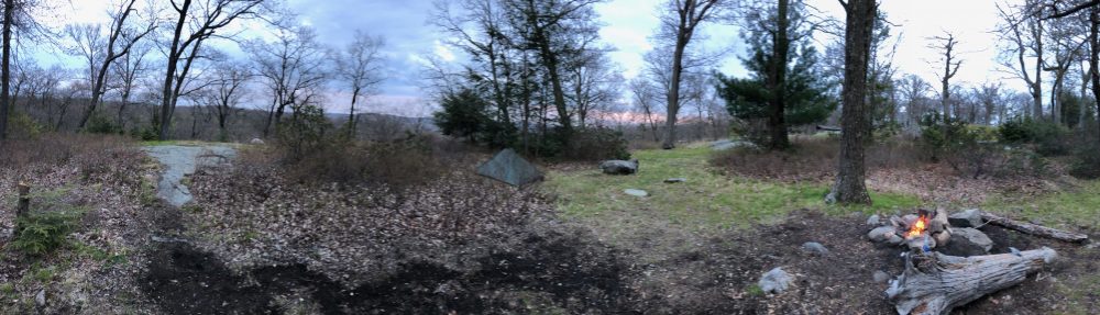
After we got the tents set up, Ledges and I made a few trips to the brook and filled up on water. We had run almost completely out by the time we got to camp due to the heat. Its especially easy to overheat on all that exposed rock on the mountain summits. We sat around the fire and made dinner. Fires are permitted here and while I was surprised, I was relieved not to have to clear any fire rings, and that our friends could have that experience they are used to when camping out. Fielden is the best at making fires in our group so we let her get it going while Ledges and LB filtered water and I got dinner going. It was nice having two stoves, so we could get everything ready at the same time. I had made sure they had their own cook kit with stove (and their own water filtration) should we get separated or lost.

Home for the night
We had a great evening telling stories and then went to bed. It was a beautiful night and we left the vestibules open and watched as the stars came out. None of us slept very well though, hearing lots of critters scurrying about in the middle of the night. In the morning, we filtered some more water and had breakfast and I signed the register on the way out. We had a really big hike ahead for day 2. It started with a nearly 1,000ft climb up Mt. Everett. The trail had taken us several hundred feet downhill into a saddle between the two mountains where our campsite was. So once we got back on the A.T. it was right back up.

Aaand, back up!
And it was STEEP. I would compare it to the climb up the north face of Bear Mountain, but twice as long. There were many elaborate scrambles and long sheets of rock to traverse as we ascended. Ledges said it definitely reminded him of the white mountains. That made me happy because I wanted an exciting section of trail, and it provided. We pushed on quickly, some thru hikers passing us on the way and making us look like snails with their pace. But we got up there and took in the views as they opened up, mostly to the south of Mt. Race and the Taconic plateau in its entirety as it stretched south to Salisbury.
At the summit I was immediately stung by something, either a yellowjacket or a black fly. But it didn’t hurt much or ruin the excitement. We took pictures at the summit and I had a celebratory toast. This is the highest peak we’ve hiked up together. I haven’t hiked the whites since I was a teenager, and in Shenandoah last year we only took the stony man trail from the Skyland lot, as we were driving Skyline drive. One of the hikers said when he arrived up there earlier there were some rattlesnakes he scared off. We talked to the other thru hikers and a couple that was day hiking. We sat on the foundations of the old fire tower and enjoyed our break. We thought it was going to be easy from here. Just downhill and then flat. Ha!

View south from Mt. Everett
It was a nice easy downhill to the Mt. Everett State Reservation parking lot, where we found large coolers of ice cold water. This was much appreciated as the big climb depleted our supplies significantly, and we had many miles until the next reliable water source. Conditions have definitely been on the dry side. We talked to a thru hiker Matt who didn’t have a trail name yet. I wish we could have come up with one, but even LB is just our friends initials because we are waiting to come up with a trail name for her. You can’t force these things. He told us that in the 1,500 miles he’d done so far, the cliffs on Mt. Race were the most extreme he’d encountered yet. Even Tinker Cliffs in Virginia weren’t as precarious! That made us feel better. There’s a privy here too which is always nice.

Old fire tower spot
The trail here is easy and after passing by Guilder pond (which I think is the highest pond in the state) descends gradually to a forested ridge where there are two shelters, Glen Brook and Hemlocks, situated .1 miles apart. The water source here was very dry, and I was concerned about those staying here for the night. Maybe there was more water closer to the camping area, but where the brook crossed the trail was mostly mud. We traveled the forested ridge for a bit before it climbed to the rocky spine of Mt. Bushnell. Here the trail jotted up and down, up and down, taking a bit of a toll on us in the heat. We stopped for lunch in a shady spot before another climb. These were not big ascents but the repetitive climbing and descending was arduous. We passed a family day hiking and stopped on an outcropping with great views east and north of Mt. Greylock. We were stopping more and more now as the sun was baking us on these rocks and we thought for sure we’d be at Jug End by now.

Monument Mtn and Greylock beyond, from Mt Bushnell
Seemingly hours later, we arrived at the aptly named peak, which marks the northern end of the plateau on this ridge. A day hiker we passed who has hiked here about 100 times laughed when we asked if it was steep. Now I know why. You might as well have rappelled down it. It began with several long, steep, rock faces to cross. After that, a literal rock wall we had to climb down. After that, the trail came out to another definite ledge. It routed you around at a downward angle on some slick rock with nothing but a huge drop off if you took the turn wrong.

Hemlock grove
Needless to say, some of us took a less dangerous path past it. Here we thought we’d be done with all that cliff walking! LB took the scary route. Go LB! But that was not the end of it. The trail, though now in the forest, steeply descends the mountainside on a series of rock staircases and switchbacks. A bit like St. Johns ledges but far longer and not quite as easy to get footings on. It went on seemingly forever. We met the day hiker again, and when we asked where there was water, she said she’d leave us some at Rt 41, which we greatly appreciated. We were running low again. And its good we did because the water sources beyond were scarce except for a swamp right before we reached the car.

Bridge in Egremont
As we headed north from Jug End Road, we entered a forest of hemlocks, and then came out into the meadows alongside the Kellogg Conservation Center. From up on Jug End and Bushnell it seemed so far away and so far below. Finally we were passing fields of cows, and fairly close to the KCC and reached rt. 41 where we found the water she left us. We filled up and continued on through the fields. Here I was fooled by outdated distance information on my app. I knew from the AWOL guide that the mileage was something like 2.5 to the car from Jug End Road. But the old data on the app said 1.4. Needless to say it seemed like a really long walk, though it was beautiful. A large, very old hemlock forest again opened up from the meadow edge. I commented that it was like Middle earth, where you pass from realm to realm, this one being that of the elves!

Done!
There was supposed to be a large swamp here, and we crossed several bog bridges and planks, but there was hardly any water. Only as we approached the road did we cross an actual large brook on a big bridge. As we reached the end of the hike (1.5 miles shy of the actual section end at Rt. 7), we saw that the cooler of trail magic we found there when we dropped off the car the day before was still there. We meant to leave notes saying thank you for all these trail angels, but we were completely exhausted. Thank you trail angels!

Looks like we made it
We did just under 9 miles today and proceeded to throw our packs and ourselves on the grass and took a few photos to celebrate finishing the hike. There were also lots of deer ticks in the grass! So we quickly gathered up our things, made sure none of them were on us, and hopped in the car. We were so tired we just pointed to the Shay’s Rebellion monument and felt pleased that we didn’t leave the car at the originally planned point almost 2 miles farther.

Luxurious rewards
Once in the car, it was back up the road again to the AMC Northwest camp to get the other car, and then down the dirt road across the Connecticut line into Salisbury. We saw beautiful waterfalls from the road as it wound and descended the mountain ridge alongside Lion’s Head. We got to our hotel and enjoyed a much needed shower and beer before going to dinner at a great restaurant called the Black Rabbit, next to Mizza’s pizza where I met Rainman a month or so ago. The food was amazing and we slept like logs that night in the king sized beds. The next morning we headed out of the mountains, grateful. We are already planning our next adventure. Though maybe we will do that one farther south in Virginia or North Carolina.
The video is here.
Miles day 1: 6.3
Miles day 2: 8.6
Bears: 0
Rattlesnakes: 1
— Linus

Hi Adam. I love being on your readers list! Never mind all that other “I will read this someday” stuff.
Wonderful share of adventure.
Can we use a chunk of this posting for the Autumn CT-AMC newsletter this coming September?
Happy trails!
Darcy CT-AMC editor
Sent from my iPhone
>
LikeLike
Sure!
LikeLike
Darcy I’ve made all the edits so grab what you need!
LikeLike
I am going to make s few quick edits this evening so when it’s newsletter time , pull the text so it’s the most current 🙂
LikeLike
Darcy I’ve made all the edits so grab what you need!
LikeLike
Water was about what you said it had been last weekend. Great write up! We hiked from Jug End south to Sages. So we went up all those crazy scrambles you came down….which I think is a bit less daunting:) The descent down the south side of Everett took it’s toll on us though. We had thought about going as far as Laurel Ridge the first night, but ended up staying at Race Brook. Placed our tents in exactly the same place as you! We saw 2 snakes as well, though they were not rattlers. No bear sightings, but saw the warning signs posted. It is a great stretch of trail! I’d like to go back and just do the short hike in to Sages and spend a quick overnight there and relax by the stream.
LikeLike
Awesome ! Yeah it’s an amazing section of trail.
LikeLike
Must do Sages to Race sometime. I’ve done Everett, but using the Race Brook Falls Trail. Remember your campsite looked like a nice one, even in snow!
LikeLiked by 1 person
Pingback: Appalachian Trail – Massachusetts Sections 8&9 (partial) | Happy On The Trails